Day 1 on the Jotunheimen NP Circuit Hike

Day 1 of the 6-day circuit hike in Jotunheimen National Park began in the Gjendesheim “turisthytte”, where we had arrived the prior day to get an early start on day 1. “Hytte” means cabin in Norwegian and these are the lodgings anyone doing the park will be staying at – unless you camp. I will use “lodge” going forward though not every place we stayed felt “lodgy”. Most, but not all, lodges are run by “DNT” (Den Norske Turistforening), an association that maintains runs trails and cabins in Norway (thank you!).

In any case here is how day 1 of my circuit hike in Jotunheimen went!

DNT, den norske turistforening, Gjendesheim, turisthytte, Jotunheimen, Norway, nature, Norge, Noruega, hiking, trekking
Red “T”s mark the way!

Our approach to Jotunheimen National Park

As I mentioned in my Jotunheimen NP hike overview post, Gjendesheim became the logical starting point for our hike. It was right off route 51 and offered easy access to hiking trails and long-term parking.

I might add that it is a good starting point for those only wanting to do a 1- or 2-day hike as it has a ferry to two other lodges on the Lake Gjende from which one can hike back to Gjendesheim (or, the reverse, hike to the one or both of the lodges and then just return by ferry). So a good option for those not wanting to do the circuit but still see amazing landscapes.

Our route on the trail

We approached Gjendesheim from the north having started our drive at Bergen. Of course, we could have come from the south but we were going to do that region after the Jotunheimen hike so we wanted to explore other territory. For example, this allowed us to visit Lom, cruise the Geirangerfjord and stay at Geiranger with its beautiful setting hillside facing the fjord.

Starting the Jotunheimen NP hike at Gjendesheim

We arrived in Gjendesheim the night before. Our car was left at the long-term parking with anything we didn’t need for the next 7 days. The lodge, right by the ferry dock, consists of a couple of main buildings and a couple smaller ones.

Gjendesheim, turisthytte, Jotunheimen, hiking, Norway, norge
The main building

We stayed in the second largest building, basically a dormitory, where we shared a room with a bunk bed and nothing else. Toilets and showers were shared by everyone. The main building is where the dining room, common living space, and reception were located. It also may have had rooms but I did not explore. That building had toilets and showers in the basement so I assume it did have rooms upstairs.

Gjendesheim, turisthytte, Jotunheimen, hiking, Norway, norge

The common living space was small but offered great views of Lake Gjende as the sun set.

Gjendesheim, turisthytte, Jotunheimen, hiking, Norway, norge

Dinner started with a delicious pumpkin soup and the main was a lamb stew that was also pretty good (in retrospection, there were no bad meals on the circuit and a couple of spectacular ones later in the circuit). Dessert was rhubarb-something, not sure how to describe it! It is worth noting that while there is no menu to order from – you eat what is served – lodges are very accommodating to vegan/vegetarian diets.

Gjendesheim, turisthytte, Jotunheimen, hiking, Norway, norge, lamb stew

Hiking from Gjendesheim to Glittenheim – 1st half

Alright, so on to the actual hike for the day! Starting a circuit hike pretty cold with a 22.5 km/14 mi route was a bit intimidating. Legs would not be yet fully awake, technique for harder terrain not fresh, etc. We started at 8:30AM taking the trailhead right across from the cabin. The trail started with a 600 ft elevation gain in the first mile so definitely not the easiest of starts. It was not a bad start though. It was good to be finally on the circuit! That first mile took us 46 mins.

Lake Gjende, Gjendesheim, turisthytte, Jotunheimen, Norway, nature, Norge, Noruega, hiking, trekking
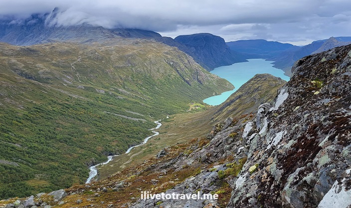
From the 1st mile looking down at Lake Gjende and the ferry dock

The second mile was kinder only gaining about 400 ft. And the third less about 275 ft. So it was an aggressive start that quickly mellowed. By mile 5, our average was 33 mins/mi so we clearly gained speed as the elevation gain eased. That was good as not only I was coming in “cold” (being the first day of the hike) but also first day with the 18-lb backpack on me.

In this segment we passed the end of Lake Bessvatnet and then hit Lake Russvatnet which we would alongside for about 1.5 miles (from mile 4.8 to 6.4) before heading up to reach high mountain terrain after mile 7.5.

Hiking from Gjendesheim to Glittenheim – 2nd half

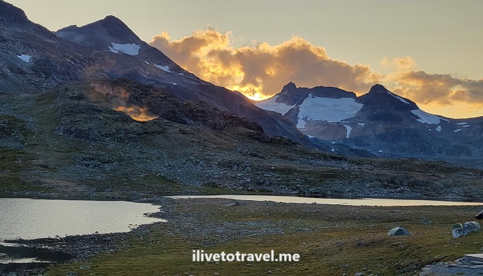
So the second half of the hike began! From mile 7.5 to mile 11 was my favorite stretch of this day. I just really like wide open, high mountain terrain, allowing the eye to see far. Of course, it helped that uphills were few and smaller. We saw a handful of hikers but that was about it; that was more than we saw in the first half!

Lake Gjende, DNT, Gjendesheim, turisthytte, Jotunheimen, Norway, nature, Norge, Noruega, hiking, trekking, senderismo Noruega
Nice part of the trail

The final 3 miles were a mix of flat and downhill. The approach to Glittenheim, for someone who had already walked 12 miles or so, felt brutal: the cabin is right across from you but you can’t cross the water/river there -> you have to walk alongside it for a bit before the bridge to cross it. It felt eternal (it wasn’t) due to being tired and ready to get the boots and backpack off!

How difficult was the terrain from Gjendesheim to Glitterheim?

It is worth mentioning that there were definitely challenging parts to this trail. Plenty of water and mud due to recent rains requiring water crossings, stepping over stones to avoid walking in the water.

Jotunheimen National Park, DNT, Den Norske Forening, hiking in Norway, Norge trekking, Noruega senderismo
This IS the trail! A common occurrence

This required minding not only finding the next stone to step on but also ensuring not slipping or that the stone would move once you stepped on it. Muddy spots were handled similarly but I hated those more. There were plenty of these and rock fields to maneuver over (not around!). It took focus and, at the end of the day, my neck and shoulders were very stiff and needing a massage.

Rock field!
Lake Gjende, DNT, Gjendesheim, turisthytte, Jotunheimen, Norway, nature, Norge, Noruega, hiking, trekking, senderismo Noruega
Rocks everywhere – fun challenge but tiring!

The trail also included 3 bridges got larger water crossings, including the one at the end.

Lake Gjende, DNT, Gjendesheim, turisthytte, Jotunheimen, Norway, nature, Norge, Noruega, hiking, trekking, senderismo Noruega
One of the bridges on the trail

And the temperature?

My hike was in late August/early September. Skies that day were a little overcast. Temperature-wise, though I started with a jacket, eventually I took it off and my wool baselayer shirt was sufficient. I did wear glove liners; it wasn’t cold enough for real gloves but the liners provided just the right amount of protection against the cold and the wind, while allowing to use fingers more normally. Other than that, nothing of note to report.

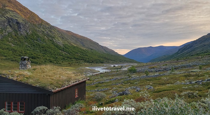
The Glitterheim lodge

I couldn’t have been more elated to arrive at Glittenheim. Though not the best of the lodges, it was heaven after a day 1 of 14 miles! There were two large buildings, much as at Gjendesheim.

This time we stayed in the main building on the second story. Our room again was a bunk bed room with no toilet or shower. The hallway did have a bathroom sink which helped with brushing teeth and filling water bottles. The showers and the toilets, though, were in the basement. In the middle of the night, going down two floors, with very sore knees after a 14-mile hike, using a spiral staircase while half asleep, was not my idea of fun. On top of that, lights would not turn on downstairs as, I guess, generators were turned off. I was thankful I had taken my phone for no good reason – the flashlight feature came in handy!

The common living area was nice with a massive fireplace and great views. The dining room, as usual, was communal tables which is nice to meet some other folks, hear where they are from, hear their hiking plans, etc. That night we sat with a young couple from Israel (whom we would see just about at every lodge during the circuit) and another young couple from the Ukraine (living in Poland).

Glittenheim, Jotunheimen, hiking in Norway, trekking, Norge, Noruega, nature, outdoors, DNT
Glittenheim common spaces

Dinner was buffet-style. The first dish was spinach soup and the entrée a beef stew with potatoes as the side. (If you have not gotten this from describing the food at both lodges… there is no menu. You eat of what is being served!) The dessert was very interesting. It was some form of rhubarb jelly over which one poured something akin to milk. I was hesitant at first but found it delicious!

After dinner we enjoyed beers at the common living space before going upstairs to ready things for the next day and get some good, well-earned rest!

Lake Gjende, DNT, Gjendesheim, turisthytte, Jotunheimen, Norway, nature, Norge, Noruega, hiking, trekking, senderismo Noruega, Russvatnet
A beautiful route

On to Day 2 – Glittenheim to Spiterstulen via Glittentind!

Or, go to read the overview of the circuit at Jotunheimen NP.

(Subscribe to the blog so you can be notified when the next post is issued OR bookmark this page and come back in a week or so!)

A Cool Hiking Circuit in Norway: Jotunheimen National Park

I recently had the good fortune to be able to go to Norway to do a hiking circuit in Jotunheimen National Park. Jotunheimen is northeast of Bergen, about halfway between the Atlantic Ocean and the Swedish border.

The park offers a wide range of opportunities to explore nature and experience it any way you want. These range from easy & short hikes to long & challenging ones. It is also possible to drive to some of the cabins/huts and just do short walks and enjoy the scenery around the cabins/huts. Oh, and some of the cabins/huts are worth spending time at!

Hiking Circuit in Jotunheimen, norway, norge, nature, lake

Our hiking circuit in Jotunheimen – options

A friend of mine had hiked in Jotunheimen before and suggested a hiking circuit for us to do over a period of 6 days. There were options in terms of:

  • which direction (clockwise/counterclockwise)
  • starting point (which of the driving accessible cabins/huts)
  • ending point (either the same as the starting point or another, coupled with a ferry ride to get back to the starting point)
  • cabin-to-cabin itineraries
  • routes options within a cabin-to-cabin route.

Our hiking circuit in Jotunheimen – starting point and direction

We opted to start in Gjendesheim as it afforded an early start if we stayed right there vs. ferrying to Memurubu or Gjendebu. That meant an earlier start than most people who would be doing hikes on that day. The trails ended up not being that crowded at all but I still liked the early start!

Gjendesheim also has a nearby long-term parking about a mile away which was good since we had decided to rent and hold the car while we spent the week in the park.

In terms of the direction, my friend had done counter-clockwise before and strongly believed that to the best way to tackle the circuit. For me, it was good getting the longest segment out of the way on the first day (which had the downside of doing the longest day when still not fully “warmed up”).

Our hiking circuit in Jotunheimen – the route

So with Gjendesheim being the starting point and the direction being counterclockwise, the obvious first cabin/hut was Glitterheim. This meant the 14-mile hike.

The next stop was obvious: Spiterstulen. However, the question was how to get to Spiterstulen. See, there were two options there:

  • Hike up to summit Glittertind, northern Europe’s second highest peak, OR
  • Hike around Glittertind.

We opted to summit Glittertind, weather-permitting, as it would be great to have the experience of summitting.

From Spiterstulen, the best option is Leirvassbu. This was my favorite trail but more on that in a later post!

From Leirvassbu, our best option on the loop we were going for was to head to Gjendebu on the shores of Gjende Lake.

From there, there is the option to skip out on the rest of the circuit and take the ferry to Gjendesheim (or even to Memurubu). We, of course, wanted to hike to Memurubu. That is a story onto itself…

Finally, from Memurubu the options included the ferry, the Bessegen route, and the shore-side trail. We opted for the latter and that story will be in a future post!

Hiking Circuit in Jotunheimen, norway, norge, nature, lake

Our hiking circuit in Jotunheimen – the summary

  • Day 1: Gjendesheim -> Glitterheim (14 miles) -> read about it here
  • Day 2: Glitterheim -> Spiterstulen (via Glittertind) (11 miles) -> read about it here
  • Day 3: Spiterstulen -> Leirvassbu (12 miles) -> read about it here
  • Day 4: Leirvassbu -> Gjendebu (10 miles) -> read about it here
  • Day 5: Gjendebu -> Memurubu (6.7 miles) -> read about it here
  • Day 6: Memurubu -> Gjendesheim (6.6 miles) -> read about it here

For me, in hindsight, this itinerary forced me to do the hardest work upfront (days 1 and 2) and having “easier” hikes on the remaining days. Don’t be fooled when I say “easier”. None are a walk in the park by a long stretch!

There is no right or wrong way to do Jotunheimen but I can certainly say this route worked really well for me!


Check out the park’s website here.

Exploring Capernaum’s holy sites in a Holy Land pilgrimage

Ten miles north of the town of Tiberias along the Sea of Galilee is the town of Capernaum. Capernaum is sort of the northwest quadrant of the lake/sea. All around Capernaum are important religious and historical sites that merit a couple of days to visit. Exploring Capernaum and the Sea of Galilee is a key part of any pilgrimage to the Holy Land, and so it was for mine.

St. Peter’s Church and House

In an earlier post, I said I would write about two churches of St. Peter; the one in that post, right in the town of Tiberias. This post will cover the second one: in Capernaum.

st. peter church capernaum, catholic church in israel, holy sites in israel, holy land pilgrimage, iglesia de san pedro capernaum

Capernaum seems to have been established a couple of centuries before Christ and have disappeared around the 11th century AD. Quite possibly, Capernaum is best known for being the town where St. Peter lived before he was called to follow Jesus and for some time after that. Even Jesus himself stayed at that house for a period of time!

Today, the ruins of what was Peter’s home are covered by the modern Church of St. Peter that has been built over those ruins as churches have for centuries. Clearly, the house was known to be that of one of Jesus’ disciples and key Apostle. One can easily imagine that those who were their followers preserved that memory and passed it down generations.

In all likelihood, maybe a shrine or small church probably helped protect the ruins initially. Later, point a Byzantine church was built on the site; those ruins are still also noticeable. The Byzantine church was probably hexagonal and that is seen in the ruins as it surrounds a more square/rectangular smaller structure that was Peter’s home.

st. peter house capernaum, catholic church in israel, holy sites in israel, holy land pilgrimage, iglesia de san pedro capernaum, casa de san pedro

In the top photo above, right off the top middle, you can see the walls of Peter’s house; the larger, outer wall (with a diagonal) is the base of the Byzantine church built on the site of Peter’s house.

The cool thing about the modern-day Church of St. Peter is that it has a glass floor at its center, protected by a barrier, so the faithful (and the curious…) can stand above, and reflect or say a prayer looking down at the structure. We were fortunate to have had a private Mass said there by the Franciscan priest leading our pilgrimage. Very special.

st. peter church capernaum, catholic church in israel, galilee, tiberias, sea of galilee, holy land pilgrimage, iglesia de san pedro capernaum

Other ruins in Capernaum

Beyond the church and the ruins of the home, more ruins of the town of Capernaum are exposed. Those ruins include the synagogue that stood there at the time of Peter. Of course, over those early centuries the synagogue also got built up or re-built so the “layers” are visible in the synagogue’s ruins.

exploring capernaum, synagogue, peter's home, holy land, pilgrimage, israel, ancient ruins in the holy land, galilee, ruina sinagoga capernaum

It is mind-boggling to see homes, alleys and a synagogue that, not only Peter, but also Jesus, were…

Mount of the Beatitudes

Very close to Capernaum is the Mount of the Beatitudes, where Jesus gave one of the most beautiful sermons I know. The site has a not-that-old church built at the top and it offers beautiful walking grounds and gardens with a commanding view of the Sea of Galilee.

galilee, exploring capernaum, mount beatitudes, monte bienaventuranzas, israel, peregrinaje tierra santa, holy land pilgrimage

Magdala, Mary Magdalene’s hometown

The current town of Migdal is the “heir” to Magdala, the town made famous by Mary Magdalene. The original Magdala is a little bit away from its modern counterpart. It is currently an archeological site being investigated and operated by the Franciscan order. It is not currently open to the public as the site is not ready but should be in the near future.

Magdala, hometown Mary Magdalene, peregrinaje tierra santa, holy site israel, Sea of Galilee, holy land pilgrimage, , archeological site magdala
Magdala, hometown Mary Magdalene, peregrinaje tierra santa, holy site israel, Sea of Galilee, holy land pilgrimage,

Tabgha – Primacy of Peter, Multiplication of Fishes

Another site close to Capernaum (south of it) is Tabgha. This area is both where Jesus did one of the multiplication of fish miracles and also where Jesus made Peter first among his apostles. The latter is commemorated by a small church right at the edge of the Sea of Galilee. The church has a “mensa Christi” (table of Christ) which is a rock that Jesus used to lay out a meal for the Apostles as he asked them to “feed his sheep”.. That rock is housed by the small church (the current one dating from 1933).

mensa Christi, table of Christ, Tabgha, Sea of Galilee, feed my sheep, primacy of peter, holy land pilgrimage, israel, peregrinaje tierra santa
mensa Christi, table of Christ, Tabgha, Sea of Galilee, feed my sheep, primacy of peter, holy land pilgrimage, israel, exploring capernaum

Fun fact from my exploring Capernaum and the other sites…

We drove around the northern half (or so) of the Sea of Galilee. That means we were less than 56 miles from Damascus, Syria. Also it means we entered the lower part of the Golan Heights, territory Israel took from Syria after winning a war between the two countries.

A Few Great Hikes in Acadia National Park

When it comes to beautiful places, I don’t mind repeat visits. This month, I was fortunate enough to return to Acadia National Park in Maine. In my first visit, I did some hiking but also explored more of Maine in the vicinity, such as the town of Belfast. This time, I was able to do more great hikes in Acadia than in the first trip as that was the focus of the trip.

St. Sauveur Mountain, hiking in Maine, hiking in Acadia, US national parks, Acadia Mountain, outdoors in Maine

What makes for a great hike

For me, there is no one ideal hike. In this trip over a half dozen or so hikes, what I loved the most was that most trails offered some level of uniqueness. Be it the spectacular views of the ocean and islands, or the challenge of rock-running, or the ravine option on a downhill, or the ladders & ropes on another, the variety that Acadia offers was quite surprising and welcome.

Also, what makes a hike great is reading about the options beforehand to help narrow things down. I use the AllTrails app (this is not a sponsored post!). I find its features super cool: visualizing the trail, elevation views, tracking moving vs total time, etc. It is also very easy to use.

So heading into a hike, I may not know what will be unique and surprising, but I feel it helps me pick hikes I will like, and how to do them. For example, do I want to do a loop clockwise or counter-clockwise.

Finally, a great hike also is made so by following your preference on going solo, hiking with a bud, or hiking a group. I prefer hiking with a friend as it allows for quality time and an alternative to endless selfies! And certainly, someone to goof off with along the way! Fun times.

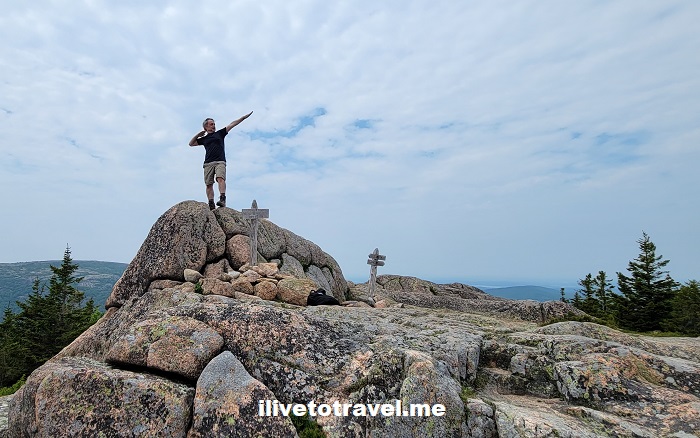
usain bolt in maine, hiker in maine, acadia hiking, stud in maine
Cuban Usain Bolt – and, for once, nature imitates art!
usain bolt in maine, hiker in maine, acadia hiking, stud in maine
hiking in acadia, pushups in maine, hiker stud, blue steel pose in maine
My “Blue Steel” look and trying to push the rock away with my pushup! (didn’t work!)

In no particular order, here are some of the great hikes in Acadia that I enjoyed in this trip (in no particular order).

Witch Hole and Pond Carriage

At 7.8 miles or so but little elevation gain, this trail qualifies as moderate. This trail is near Hulls Cove by the Park Headquarters. It passes small ponds along the route and it is a smooth trail good for hikers, regular bikers, and strollers. The choice to do this trail on day 1 was that it was supposed to rain and I thought it would be better to avoid rocky trails. I certainly was not going to let rain keep me from hiking but also wanted to be sensible!

witch hole hike, waterfall in maine, hiking in maine, acadia national park

St. Sauveur and Acadia Mountains

In researching these two mountains, I learned there was an easy way to build a loop hike that hit both and covered 4.5 miles or so. Neither mountain gets beyond 700 ft in elevation but, together, they are considered a moderate hike as the terrain is not smooth.

Acadia Mountain trail, hiking in Acadia, hiking in Maine
St. Sauveur Mountain, hiking in Maine, hiking in Acadia, US national parks

For those who may not want to go up a mountain twice in one loop, the Man O War trail allows a way to return to the trailhead off route 102.

St. Sauveur Mountain, hiking in Maine, hiking in Acadia, US national parks

We felt the counterclockwise direction turned out to be better once we had finished the hike. St. Sauveur Mountain was good but the views from Acadia Mountain were better. In addition, the uphill and downhill on Acadia Mountain were a lot of fun, and a great way to finish the loop hike! A lot of stones/rocks to run up (or down) added a neat challenge to the hike.

acadia mountain, hiking in Acadia, adventures in Maine, nature in maine, forest in maine
Come again? Am I running up that??!!
rock running, acadia mountain, hiking in Acadia, adventures in Maine, nature in maine, forest in maine
acadia mountain summit, views from acadia, hikers in maine, two guys hiking

Pemetic Mountain

This 5-mile hike starts at the restaurant on Jordan Pond in very flat terrain at the pond’s edge. A little more trafficked due to the popularity (and ease?) of the pond trail but, quickly, the trail to Pemetic veers off and then it was not as crowded (though we did run into people along the way).

Pemetic Mountain trail, hiking in Acadia, hiking in Maine, adonis in maine
Pemetic Mountain trail, hiking in Acadia, hiking in Maine, hikers in maine, two guys hiking
Pemetic Mountain trail, hiking in Acadia, hiking in Maine

A neat surprise on this one, on the downhill, was to go down the regular path OR to go down a ravine with the aid of two ladders. A no-brainer for this daring hiking duo: ravine!

Acadia National Park, hiking in Maine, trails with ladders, ravine
Acadia National Park, hiking in Maine, trails with ladders, ravine, Pemetic Mountain trail

A good bit of the downhill was rocky of the more painful kind: not the large rocks to jump your way through but the ones that, even if being careful, is very inviting to a twisted ankle.

Acadia National Park, hiking in Maine, rocky trail in Acadia, Pemetic Mountain trail

The hike ends up skirting the Bubbles (North and South) and you could decide to go up one or both of them. We skirted them and ran into a beautiful forested area. This was a very cool hike.

Acadia National Park, hiking in Maine, forest in Maine, palette of green, Pemetic Mountain trail

Bernard Mountain

On the last day of the trip, we had to squeeze one final hike. We wanted to do some other things later in the day before heading to Bangor to be by the airport for the 6AM flight the next day. We had hiked in that part of Mount Desert Island earlier and wanted to drive around that part of the island so Bernard Mountain was the choice.

bernard mountain, hiking in Acadia, adventures in Maine, nature in maine, forest in maine, Mount Desert Island
bernard mountain, hiking in Acadia, adventures in Maine, nature in maine, forest in maine

It was a beautiful and very quiet hike. We saw only one person as we started the climb. It was very green and not much of a view at the top but what made it a gem was all the vegetation. A rolling mist near the summit was a treat!

bernard mountain, hiking in Acadia, adventures in Maine, wood art
Art in nature – love the lines and curves
bernard mountain, hiking in Acadia, adventures in Maine, hikers in maine, two guys hiking
lobster roll, Maine, hiking in Acadia
THIS was reward – it made me VERY happy!

What to know about visiting Acadia National Park

Acadia is one of the top visited national parks in the United States and it earns that through the beauty of the scenery combined with the good food (lobster, anyone?!). One word of caution: at peak season, the place can be a madhouse of traffic and cars. I could see the buildup in early June but, for example, it was still easy to find parking along Ocean Path Trail (the one-way road along the coast). Two years ago, when I went at peak time, it was nearly impossible to find a parking spot along the road. So, if at all possible, avoid peak season to maximize the ease of enjoying the place.

Another key thing to do that I did on my first visit but not on this one is to go see the sunrise atop Cadillac Mountain. As the suggestion alludes to, it is an early start day… You can drive up to the summit (I think it is a 3-mi drive) and just sit up there on the rocks awaiting the earliest sunrise in the eastern seaboard. Be mindful though: you need to have pre-purchased a pass to get to this spot at sunrise. It is a HIGHLY popular thing to do and there is only so much parking up there. You must either buy it months in advance OR check at 10AM two days before the day you want to go. Thankfully, the pass is $6 so it will not break the bank. Now, of course, check the weather the night before lest you wake up to go and the sky is overcast!

I have been blessed to visit twice and hope I can visit again and enjoy Mount Desert Island and Acadia National Park some more!

Acadia, hiker, strong hiking legs, hiking, US national parks, outdoors in Maine

A Special Church in Tiberias: St. Peter’s Catholic Church

St. Peter holds a special place in the Catholic Church as the chosen apostle to lead Christ’s church. The main church in Christendom, St. Peter’s Basilica, is understandably named after him. So it is no surprise that, during a pilgrimage to the Holy Land, one would run into a few churches also named after him! I visited two such churches in Galilee. In this first of two posts, I will share about St. Peter’s Catholic Church in Tiberias, on the shores of the Sea of Galilee (which is technically a lake but its waves can be so strong, it resembles a sea – I am told), also called Lake of Tiberias.

St. Peter Catholic Church in Tiberias Israel in the Holy Land
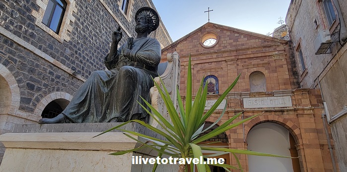
St. Peter standing guard

About the town of Tiberias

Tiberias is an old town built by Herod Antipas in AD 20 to honor (or, suck up to?) the Roman Emperor Tiberius. Though not initially appealing to the Jewish population of the land, eventually the city became a center of Jewish life over the centuries to the point that it is one of the four holy cities of Judaism in the Holy Land.

Tiberias’ population runs about 40,000 people and it is sort of a resort town (with even party boats!). It also sits at 200m below sea level.

History of St. Peter’s Church in Tiberias

The church dates to the 1100s when the Crusaders built it. It did not stay long in Christian hands as the Muslims took it over less than 100 years later and converted it to a mosque. As the centuries passed, Christians would go from Nazareth to visit the site (paying the Muslims, of course). Eventually, as happened over the centuries across the Holy Land, the Western Christian Church (before any split had occurred) started acquiring sites deemed holy.

It is important to share that at the time of the construction of the church there was the Western Christian Church and the Eastern Christian Church (as of the great schism of 1054). The Western Christian Church is the Catholic Church which had a few “spin-offs” during the Reformation and after.

Back to the story… So in the 18th century, the Franciscans (official custodians of holy sites and sanctuaries in the Holy Land from the Western Christian Church) bought the property and later built the complex around it as a monastery.

St. Peter Catholic Church in Tiberias Israel in the Holy Land
Part of the monastery, where guest rooms are

St. Peter’s Catholic Church Today

Today, the church is in a Franciscan complex which also hosts a pilgrim’s house called Casa Nova. Casa Nova has 25 rooms (basic but with good A/C!) and has an inner courtyard where the church sits. Besides this one in Tiberias, there are other Casa Novas in the Holy Land. I stayed 5 nights at the one in Bethlehem which is a jewel as it stands right next to the Church of the Nativity.

The church structure is not visible from street level due to the complex walls. From the lakeshore, one can see the back of the church and the identification of the structure as St. Peter Catholic Church.

Interestingly, the church is in the shape of a ship as St. Peter was a fisherman before becoming a follower of Christ. Its website says: “It symbolizes the Church of Christ resisting storms according to the divine promise that “the gates of the netherworld shall not prevail against it” (Mt 16,18).

St. Peter Catholic Church in Tiberias Israel in the Holy Land
Entrance to the church

The interior of St. Peter’s Catholic Church

The interior is simply but powerful in evoking the story of St. Peter: the miracle of the catch of fish, his naming as first among the Apostles, his building of the church of Rome, and his martyrdom.

St. Peter Catholic Church in Tiberias Israel in the Holy Land
The view as one enters: the altar and its mosaics
St. Peter Catholic Church in Tiberias Israel in the Holy Land
Beautiful depiction of St. Peter the fisher of men
St. Peter Catholic Church in Tiberias Israel in the Holy Land
Below St. Peter on the boat and right above the altar
St. Peter Catholic Church in Tiberias Israel in the Holy Land
St. Peter Catholic Church in Tiberias Israel in the Holy Land, holy water
Holy water bowl

I found it unusual among the holy sites and sanctuaries I visited over the 10 day pilgrimage. It was only really visited by the people staying at Casa Nova (perhaps a few others?) allowing respite from the crowds of pilgrims and tourists. This allowed for the right environment to sit quietly in prayer and thanksgiving.

St. Peter Catholic Church in Tiberias Israel in the Holy Land
Fisher of men, leader of the Christian Church, …
St. Peter Catholic Church in Tiberias Israel in the Holy Land
… “tend my sheep”

Beautiful Sirmione, Lake Garda’s Jewel

The town of Sirmione, Lake Garda is on the northern tip of a tiny peninsula that juts out of the lake’s southern shores. Lake Garda is the largest of Italy’s northern lakes and is very close to Verona.

I had never heard of it until 2021 when I went to the area to hike in the Dolomites. At that time, I was doing an overnight in Verona and decided to hop on the train for the short ride to Peschiera del Garda. Peschiera sits at the southeastern tip of the lake and just a little closer to Verona.

Second time visiting Lake Garda

In 2022, I got to return to Verona and decided that perhaps I would not overnight there but, instead, somewhere on Lake Garda’s shore. I started researching alternatives to Peschiera and discovered Sirmione. I opted for making a stop in Verona along the way for lunch at a restaurant I discovered the prior year, and then spending the balance of the day enjoying Sirmione.

Sirmione has a little bit of everything!

To enter the heart of the town, you must cross a bridge and go through the main gate. Once you enter the gate into the old town, it is pedestrian – for the most part. There are oodles of places to eat, have some gelato or perhaps a beverage.

Sirmione, Lake Garda, peninsula, Verona, Italy's lake district, medieval castle, roman villa, roman ruins, lake boat ride

Sirmione is known for thermal baths, for being a beautiful “town”, for its resort-like R&R offerings, and its amazing old medieval castle.

Sirmione, Lake Garda, peninsula, Verona, Italy's lake district, medieval castle, roman villa, roman ruins, lake boat ride
One of the spas intown

There are also the ruins of a Roman villa on the tip of the peninsula itself! This town has it all.

Sirmione, Lake Garda, peninsula, Verona, Italy's lake district, medieval castle, roman villa, roman ruins, lake boat ride
The ruin of the Roman villa

A different way to appreciate Sirmione

We opted for a boat ride around the peninsula to appreciate the town from a different vantage point. The tour boats are usually located right outside of the gate to the town; easy to find. The boat ride was super fun as our captain/guide was quite a character. I recommend going right before the sun begins to lower for the best light for photos!

Sirmione, Lake Garda, peninsula, Verona, Italy's lake district, medieval castle, roman villa, roman ruins, lake boat ride
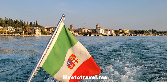
My Mom looking like a movie star!

Our lodging right outside the town gate

We stayed outside of the town but almost as close to the gate as possible on the west side of the peninsula. It is a skinny peninsula with only one road. Our hotel was small and super nice. My room’s balcony faced the park in the direction of the town’s gate but if I just looked left, I had a view of the lake.

Sirmione, Lake Garda, peninsula, Verona, Italy's lake district, medieval castle, roman villa, roman ruins, lake boat ride

While Sirmione may be off the main path of most tourists visiting Italy, if you want to branch out and see a different Italy in a beautiful natural setting, Sirmione is it!

Sirmione, Lake Garda, peninsula, Verona, Italy's lake district, medieval castle, roman villa, roman ruins, lake boat ride

Cheese Town in The Netherlands: Gouda

As my trip to The Netherlands was taking shape, I was looking forward to visiting the town eponymous with cheese: Gouda. I had never stop to contemplate what this cheese town in The Netherlands could actually be like, much less look it up.

Gouda’s name doesn’t sound like it reads

Once in The Netherlands, I learned the town name is pronounced something like “Hao-da”. It does sound ridiculous vs. the pronunciation of the letters in English (or Spanish, or many other languages). But that is the cool thing about Dutch: it is very much its OWN thing. I tried not to be pretentious since it was only a half-day visit. So I stuck to “Goo-da” but I avoided saying it in front of locals to not offend 🙂

Gouda, Holland, cheese town, The Netherlands, travel, Dutch cheese, exploring
Approaching town center coming from the nearby train station

Getting to Gouda

My visit to Gouda would be a daytrip from Rotterdam. Staying in Rotterdam, made it very easy to squeeze in a side trip since the ride was so short – about 20+ mins. From the Gouda train station, it was a 5-min walk to the shopping/pedestrian street leading to the heart of town. Easy-peasy!

Gouda, Holland, cheese town, The Netherlands, travel, Dutch cheese, exploring

Tourist in Gouda

We stopped at the tourist info office at the heart of town (the “VVV“) and oriented ourselves. It is a small office and a good place to get info, plans, etc. if you have not done much research beforehand. They sell a handy and compact visitor booklet for 5 euros that is worth the spend. It orients you to town and the places to be sure to notice/see intown.

The tourist office is within a historic building, De Waag, where they weighed cheese brought in to the market for sale. Considering Gouda’s cheese market was established in 1198, we can say a lot of cheese has gone through it. Now, the Waag hosts the VVV and a small museum.

Gouda, Holland, cheese town, The Netherlands, travel, Dutch cheese, exploring

Cheese Town

We learned that Gouda became the “it” place for the cheese commerce beating other competitor towns. I thought the cheese was named for the town because it was made there but, no, it was made in the region. Gouda was just like the trading center. Who knew?

The central square still hosts a cheese market one day a week. The Gothic building at the center, City Hall or Stadhuis, built around 1450, was placed alone to avoid it catching fire should a fire start around it.

Gouda, Holland, cheese town, The Netherlands, travel, Dutch cheese, exploring, city hall, stadhuis
Gouda, Holland, cheese town inThe Netherlands, travel, Dutch cheese, exploring, stadhuis, city hall, rathaus
Gouda, Holland, cheese town in The Netherlands, travel, Dutch cheese, exploring

Cheese Tasting

We opted to do a cheese exploration by visiting the Gouda Cheese Experience. It was a neat place with some hands-on interaction (not making cheese but in other ways) which made it interesting for kids and adults.

Gouda, Holland, cheese town, The Netherlands, travel, Dutch cheese, exploring, cheese experience
True hands-on!

At the end, we had the chance to taste some cheeses before heading out. It was a good way to learn more about cheesemaking in all its aspects (ingredients, process, packaging, etc.).

Gouda, Holland, cheese town, The Netherlands, travel, Dutch cheese, exploring, cheese experience, cheese tasting

Amazing stained windows at Sint-Janskerk

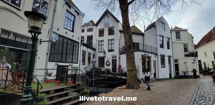
Taking a small side alley from the market square, one enters the quaint area around the church of St John’s (Sint-Janskerk). The area is small and kept much as it has been for ages. It became one of my favorite spots in The Netherlands!

Gouda, Holland, cheese town, The Netherlands, travel, Dutch cheese, exploring, cheese experience
Gouda, Holland, cheese town, The Netherlands, travel, Dutch cheese, Dutch architecture
Gouda, Holland, cheese town, The Netherlands, travel, Dutch cheese, Dutch architecture, Dutch canal
Gouda, Holland, cheese town, The Netherlands, travel, Dutch cheese, Dutch architecture
Gouda, Holland, cheese town, The Netherlands, travel, Dutch cheese, Dutch architecture, Lazarus Gate
The beautiful Lazarus Gate
Gouda, Holland, cheese town, The Netherlands, travel, Dutch cheese, Dutch architecture, Lazarus Gate
The reverse (or garden-side) of the Lazarus Gate
Gouda, Holland, cheese town, The Netherlands, travel, Dutch cheese, Dutch architecture

The church is protestantly sparse – devoid of the warmth that I am used to in a place of worship. However, it hosts 72 amazing 16th century stained windows (most of them, not all). These stained windows were taken down during WW II so they would not be destroyed. They were stored all over the place until the war ended and they could safely hang in their usual spots.

Using an audioguide is highly recommended (included in the entrance fee) to better appreciate the art and what it depicts. It was time well spent!

Gouda, Holland, cheese town, The Netherlands, travel, Dutch cheese, Dutch architecture, St John Church, Janskirk
Gouda, Holland, cheese town, The Netherlands, travel, Dutch architecture, St John Church, Janskirk, stained glass window

The church was built in the mid-sixteenth century after fire destroyed the medieval church that was located there (not an uncommon fate for churches in those times). Another claim to fame is that it is the longest church in The Netherlands.


I hope this gives you a small glimpse into this curious Dutch town – and that perhaps you read this and it makes you want to eat some Gouda cheese!

An Attic Church in Amsterdam

When The Netherlands left Catholicism after the Reformation, all Catholic churches became Protestant churches. While the Dutch were able to practice any religion, Catholics were not allowed to practice Catholicism in any public setting (let’s say, a loose definition of religious freedom was at play; they were allowed to be Catholic but only to practice in private). Therefore, people turned to private settings for the celebration of Mass and house “churches” came about around the country, hence this attic church in Amsterdam came about.

Amsterdam’s hidden Catholic church

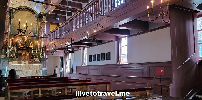
One such place has remained intact, as it was set up a couple of centuries ago. It is known today as Our Lord in the Attic. The man who built this setting for Mass in the connected attics of three houses also lived in one of the houses. He was a rich merchant in 17th century Amsterdam. His last name was Hartman so the church was known as the “Hart Church” for some time.

attic church in amsterdam, hidden catholic church, netherlands, things to see amsterdam
attic church in amsterdam, hidden catholic church, netherlands, things to see amsterdam, altar

Visiting the attic church

One can visit this neat museum that still holds Mass on the first Sunday of each month and on Christmas Day. One not only can see the “church”, the priest’s quarters, but also the family’s residence.

The museum acquired a property across the side alley and the main entrance, shop, etc. are located there.. One goes downstairs to then, through a tunnel that runs under that side alley, one reaches where the visit begins.

In that space, one can see a model of the two buildings and visualize the space about to be explored. I recommend coming back and taking a look at the model ONCE the visit has been done.

Also, it is at that point where the visitor picks up the optional audio guide. The audio guide is included in the entrance fee (16.5 euros when I visited). It is highly recommended to use it so the place is better understood and appreciated.

attic church in amsterdam, hidden catholic church, netherlands, things to see amsterdam, altar

The canal house hosting the attic church

The living quarters may seem austere to us today but the house seems to have been spacious. The rooms are not all loaded up with furniture to show how it exactly was but there are some pieces of furniture and art.

attic church in amsterdam, hidden catholic church, things to see amsterdam, canal house amsterdam
Above: spacious living room. Below: dining room and bedroom!
attic church in amsterdam, hidden catholic church, things to see amsterdam, canal house amsterdam
Grandiose room with a massive fireplace!
hidden catholic church, things to see amsterdam, canal house amsterdam, old kitchen
The house’s kitchen

A canal house with a great view of the canal

Take a look at the great view from the main level through the window and then from up higher. Of course, the area is now nicely painted and with modern vehicles but still a great view!

hidden catholic church, things to see amsterdam, canal house amsterdam
row houses Amsterdam, things to see amsterdam, canal house amsterdam

The priest’s quarters

As I mentioned earlier, the priest was also provided a place to live in the back. It seemed like a spacious and convenient spot even if without the canal view the owner and his family enjoyed. And a potty closet to boot!

attic church in amsterdam, hidden catholic church, things to see amsterdam, canal house
old toilet, old canal house amsterdam, things to see amsterdam

Crazy staircases!

Of note to me were the two original staircases that remain. Steep, curvy – they require paying attention to not trip or fall!

crazy steep staircases, old canal house amsterdam

This is likely not atypical for many of the houses in Amsterdam’s historic center. Yet one more reason to check out Our Lord in the Attic: to see how Amsterdam’s beautiful canal houses felt like back when and could still be today!

A Unique Spot in Verona: Piazza dei Signori

The Piazza dei Signori (or, “Piazza of the Gentlemen”) is right next to the more famous (and impressive) Piazza delle Erbe in the heart of Verona, Italy. It likely earned its name as it is surrounded by important buildings or “palazzos”. It is not as old as the Piazza delle Erbe – and it is perhaps less “electric”. However, the buildings that surround it are impressive from an architectural and historical standpoint.

Finding this lesser-known piazza

Coming from the Piazza delle Erbe, one enters the piazza through an alley above which hangs a large whale bone. Legend has it that it will fall once someone who has never lied walks under it. I have walked under it on two different visits to Verona and I can report it did not fall on me.

Piazza dei Signori, Verona, Italy, italia, architecture, Palazzo della Raggione, history, Dante Alighieri, Divine Comedy, italian squares, whale bone
Look up!

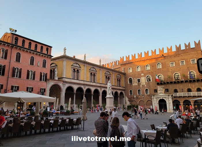
If you keep going you will enter the large piazza surrounded by interesting buildings, some cafes and a large open space with a statue at its center. Of course, the piazza has entries on all sides so it connects well to other parts of the old town.

The next photo is taken looking back from the Piazza dei Signori towards the alley where the whale bone hangs.

Piazza dei Signori, Verona, Italy, italia, architecture, Palazzo della Raggione, history, Dante Alighieri, Divine Comedy, italian squares, lamberti tower
Looking at the Palazzo della Raggione (left)

Important buildings all around

From the Loggia of the Council to a small church, the square is dotted by buildings that have housed administrative, political and judicial offices. They were built many centuries ago. For example, the Palazzo del Capitanio was built in the 14th century and the Loggia in the 15th. However, many of these buildings have undergone changes and renovations over the centuries, as can be expected. Their styles seem to differ enough to my untrained eye with the Loggia being more different than the others.

Piazza dei Signori, Verona, Italy, italia, architecture, Palazzo della Raggione, history, Dante Alighieri, Divine Comedy, italian squares

I would not call it a pretty square though it is charming enough. Verona’s Piazza delle Erbe or Krakow‘s main square, for example, best it in beauty and charm. But this piazza conveys well how these cities were run centuries ago through the history of these palazzos (OK, “palazzi” in proper Italian…).

One cool and grand staircase

The Palazzo della Ragione sits on the alley that connects the Piazza delle Erbe and the Piazza dei Signori. Construction of the palazzo started late in the 12th century but the building kept getting modified/added on for centuries. It evolved with the needs of the time. And it has served many purposes: political, administrative, and even commercial, hosting markets. Today the palazzo hosts a modern art museum and a district court.

The palazzo has an inner courtyard (also called Courtyard of the Old Market) with one of the most spectacular outdoors staircases I have seen in Italy: Scala della Ragione. I did not know to go find it. I just accidentally discovered it. The lesson from this is to pop in any open entranceway one runs into when exploring a town!

Piazza dei Signori, Verona, Italy, italia, architecture, Palazzo della Raggione, history, Dante Alighieri, Divine Comedy, italian squares, torre lamberti, scalla della raggione

Climb and check out Verona from up high

If you have read other posts in this blog, you may have read that I enjoy climbing any tower or dome that gives me a great bird-eye’s view of any town.

Thankfully, the Palazzo della Ragione hosts the Torre dei Lamberti. This is the structure towering over the Scalla della Raggione in the photo above. This 84-meter tower offers a great 360 degree view of Verona. The tower was initially built in 1172 by the Lamberti family. If I understood right, it was made taller a little later (notice in the photo how it changes about halfway up).

Piazza dei Signori, Verona, Italy, italia, architecture, Palazzo della Raggione, history, Dante Alighieri, Divine Comedy, italian squares , view from above. tower in verona
Looking down towards Piazza d. Signori towards the river
Piazza dei Signori, Verona, Italy, italia, architecture, Palazzo della Raggione, history, Dante Alighieri, Divine Comedy, italian squares , view from above. tower in verona
Piazza delle Erbe

The good news: there is an elevator for the climb so it is not all based on self-propulsion! And the ticket gives access to the modern art museum in the palazzo.

The main attraction: Dante Alighieri

As you can see, I discovered things I was unaware of. However, what drew me to this piazza was to see the statue to a famous guest resident of Verona: Dante Alighieri. Dante is Italy’s most pre-eminent poet and, possibly, of letters overall, not just poetry. The Divine Comedy with its hell, purgatory and heaven was written by an imaginative Dante in poetry form.

Dante, a Florentine by birth, exiled himself from his home town due to political drama. He never returned to Florence and is actually buried in Ravenna. At the 600th anniversary of his birth in the 19th century, the Veronese built the statue we now see in the piazza in his honor.

Piazza dei Signori, Verona, Italy, italia, architecture, Palazzo della Raggione, history, Dante Alighieri, Divine Comedy, italian squares , view from above. tower in verona
Dante with the Loggia of the Council behind him

There is a lot to see in Verona. This piazza, though not the most famous of the sites in Verona, is well worth the visit.

It Is High Time to Explore Split!

In between Venice, Italy and Dubrovnik, Croatia lie a number of islands and coastal towns that form Croatia’s Dalmatian coast. I have been fortunate to have visited Dubrovnik twice – as charming a town as I have ever seen. But, in a recent trip along the coast, I got to spend a brief day in Split, not quite halfway between Dubrovnik and Venice and a UNESCO World Heritage Site.

While Dubrovnik beats Split in the picturesque category, Split is very pleasing to the eye and feels much more approachable and livable. I would rather spend a couple of weeks in Split than in Dubrovnik for sure.

Split, Croatia, Roman ruins, Dalmatia, Adriatic, coast, travel, history, architecture, Diocletian palace, Jadrolinija ferry

A bit on how Split became important… Diocletian

Split is an old town in a continent of old towns. Its main claim to fame is the palace built by Roman emperor Diocletian as his retirement home. Diocletian retired from being emperor in a job that people did not get to retire from. Much as the late Pope Benedict XVI did in another job typically worked until natural (or otherwise) death came about.

Diocletian ruled in the late third century A.D. after doing a lot of things, including persecuting Christians in his empire. The bloodiest and largest persecutions conducted by Rome across the early A.D. centuries were his – nice guy… Diocletian was born in the Roman area called Dalmatia (a good bit of current Croatia). As many did before him, he rose through the Roman military’s ranks to become emperor.

The rare retired Roman emperor needs a palace

Diocletian decided to voluntarily leave the emperor role as illness had impacted him. He built himself a palace a short distance from the capital of the province of Dalmatia by the waters of the Adriatic.

His palace was built more like a fortress, surrounded by massive walls on all four sides (as the image below shows) and dotted by a number of towers. It also had four main gates, one on each side, with one of them facing the water.

Split, Croatia, Roman ruins, Dalmatia, Adriatic, coast, travel, history, architecture, Diocletian palace
The left side faced the Adriatic

Today, land has been reclaimed so that gate is no longer opening up to boats but to cafes and other establishments that then face the water.

Retaining Roman walls in a modern setting

The “palace” retains some of the walls and a few towers as well as some of the structures from Diocletian’s time.

Split, Croatia, Roman ruins, Dalmatia, Adriatic, coast, travel, history, architecture, Diocletian palace

As you walk inside the so-called palace, you find amazing remnants of the original structure. For example, a small sphinx brought from Egypt, the vestibule area where people waited to enter the former emperor’s quarters, and the like.

Split, Croatia, Roman ruins, Dalmatia, Adriatic, coast, travel, history, architecture, Diocletian palace, cistern
Former cisterns, later sewage dump, now often market stalls
Split, Croatia, Roman ruins, Dalmatia, Adriatic, coast, travel, history, architecture, Diocletian palace
Sphinx on the lower left; entrance to emperor’s quarters ahead

A palace that is a town, still lived in

However, over the centuries buildings/structures have come and gone. The inside of the palace is more like an old town that is still being lived in – an ongoing residential area almost two millennia later.

Split, Croatia, Roman ruins, Dalmatia, Adriatic, coast, travel, history, architecture
Split, Croatia, Roman ruins, Dalmatia, Adriatic, coast, travel, history, architecture, Diocletian palace, church, arch

We heard that, unfortunately, private businesses are buying buildings to set up fancy boutique hotels, offer rental apartments for tourists, etc. This means that locals are being pushed out. It is a shame that it is taking place here (and many other charming towns across Europe) though one can see the appeal.

Split, Croatia, Roman ruins, Dalmatia, Adriatic, coast, travel, history, architecture, Diocletian palace

Markets always offer good photo opps!

Split, Croatia, Roman ruins, Dalmatia, Adriatic, coast, travel, history, architecture, market scene

Different architectural styles

If you pay attention as you walk around, you will notice the mark from different architectural styles from Roman to Venetian Republic to Hapsburg and more. I imagine it will mean a lot more to architects than to me but even I, a layperson, enjoyed seeing the contrasting styles in town.

Split, Croatia, Roman ruins, Dalmatia, Adriatic, coast, travel, history, architecture
Split, Croatia, Roman ruins, Dalmatia, Adriatic, coast, travel, history, architecture, Venetian architecture in Croatia

An amazing town to check out

Split is much more than Diocletian’s palace. It is an important port and the many ferries coming and going to Italy and other towns and islands in the Adriatic are evidence of that. I am hoping to find a place to rent (outside of the palace!) and spend time chilling in this fantastic Adriatic and historical town!

Split, Croatia, Roman ruins, Dalmatia, Adriatic, coast, travel, history, architecture
Beautiful Adriatic sky and waters
Split, Croatia, Roman ruins, Dalmatia, Adriatic, coast, travel, history, architecture
Ciao, Split – ’til next time!

Dante, Dante, Where Are Thou? (As in Alighieri)

Dante Alighieri‘s Divine Comedy is a masterpiece of allegory, sharing with us the growth of the main character (Dante himself) as he traverses hell, purgatory and heaven. It has inspired many through the centuries (many centuries) since it was written. Including The Masquerade at Excelsior Mill in Atlanta with its three epic levels of hell, purgatory and heaven. But I digress.

Once an exile, always an exile

Dante was born in 1265 in Florence, Italy so he has been known for a LONG time. Due to politics (apparently, a nasty business not just in modern times), he had to flee his native town. Back then, Florence was a powerful republic, not just a city as we know it today.

He fled and took refuge in Verona, of Romeo and Juliet fame, where he is honored in a square – postcard #1.

Verona, Dante Alighieri, Divine Comedy, Divina Comedia, Italia, Italy

His Divine Comedy is a poem and I understand it is a brilliantly designed one in its original language: Italian. That -and a recent two-week trip- motivated me to learn Italian. I was able to actually hold conversations in Italian thanks to that effort. Though I am sure I butchered it a lot. In any case, he is the Shakespeare, the Cervantes of Italy and he pre-dates them. He is from the Middle Ages!

Death threat and actual death in Ravenna

Anyway, he was exiled on perpetuity and the pain of returning was being burned at the stake so one can understand why he did not return.

Sadly, he died at 56 of malaria in the Adriatic coastal city of Ravenna. Ravenna became an important city as Rome descended into chaos. It became capital of the Western Roman Empire in the early 5th century.

And that leads me to postcard #2 – his tomb in Ravenna. This tomb is from the 18th century. No, he did not live that long. Over the centuries, Florence regretted casting out this most famous of its sons and tried to get his remains back and even built a tomb. But, it remains empty as Ravenna has kept him all this time, even hiding his remains for some period of time to ensure they were not taken away. I think Ravenna should keep him…

Dante Alighieri, Ravenna, Dante tomb, Italy, Italia, Divina Comedia, Divine Comedy

How to read the Divine Comedy

I hope this unusual post in my blog was entertaining if nothing else. And, if you have never read the Divine Comedy, I recommend you do it. But with some guide to explain it along as there are a lot of hidden meanings, parallels across stories in the book, etc. It is well worth discovering this gem of Middle Age (or any age) literature – and if you can do it in Italian, even better!

Checking out Cloudland Canyon State Park

On a very cold fall morning (actually, late morning as it was 11:45AM) I started what would be a super cool hike in Cloudland Canyon State Park in NW Georgia. NW as in the true corner of Georgia where it meets Alabama and Tennessee, in the Cumberland Plateau. A friend selected this state park, two hours’ drive away from Atlanta, for our Sunday hike. Excellent choice!

The state park offers several trails but the most epic one is the one that allows the hiker to properly appreciate the Cloudland Canyon: the West Rim Loop Trail. Oh, and worth noting the park offers fishing, horseback riding trails, picnicking and the like. For those not hard-core hikers, the Overlook Trail offers a way to see some of the beauty.

cloudland canyon state park, hiking, north Georgia, outdoors, nature, fitness
Approaching the trails from the parking lot

The West Rim Loop Trail

The trail actually starts with an in-and-out section that is about 1-mile+ long that crosses Daniel Creek. It is worth noting (and expressing gratitude!) that this state park is so well prepared for us hikers. It has excellent, readable signage (Iowa State University is a sponsor or supporter of these – thank you!) and very reliable trail markers (yellow for the West Rim Loop Trail).

There are some magnificent rock formations of different sorts, which are also seen further south in the trails of north Atlanta.  Certainly, one can envision how the natives in the area used those formations for their shelter.
Yellow marks the way!

Also, there are many well-prepared lookouts, many with very good and sturdy railings, and some vantage points just left open as nature set them up!

cloudland canyon state park, hiking, north Georgia, outdoors, nature, fitness
One of the many vantage points
There are some magnificent rock formations of different sorts, which are also seen further south in the trails of north Atlanta.  Certainly, one can envision how the natives in the area used those formations for their shelter.

At the end of it (35 minutes later), it meets up with the loop part of the trail, about a 2-mile hike reaching about 1,900 ft altitude. We completely guesses which way to go once we got to the loop and we opted to go left.

Good choice. Though it starts with a long uphill, the left side offered a great view over a plain-like area and a town that I believe was Trenton, Georgia. At some point, the loop hit a rocky promontory sort halfway through and then the trail turned to face to east rim and rockface of the Cloudland Canyon.

Checking out rock formations

There are some magnificent rock formations of different sorts, which are also seen further south in the trails of north Atlanta.

cloudland canyon state park, hiking, north Georgia, outdoors, nature, fitness

Certainly, one can envision how the natives in the area used those formations for their shelter.

hiking, rock formations, north Georgia, nature, outdoors, ilivetotravel
Not my home but in a bind…

The walls of a grand canyon

Wow! What a spectacular and long canyon-face! Certainly that was the part to see after passing the mid-point of the loop! One is rewarded with many lookouts (in-and-out very short trails) to enjoy the view.

cloudland canyon, georgia state park, nature, outdoors, hiking

Overall, the West Rim Loop Trail is 5 miles long. It took us 3 hours with the stops we made on the lookouts, random photos and snack/water breaks. There were other hikers but far from “crowded”.

One neat thing is that there are yurts and cabins in this trail. I think it would be awesome to do an overnight or two and see the scenery at different times of day.

Oh, and there’s more! Waterfalls!

Once we finished the trail, we went to see Cherokee Falls which is near the entrance to the trail. It is a spectacular climb down stairs (with the subsequent climb back up!) to get to it. The path that is not a staircase is much easier to handle!

cloudland canyon state park, hiking, north Georgia, outdoors, nature, fitness

One passes a MASSIVE boulder hanging over the trail (with a bench under it).

cloudland canyon state park, hiking, north Georgia, outdoors, nature, fitness
Don’t linger long under it!

The waterfall setting is well worth the trouble as were those at Panther Creek, another rewarding hike to a waterfall in north Georgia. My knees were a little sore when we finished the loop trail but, boy, did I make the right choice going down to see the waterfalls! The roundtrip to see the waterfall was a mile. Another mile roundtrip would have taken us to a downstream waterfall, Hemlock Falls. But, at 6 miles and my knees, I was glad to leave that for a future visit!

cloudland canyon state park, hiking, north Georgia, outdoors, nature, fitness
This is the reward – a spectacular spot!

If I were to return, besides trying to stay overnight at a yurt or cabin, I would certainly do it a little earlier in the fall because the color change of the trees would only add another level of spectacular to what is already a spectacular setting!

%d bloggers like this: