US & Canada
-
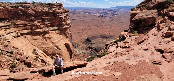
Two Days Exploring Canyonlands, a Mighty Five National Park Powerhouse!
More Details: Two Days Exploring Canyonlands, a Mighty Five National Park Powerhouse!Canyonlands seems endless: truly a Mighty Five National Park! Along with Arches, Zion, Bryce Canyon, and Capital Reef, it is one of the Mighty 5 U.S. National Parks in Utah. Canyonland National Park is located near Moab, Utah and not far from Arches National Park, it is far from from a major airport but certainly…
-
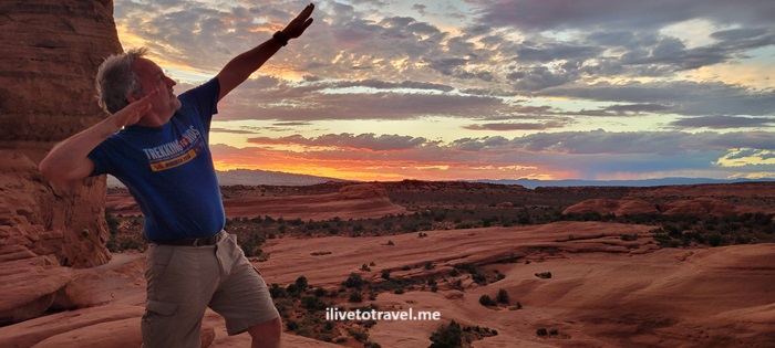
A Day in Arches, One of the Mighty Five National Parks
More Details: A Day in Arches, One of the Mighty Five National ParksIn June 2024 I spent a day in Arches National Park as part of an 8-day hiking trip along the “Mighty Five” U.S. National Parks in Utah. Arches is one of the most iconic and recognizable of the National Parks, a great system of parks and preservation of the beautiful nature available to anyone who…
-
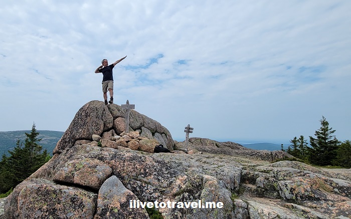
A Few Great Hikes in Acadia National Park
More Details: A Few Great Hikes in Acadia National ParkWhen it comes to beautiful places, I don’t mind repeat visits. This month, I was fortunate enough to return to Acadia National Park in Maine. In my first visit, I did some hiking but also explored more of Maine in the vicinity, such as the town of Belfast. This time, I was able to do…
-
Checking out Cloudland Canyon State Park
More Details: Checking out Cloudland Canyon State ParkOn a very cold fall morning (actually, late morning as it was 11:45AM) I started what would be a super cool hike in Cloudland Canyon State Park in NW Georgia. NW as in the true corner of Georgia where it meets Alabama and Tennessee, in the Cumberland Plateau. A friend selected this state park, two…
-
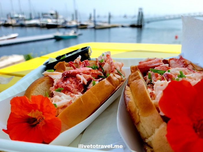
Around Belfast. Maine, That Is.
More Details: Around Belfast. Maine, That Is.A little over 30 miles from Bangor, lies the coastal town of Belfast, Maine on Penobscot Bay. It sits about midway on the Maine coast right on US route 1. With about 7,000 inhabitants, it is a small town but it is the seat of Waldo County. At the start of my trip to Maine…
-
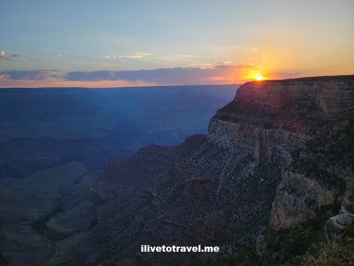
Cross-Country Drive Day 3 – From the Grand Canyon to Amarillo, Texas
More Details: Cross-Country Drive Day 3 – From the Grand Canyon to Amarillo, TexasA brief summary of day 3 of my cross-country drive: Grand Canyon to Amarillo, Texas, begins with the stats! Stats of the drive Third day: Grand Canyon National Park (GCNP) in Arizona to Amarillo, Texas Routes taken: Route 64 (south) to I-40 east, crossing New Mexico Departure time: 6:20AM (Pacific time in Arizona) Arrival time: 7:20PM (Central…
-
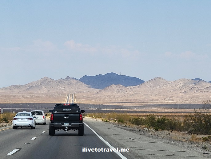
Cross-Country Drive Day 2 – Kingman to the Grand Canyon
More Details: Cross-Country Drive Day 2 – Kingman to the Grand CanyonCross-country drive starts in San Jose, California and crosses the southeastern part of the state including Barstow and hot Needles, California.
-
Cross-Country Drive Day 1 – San Jose, CA to Kingman, AZ
More Details: Cross-Country Drive Day 1 – San Jose, CA to Kingman, AZCross-country drive starts in San Jose, California and crosses the southeastern part of the state including Barstow and hot Needles, California.
-
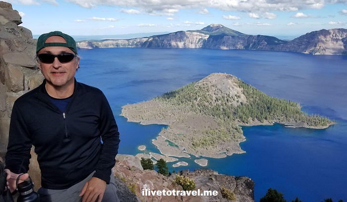
How to Explore Crater Lake National Park
More Details: How to Explore Crater Lake National ParkOregon is known for many great landscapes from its magnificent coast to the Cascade Mountains, to the Willamette Valley, to the Columbia River Gorge, etc. But one of its most spectacular sights has to be Crater Lake. Crater Lake, since 1902 part of Crater Lake National Park, serves as witness to the incredible story of…
-
11 Places to See on the Oregon Coast
More Details: 11 Places to See on the Oregon CoastThe Oregon coast stretches for over 360 miles (580 km) facing the mighty Pacific Ocean. To drive along the coast non-stop would take approximately seven hours on U.S. Route 101. Of course, stops are likely and recommended to plan well! We did the top third on one day, and the remaining on a second day.…
-
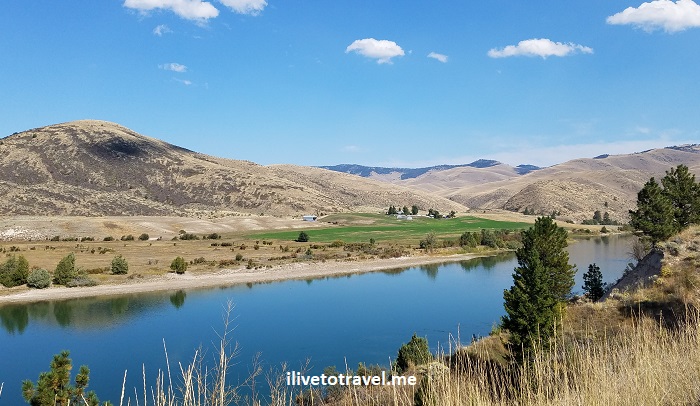
Great Drive Series – St. Ignatius to St. Regis, Montana
More Details: Great Drive Series – St. Ignatius to St. Regis, MontanaWhile exploring northwest Montana with a friend this past September, we tried to chart different routes as we covered a loop over a 4-day visit to the area. We started in and finished in Spokane but wanted to minimize taking the same route twice. We succeeded in that effort save for the stretch on the…
-
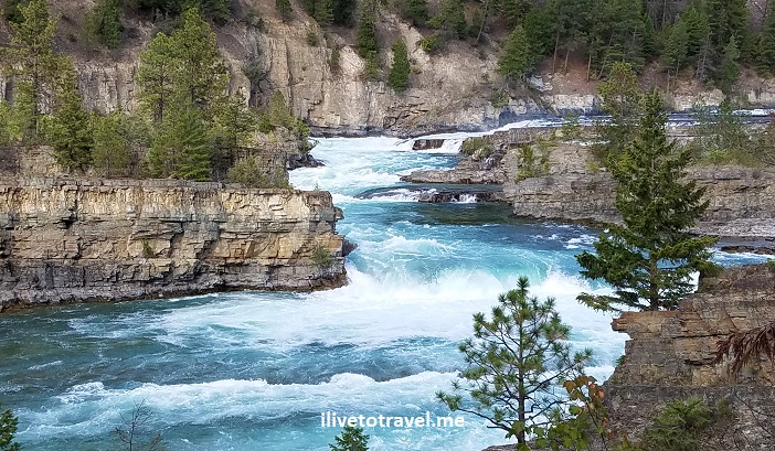
3 Places to See in the Remote Corners of Idaho and Montana
More Details: 3 Places to See in the Remote Corners of Idaho and MontanaUp in the panhandle of Idaho and the northwest corner of Montana, there is some spectacular, largely unspoiled scenery. I imagine not many get to see these lands as people focus on Coeur d’Alene, Big Sky or Glacier Mountain National Park. Well, it may make sense that they focus on those places but, if you have the…