Travel Journal
Relaying the experience of a journey…
-
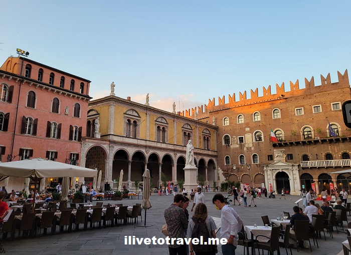
A Unique Spot in Verona: Piazza dei Signori
More Details: A Unique Spot in Verona: Piazza dei SignoriThe Piazza dei Signori (or, “Piazza of the Gentlemen”) is right next to the more famous (and impressive) Piazza delle Erbe in the heart of Verona, Italy. It likely earned its name as it is surrounded by important buildings or “palazzos”. It is not as old as the Piazza delle Erbe – and it is…
-
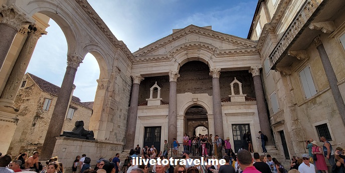
It Is High Time to Explore Split!
More Details: It Is High Time to Explore Split!In between Venice, Italy and Dubrovnik, Croatia lie a number of islands and coastal towns that form Croatia’s Dalmatian coast. I have been fortunate to have visited Dubrovnik twice – as charming a town as I have ever seen. But, in a recent trip along the coast, I got to spend a brief day in…
-
Dante, Dante, Where Are Thou? (As in Alighieri)
More Details: Dante, Dante, Where Are Thou? (As in Alighieri)Dante Alighieri‘s Divine Comedy is a masterpiece of allegory, sharing with us the growth of the main character (Dante himself) as he traverses hell, purgatory and heaven. It has inspired many through the centuries (many centuries) since it was written. Including The Masquerade at Excelsior Mill in Atlanta with its three epic levels of hell,…
-
Checking out Cloudland Canyon State Park
More Details: Checking out Cloudland Canyon State ParkOn a very cold fall morning (actually, late morning as it was 11:45AM) I started what would be a super cool hike in Cloudland Canyon State Park in NW Georgia. NW as in the true corner of Georgia where it meets Alabama and Tennessee, in the Cumberland Plateau. A friend selected this state park, two…
-
Rouen: Full of History in War and Art
More Details: Rouen: Full of History in War and ArtFrance has so many destinations to explore, it is hard to cover them all or explore them as in-depth as they deserve. Even after living in Paris for 6 months many years ago, I could not cover all the territory that I would have liked. One of the towns that I always wanted to visit…
-
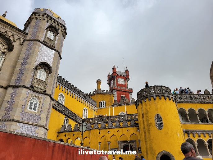
One Most Eclectic Portuguese Palace – Sintra’s Pena Palace
More Details: One Most Eclectic Portuguese Palace – Sintra’s Pena PalaceWell, for those interested in one of the most eclectic palaces around, Portugal has one for the books: the Pena Palace in Sintra. Look no further for a Portuguese palace! The town of Sintra Sintra is a town easily reached from Lisbon; an hour away or so. It is very picturesque with its old district,…
-
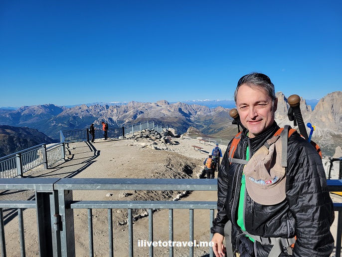
A Phenomenal Spot to Chill in the Dolomites
More Details: A Phenomenal Spot to Chill in the DolomitesThe third day of my hike in the Dolomites had me being driven from the Sasso Lungo area to a cable car (funivia) leading to Sass Pordoi. It is a nice way to ease into a hiking day to start with a short drive as, unbeknownst to me, this day was not going to be…
-
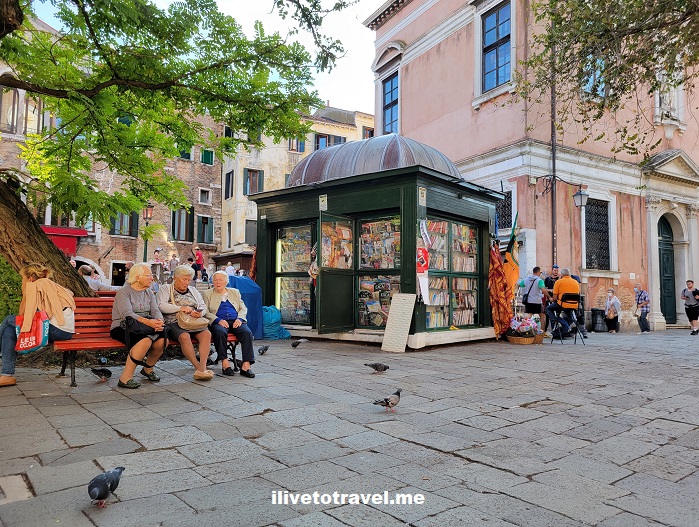
The Best of Venice – Get Lost in Its Neighborhoods
More Details: The Best of Venice – Get Lost in Its NeighborhoodsIn a prior post, I shared some images of Venice‘s majestic boulevard: its Grand Canal. From the modern pedestrian bridge near the train station to the iconic Rialto Bridge to St. Mark’s Square – and many palazzos in between, that post showcased Venice but now, the best of Venice! However, I enjoy Venice a lot…
-
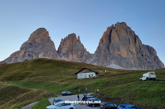
Hiking to the Sassolungo, an Impressive Massif in the Dolomites
More Details: Hiking to the Sassolungo, an Impressive Massif in the DolomitesOn day 2 of my hike in the Dolomites, we left the Rosengarten to reach the Sassolungo, an impressive massif in the western Dolomites. Mt. Sassolungo (also known as Langkofel in German, or Saslonch in the local language) is the tallest peak in the massif at around 10,400 ft (3,180 m). Mt. Sasso Piatto (Plattkofel…
-
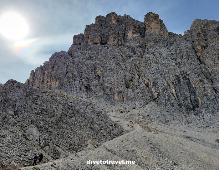
Challenge in the Dolomites: Hiking the Rosengarten
More Details: Challenge in the Dolomites: Hiking the RosengartenMy first day of hiking presented a neat challenge in the Dolomites taking us from Carezza / Karersee to Rifugio Passo Principe (Grasleitenpasshütte). There we would spend the night after traversing the iconic Rosengarten Massif, near Bolzano, Italy. The massif contains several peaks with its highest elevation being at 9,849 ft (3,002 m). The trek…
-
Around Belfast. Maine, That Is.
More Details: Around Belfast. Maine, That Is.A little over 30 miles from Bangor, lies the coastal town of Belfast, Maine on Penobscot Bay. It sits about midway on the Maine coast right on US route 1. With about 7,000 inhabitants, it is a small town but it is the seat of Waldo County. At the start of my trip to Maine…
-
Not Egypt’s Valley of the Kings but its Valley of the Whales: Wadi El-Hitan
More Details: Not Egypt’s Valley of the Kings but its Valley of the Whales: Wadi El-HitanHave you visited the Valley of the Kings near modern day Luxor in Egypt? Yes? Have you visited that “other” valley in Egypt? “What other valley?” you ask? Well, the Valley of the Whales, of course! AKA Wadi El-Hitan! Located about 100 miles southwest of Cairo near the town of Fayoum, you can easily visit…