Cross-Country Drive Day 2 – Kingman to the Grand Canyon
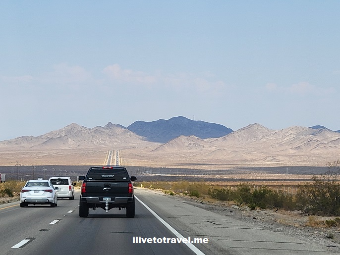
Stats of the drive

Second day: Kingman, Arizona to the Grand Canyon National Park (GCNP)

Routes taken: I-40 east to Route 89 north (around Flagstaff) to Route 64 west (at Cameron) to hit the eastern entrance to the GCNP

Departure time: 9AM

Arrival time: 3PM

License plates spotted: 43 states (somehow I suspect the gravity pull of the Grand Canyon had something to do with this success!)

sunrise, Grand Canyon, rim view, Arizona, route 66, route 89
Along Route 89

A simple plan

The trip’s plan included spending an overnight at the Grand Canyon National Park and enjoying the beautiful views. The drive from Kingman to the GCNP was going to be only about 3 hours so we planned for a late start this day. This would give us a break from early starts that would characterize the entire roadtrip.

sunrise, Grand Canyon, rim view, Arizona, route 66

Maximizing the Grand Canyon experience

Since we only had an afternoon and an evening (we would leave early the next morning), we splurged by staying right at the rim of the Grand Canyon. For those who have not been there, if you stay at hotels outside of the GCNP, you have about an hour’s drive (or more) for most of them. So that would be a 2-hr roundtrip in and out lost in driving.

We stayed at the Thunderbird Lodge on the edge of the canyon and got a partial view of the Grand Canyon. It was a spectacular setting despite the view being partial.

Thunderbird Lodge, Grand Canyon, rim view, Arizona
The view from the ground floor of Thunderbird Lodge

Sunset light at the Grand Canyon

sunset, grand canyon, el tovar, arizona, national park
Looking east towards El Tovar

But let’s not forget about Kingman

So I just spent telling you about day 3’s sunrise but did not tell you about day 2’s sunrise…

Being that my body was still on Eastern time, I woke up sometime in the 4AM range. First thinking my options were TV or reading, I promptly concluded that it would be good to get some exercise in even if mild. Also, I figured I should try to see some of the town but driving was the last thing I wanted to do. So, I just went for a 45-min walk which also overlapped sunrise.

Our hotel (a very nice Best Western) was right on historic Route 66 so I got to walk some of it seeing the police and fire stations and a few business. I also walked the streets of a middle class neighborhood right behind Route 66 but dogs would bark and being still the wee hours, I felt it a little rude of me to disturb the peace so I went back to Route 66 – to get some of the kicks the famous song promises!

sunrise, Grand Canyon, rim view, Arizona, route 66
Past glories of Route 66
sunrise, Grand Canyon, rim view, Arizona, route 66
Calling Agent 86!

Now, let’s go on to day 3!

Missed the start of the cross-country drive? Check out the San Jose to Kingman drive!

Cross-Country Drive Day 1 – San Jose, CA to Kingman, AZ

Last week I got to do the longest drive I have ever done: 5 days going from San Jose, California to Atlanta, Georgia. Why? I volunteered to help friends drive back to Atlanta as they leave California. It was not only a great opportunity to spend time together but also to see my country in a very different way of traveling: on the road!

Stats of the drive

First day: San Jose, California to Kingman, Arizona

Routes taken: California 101 to California 152 to I-5 to California 58 to I-40.

Departure time: 7AM

Arrival time: 4PM

License plates spotted: 30 states + 4 Canadian provinces (incl. Nova Scotia!)

Intra-California leg: San Jose to Bakersfield

Day 1 saw us departing San Jose, as you saw above, at 7AM. As I had arrive the night before from the East coast, that was not too early for me at all.

San Jose, window seat, California, great drive

Car loaded, we took some back roads (routes 101 and 152) to get onto I-5 at Los Banos. On the way there, we passed the town of Gilroy, which I am told is the world capital of garlic. Garlic IS in the air, even when the windows in the car are closed. Wikipedia says it is “the southernmost city in the San Francisco Bay area” but that seems a REAL geographical stretch to me (maybe it is a geological thing). Don’t believe everything you read! (The irony of that statement is not lost on me…) In any case, there were a large variety of crops like walnuts, almonds, and others confirming that this Central Valley indeed is a key source of produce.

I-5, I must say, is one tedious interstate to drive with the trucks and high volume of vehicles. I was glad when we got off it to head towards Bakersfield where we would take route 58 on the way to connecting with I-40 which would carry us, not only to the state border, but eventually all the way to Amarillo, Texas.

California Central Valley, produce, onion, trucks, cross-country drive

Southeastern California, Barstow and Route 66

After passing well-known Edwards Air Force Base, soon enough we hit our lunch stop at the crossroads of I-15 and one of the endpoints of I-40: the town of Barstow, California, right on Route 66. It was our first stop on Route 66. We were not trying to stick to Route 66 as we had days of driving to do but it was cool, at a couple of places, to see this famous route that carried so many out west in the 20th century.

Route 66, California, great drive, cross-country drive
Route 66, cross-country drive, California, Barstow
Barstow

To get to the border with Arizona, we first had to pass the Mojave area with the eponymous desert, Edwards AFB, and other facilities for military training and logistics. We also saw the lot where many airplanes are parked to not clutter airport space – it was odd to see so many planes in the middle of nowhere!

Hot Needles packing heat

It was a peculiar area and, of course, very hot. Temperatures hit 108F (42C). We thought that was outlandish but we were about to learn how reasonable 108F was.

As we took a southward turn on I-40 to go below Goose Lake

map, Goose Lake, Parker Junction, Needles
I-40 goes around the lake making a “U” that, on the right, will hit Kingman, AZ

… we passed the town of Needles and reached 120F (49C).

needles, california, extreme weather

Yea, that was hot; the car windows were very hot to the touch – from the inside of the air conditioned car… “Needles” to say (LOL), we did not get out of the car… But we enjoyed the views as usual.

Colorado River, route 66, cross-country drive, Arizona, California
Crossing the Colorado River between Needles and Kingman

The road traveled

We made it to Kingman where we stayed in the central (and older) part of town; more on that in the next post). We stayed at a Best Western that re-defined that brand for me – I was impressed with the cleanliness and freshness of the room and other facilities (I got nothing from saying that – that is just sharing my experience with you!).

To wrap up day 1, I will share a couple of pictures from the road and the vistas of southeastern California.

Southeastern California, route 66, cross-country drive
Finally in Arizona and a short drive left to Kingman!

Let’s see what happened and what was the destination on day 2 of this cross-country drive!

%d bloggers like this: