Geiranger: Great Views and Waterfall

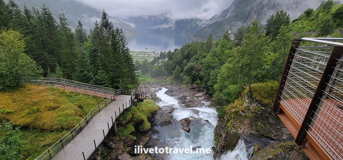
After a phenomenal and scenic ferry ride along the Geirangerfjord, I arrived in Geiranger. Our hotel was perched high up looking down to the town and the fjord – a perfect setting.

Geiranger, waterfall, geirangerfjord, hiking in norway, unesco world heritage site in norway
Looking down to the fjord

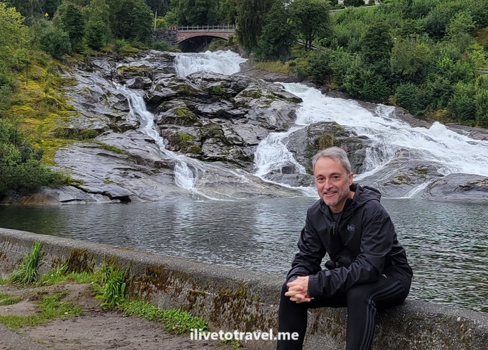
The visitor center for the waterfall trail (UNESCO World Heritage Site) is right across the street. One can do an easy walk along a metal sidewalk overhanging the terrain and see parts of the waterfall right there and up close, while also passing some local houses and viewing the end of the fjord straight ahead and down.

Geiranger, waterfall, geirangerfjord, hiking in norway, unesco world heritage site in norway

Waterfall hike in Geiranger

For those inclined for more of a hike, the hike to the Storseterfossen waterfall, can be started from right there. It is a 3.5 mile in-and-out up the side of a mountain. The trail can be covered with sheep droppings so that adds to the fun! It was not a perfectly maintained trail though I would learn throughout the next two weeks of my Norway hiking trip that that is standard.

Geiranger, waterfall, unesco heritage norway, world heritage, hiking in norway , Storsaeterfossen , geirangerfjord
Along the trail
Geiranger, waterfall, unesco heritage norway, world heritage, hiking in norway , Storsaeterfossen , geirangerfjord
Other paths along the way
Geiranger, waterfall, unesco heritage norway, world heritage, hiking in norway , Storsaeterfossen , geirangerfjord
Destination in sight!
Geiranger, waterfall, unesco heritage norway, world heritage, hiking in norway , Storseterfossen , geirangerfjord
They are watching you every step!
Geiranger, waterfall, unesco heritage norway, world heritage, hiking in norway , Storseterfossen , geirangerfjord
Storseterfossen

Anyway, hope this short post gave you a glimpse into Geiranger, made famous by the fjord but beautiful thanks to the waterfalls on the town. From here, we would we one day closer to start our great hike in Jotunheimen National Park!

Great Drives in Norway: Førde to Geiranger

I have so much to write about my trip to Norway! Finally completed my writing series about hiking in the Jotunheimen National Park. Now, time to turn to some of the other experiences from this trip. Here a glimpse into one of the coolest drives from the trip: heading from Førde to Geiranger.

Arriving in Førde and departing the next morning

Førde is a town of possibly around 11,000 folks. We arrived there after a 3.5-or-so hr drive from Bergen. We had landed from the US at a reasonable time after a very tight connection in Amsterdam (20 minutes!). Needless to say, our checked luggage did not run as fast as we did so then we had to sit at the Bergen airport waiting for the next inbound KLM flight 3 hrs later. Our start time was close to 4PM if memory serves me right. It was a relatively easy drive including a ferry ride at sunset.

Førde, Forde, Norway, Geiranger, Geirangerfjord, driving in norway, norsk, noruega
Top: Late afternoon on the ferry. Bottom: Sunset over Førde

In any case, we got to Førde around 9PM and headed straight to dinner as there were not that many options that were palatable after such a long day after a trans-Atlantic flight. We enjoyed some beverages at the bar at the Scandic hotel we stayed at and then said our good nights to get a fitful night of sleep.

The next morning, before setting out for Geiranger, we took a quick walk around town just to stretch our legs, breathe some fresh air, and wake up. Førde is a small but not-too-small town which made it a perfect stop for us.

Førde, Forde, Norway, Geiranger, Geirangerfjord, driving in norway, norsk, noruega
Around Førde

On the road to Geiranger

After fueling up, we hit the road. As the map below shows, it was to be a 4 hr drive or so. One must be aware that speed limits are much lower in Norway than back home so a certain distance will take longer there. And, do not be tempted to speed – the fines are huge!

The road is very scenic and the greens are so vibrant it does not feel real.

Førde, Forde, Norway, Geiranger, Geirangerfjord, driving in norway, norsk, noruega, nature in Norway

A ferry ride to experience along Geirangerfjord

The final hour of our drive would actually not be a drive but a ferry ride that would take us down the Geirangerfjord into Geiranger at the end of it. To get on this particular ferry on our route, we need to get to the small town of Hellesylt. Maybe it is less than a small town but it certainly was charming at the feet of an impressive cascade.

Førde, Forde, Norway, Geiranger, Geirangerfjord, driving in norway, norsk, noruega, nature in Norway, Hellesylt

This ferry not only offers transporting people and vehicles from one town to another, but also provides a very scenic tourist route. Along the edges of the fjord, one can spot abandoned farms and many tall waterfalls. Along the way, a recording provides some explanations in several languages. Though it can be cold and/or rainy, the best seat is upstairs and outside!

Førde, Forde, Norway, Geiranger, Geirangerfjord, driving in norway, norsk, noruega, nature in Norway, Hellesylt

At last, arrival at Geiranger!

Førde, Forde, Norway, Geiranger, Geirangerfjord, driving in norway, norsk, noruega, nature in Norway, Hellesylt
Top: Geiranger from the water Bottom: View towards the fjord from Gieranger

Day 6 in the Jotunheimen NP Circuit

Well, all good things come to an end and, so, is the final post about my 6-day hike in Jotunheimen National Park: from Memurubu to Gjendesheim.

Now, it is not my final hike in Norway for this trip but it wraps up exploring the beautiful and grandiose Jotunheimen. Jotunheimen is a park I had never heard of before until this trip entered the picture as a potential adventure. Grateful to my friend Troy for introducing me to this jewel of nature in Norway!

Should I stay or should I go?

On day 6 we were not only finishing the hike in Jotunheimen NP, but we were also going to leave the park altogether. We had an option to stay at Gjendesheim (again) that final day in the park but we had places to go! We were going to head to the Valdres valley and the small town of Røn. It did not make sense to get to Gjendesheim to spend a few hours and then drive a few hours the next day before our destination. We opted to make it to Gjendesheim and get on the road. It is not like Gjendesheim was Leirvassbu where I would not have minded an extra night! So the plans were to get to our car (in the long-term parking lot a mile from Gjendesheim) and hit the road.

But, first, let’s talk about leaving Memurubu

jotunheimen, ilivetotravel, trekking in norway, hiking i norge, norvege, senderismo en noruega, adventure
One last look towards the main building of Memurubu

We had planned to leave Memurubu and take the Bessegen route to Gjendesheim, not an easy route but well-known as an epic route. However, the weather forecast called for high winds that day at lake level. Bessegen was both higher up and more exposed to the edges (not quite cliffs) and a wind gust would be a life-endangering situation. So we decided to take the lower level route lake-side. It was maybe not as fun and interesting as Bessegen but, under those conditions, smarter.

jotunheimen, ilivetotravel, trekking in norway, hiking i norge, norvege, senderismo en noruega, adventure
The awesome marmalades at breakfast

A relatively easy trail…

… but the trail did not lack challenges though. Bessegen may be left for homework (i.e., a return trip) but the lake-side route was not just a nicely groomed trail. Nothing is at JNP! The cool thing about Bessegen is that you don’t have to do a circuit to do it as there are ferries to Memurubu so it can be just a day hike for those not wanting to do a longer circuit.

The trail initially had some elevation gain before the trail returned lakeside.

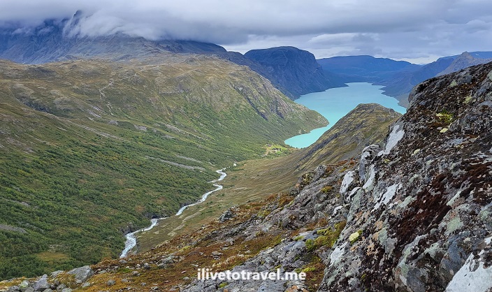
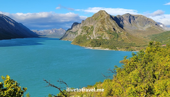
jotunheimen, ilivetotravel, trekking in norway, hiking i norge, norvege, senderismo en noruega, adventure, lake gjende
Elevation gave us one great last view of the lake
jotunheimen, ilivetotravel, trekking in norway, hiking i norge, norvege, senderismo en noruega, adventure

Then the trail went through forested areas and included water crossings and rock beaches before the final approach to Gjendesheim.

jotunheimen, ilivetotravel, trekking in norway, hiking i norge, norvege, senderismo en noruega, adventure

Overall, it was about 6.5 miles. We did it in 4 hours, including stops, the longest one in a rock beach where we had our lunch. By this point, of course, my legs were tired, my feet sore and my Achilles heels letting themselves be known. But, it didn’t really matter. The circuit we had just completed was worth every pain, every sore spot, every chain segment, every early wakeup, etc. Approaching Gjendesheim was a welcome sight but, also, bittersweet as it meant having new experiences around Jotunheimen was coming to an end. At least, on this trip…

jotunheimen, ilivetotravel, trekking in norway, hiking i norge, norvege, senderismo en noruega, adventure
Finished the Jotunheimen Loop!

Missed the start? Go to Day 1 (Gjendesheim to Glittertind)

Or, go back to the prior day: Day 5! (Gjendebu to Memurubu)

Day 5 in the Jotunheimen NP Circuit

The circuit hike is beginning to approach its conclusion on day 5. However, it is not a time to assume it will all be easy now! The Gjendebu to Memurubu hike on day 5 presented the most scary section of the six hikes I did at Jotunheimen.

The trail that day would be about 6.75 miles and about 2,400 ft elevation gain. It took us almost 5 hrs (durations cited include breaks taken).

It was our earliest departure to-date at 8:10 AM. The day was a little rainy as we departed Gjendebu, walking past the ferry pier (that could take you to Gjendesheim). We proceeded along a forest expecting fast elevation gain, which was true after maybe 1.25 miles, when we cleared the forest.

Jotunheimin, hiking in Norway, Lake Gjende, Gjendebu, Memurubu, norge, norvege, senderismo en noruega
Just cleared the forest and started to climb

As usual in Jotunheimen, rocks and water mix to become THE trail. These trails are not groomed, folks. Walk on them. Carefully.

Jotunheimin, hiking in Norway, Lake Gjende, Gjendebu, Memurubu, norge, norvege, senderismo en noruega

Neat views and narrow trails

The terrain was STEEP. The trail hugged the side of the ridge VERY tightly as the next two photos show. Of course, offering great views.

Jotunheimin, hiking in Norway, Lake Gjende, Gjendebu, Memurubu, norge, norvege, senderismo en noruega

Chain me up to leave Gjendebu

And, at some point high up, we hit 4 rock faces that required chains to go up. The first segment was the worst as it had no toehold/foothold to help support the body weight. It was pure arm strength to pull oneself (and the backpack) up to the next level. Mind you, behind me was a steep drop as the segment was very vertical so that added to the adrenaline… The next two segments offered some toeholds which certainly made it a tad easier.

Jotunheimin, hiking in Norway, Lake Gjende, Gjendebu, Memurubu, norge, norvege, senderismo en noruega, chain trail
Yep, that is straight down
Jotunheimin, hiking in Norway, Lake Gjende, Gjendebu, Memurubu, norge, norvege, senderismo en noruega, chain trail
On the 2nd or 3rd segment where there were footholds

However, I had no idea how many of these were ahead and of what kind so it was a little concerning not having trained for it. Thankfully, there were only four chain sections and the last one required chain to walk and not slip vs. needing to pull up.

Jotunheimin, hiking in Norway, Lake Gjende, Gjendebu, Memurubu, norge, norvege, senderismo en noruega, chain, technical climb
The 4th segment’s chain and terrain. That is a STRAIGHT drop right there!

A bit after the fourth section, I was able to exhale believing we were done with the chains – which we were! At the end of the day, looking back, it was fun to have faced this challenge and glad to know I was fit enough to do it. We reached the top of this massive climb around mile 2.1. The elevation gain in less than a mile had been about 1.500 ft.

And a nice, beautiful, kind trail…

After that, the terrain consisted of climbs and descents of moderate levels with some flat segments in between. We were sort of walking along a ridge, going up to the various high points of the ridge (sort of “summits”). They went on probably for 5 miles or a little less. The scenery was amazing – a great reward for the steep-and-scary elevation gain earlier on.

Jotunheimin, hiking in Norway, Lake Gjende, Gjendebu, Memurubu, norge, norvege, senderismo en noruega, chain, technical climb
Kind trail: flat, no water, almost rock-free
Jotunheimin, hiking in Norway, Lake Gjende, Gjendebu, Memurubu, norge, norvege, senderismo en noruega, chain, technical climb
Beautiful trail
Jotunheimin, hiking in Norway, Lake Gjende, Gjendebu, Memurubu, norge, norvege, senderismo en noruega, chain, technical climb
Kind and beautiful trail; almost forgot about the chains!
Jotunheimin, hiking in Norway, Lake Gjende, Gjendebu, Memurubu, norge, norvege, senderismo en noruega, chain, technical climb
Trail going up the ridge
Jotunheimin, hiking in Norway, Lake Gjende, Gjendebu, Memurubu, norge, norvege, senderismo en noruega, chain, technical climb
Two of the climbs along the ridge – not too bad!
Jotunheimin, hiking in Norway, Lake Gjende, Gjendebu, Memurubu, norge, norvege, senderismo en noruega, chain, technical climb
Just spectacular views!

… until the final, cruel descent to Memurubu

Before getting to the final summit on the ridge, we spotted our target: Memurubu turisthytte!

Jotunheimin, hiking in Norway, Lake Gjende, Gjendebu, Memurubu, norge, norvege, senderismo en noruega, chain, technical climb
The cabin is where the river meets the lake

But, before the descent, we had a quick stop for lunch. The ham and cheese sandwich with cucumber was a favorite of mine! It is worth noting that you prepare whatever sandwich you want for lunch at the breakfast service before you leave the lodge you spent the night at. So you get to make yourself 1 or 2 sandwiches of whatever you want.

Jotunheimin, hiking in Norway, Lake Gjende, Gjendebu, Memurubu, norge, norvege, senderismo en noruega, chain, technical climb
And the descent to Memurubu begins…

We hit the final summit (at around 4,200 ft above sea level) after lunch and proceeded to descend to Memurubu which we could see during the final bit of the ridge hike. The descent was very steep and with a lot of loose rocks. It was not pleasant terrain at all but the views continued to inspire – as well as seeing the end goal so within reach 🙂 And, compared with descents like from Glittertind, this was easy stuff!

At Memurubu to rest, eat and… rest!

We arrived in Memurubu around 1:40 PM and reception was not open yet. There were quite a number of people around but many were just waiting for the ferry to Gjendesheim.

There were quite a number of people but many were just waiting for the ferry to Gjendesheim.
You can see part of the downhill trail on the right. It looks deceptively kind!

We were assigned to a room in a building near the main lodge. We opted for a private bath at this lodge which was nice. The common areas of the lodge were very nice, spacious and you really felt you wanted to hang out.

There were quite a number of people but many were just waiting for the ferry to Gjendesheim.

We enjoyed a beer after showering and before dinner. OK, maybe more than one. It was happy time at Memurubu!

There were quite a number of people but many were just waiting for the ferry to Gjendesheim. Ringnes beer

Check out Day 4 (Leirvassbu to Gjendebu)

Or, read on to the final day: Day 6 (Memurubu to Gjendesheim!)

Day 3 on the Jotunheimen NP Circuit Hike

After enjoying a day off and the scenery around Spiterstulen, the time came to leave this great setting to push forward on the circuit. Next stop: Leirvassbu. I had not really envisioned what this trail would entail but, spoiler alert, after completing the Norway trip, this trail ranked #1 in my list.

Jotunheimen, Leirvassbu, lodge, turisthytte, Norge, hiking, trekking, Norway, sunset in Norway
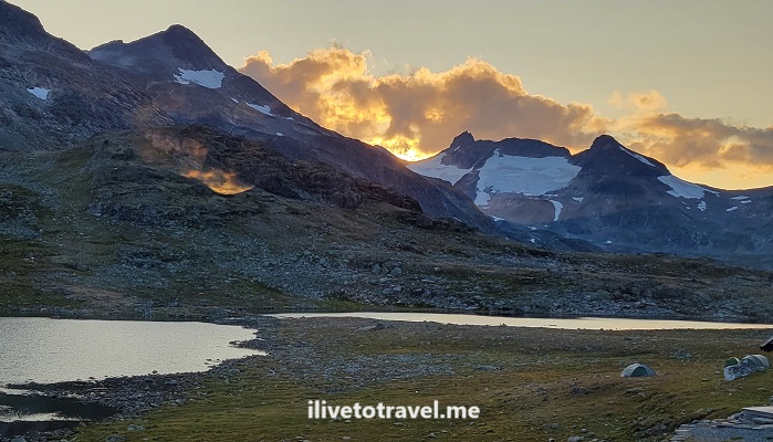
Sunset from Leirvassbu – stunning

Varied landscape and terrain

We left the lodge at the usual time: 8:30 AM. We got to the Leirvassbu lodge around 3:40 PM, so just over 7 hrs for a ~12-mile hike.

All Trails, Jotunheimen, hiking, Norway
Green = start; Black = end

There may not be great differences in the possible terrain features from one trail to the next but this one seemed kindest of all with less brutal rock crossings, fewer steep inclines, and almost no significant descents.

Jotunheimen, Leirvassbu, lodge, turisthytte, Norge, hiking, trekking, Norway
Jotunheimen, Leirvassbu, lodge, turisthytte, Norge, hiking, trekking, Norway, water crossing
Bridge #1
Jotunheimen, Leirvassbu, lodge, turisthytte, Norge, hiking, trekking, Norway
Bridge #2 – only one handrail
Jotunheimen, Leirvassbu, lodge, turisthytte, Norge, hiking, trekking, Norway, DNT, den norsk forening

Ignore TLC – go chase waterfalls!

We took a side hike off the main trail following a long waterfall that cascaded down over a mile or so. It was very peaceful and simply beautiful. About a mile into tracking it, we turned around and resumed the main trail to Leirvassbu.

Jotunheimen, Leirvassbu, lodge, turisthytte, Norge, hiking, trekking, Norway, waterfall, den norsk forening

Up to the lake “district”

The terrain was gentle along the river that ran past Spiterstulen and that ran sort of parallel to the trail for a good bit. At some point, we moved away from it and started an ascent to what became a plateau of lakes. We would walk along these lakes all the way until getting to Leirvassbu.

Jotunheimen, Leirvassbu, lodge, turisthytte, Norge, hiking, trekking, Norway

The backdrop to the lakes was nothing short of stunning!

Jotunheimen, Leirvassbu, lodge, turisthytte, Norge, hiking, trekking, Norway
Spotted the lodge! Always a happy moment.

No matter how cool the trail… a beer always follows!

ilivetotravel, beer

Leirvassbu: my favorite lodge for sure!

Not only is this trail my favorite but Leirvassbu was my favorite lodge too. The room was spartan but adequate. We had a room with a private bathroom and it was severely dated (like 1960s).

Jotunheimen, Leirvassbu, lodge, turisthytte, Norge, hiking, trekking, Norway
Lodge grounds
Jotunheimen, Leirvassbu, lodge, turisthytte, Norge, hiking, trekking, Norway
My neighbors downstairs
Jotunheimen, Leirvassbu, lodge, turisthytte, Norge, hiking, trekking, Norway

But it was all functional. However, I really liked the setting of the lodge, the common spaces (lounge and dining room), and – best of all – the bar and the food!

Jotunheimen, Leirvassbu, lodge, turisthytte, Norge, hiking, trekking, Norway
food at turisthytte, hiking in Norway, DNT, senderismo en noruega, hiking in Norge, Jotunheimen, foodporn, slow-cooked veal

The highlight of the meal was the 18-hour, slow-cooked veal main dish. Wow – it was restaurant caliber. I was not expecting that high quality cuisine in a national park lodge.

Leirvassbu has the added benefit of being on a private road so you don’t have to hike miles if you want to visit it.

Lowa, hiking boots, Norway, trekking in Norway, hiking i Norge, senderismo en Noruega, Leirvassbu, turisthytte, DNT
The end of another day: the boots get a rest!

Check out Day 2 (Glitterheim to Spiterstulen)

Or, read on to Day 4 (Leirvassbu to Gjendebu)

Day 2 on the Jotunheimen NP Circuit Hike

Having survived the first day of a 6-hike circuit – and the longest hike of the 6 -, it was time to get going on Day 2 for the next challenge: getting to Spiterstulen by climbing Glittertind mountain (vs. skirting it and going around it).

Tallest mountains in Norway and northern Europe

Glittertind is not only the second tallest mountain in Norway but in all of northern Europe. Glittertind stands at 2,452 m / 8,045 ft. The tallest mountain is nearby: Galdhøpiggen. It stands a modest 17 m / 56 ft taller than Glittertind. The height of these mountains is a little higher if you include the glaciers atop. For example, Glittertind, back in 2008, stood at 2,465 m counting the glacier.

Heading up Glittertind

We started the morning early with breakfast at 7:30AM and a departure from Glitterheim at 8:40AM. Though Glittertind stands at 2,452 m, Glitterheim itself is location at around 1,400 M above sea level. So we sort of had a head start in terms of the climb. Small mercies!

Glitterheim turisthytte, cabin in Jotunheimen, hiking in Norway, trekking, senderismo en Noruega, Norge, norvege
Leaving Glitterheim behind

The climb to the summit was about 3.8 miles. The first mile would ascend 425 ft. The second mile would go another 500 ft. Finally, the third mile would go another 450 ft. The final bit to the top would take us up approximately another 300 ft. I cannot recall for certain but it feels the last 1.5 mile was a pure rock walk. Steep and painfully slow to navigate stepping over all those rocks

rock fields, challenging hiking terrain, trekking in Norway, senderismo en Noruega, Jotunheimen, Den Norske Forening, DNT, Glittertind, Glitterheim, Spiterstulen
Norway may be also called Rocks ‘R Us
Glittertind, rock field in Jotunheimen, senderismo en Noruega, trekking i Norge, Norway hike, Spiterstulen,  Glitterheim
Can you still spot me in the rock field? Fun times

Atop Glittertind and all that snow

Within the last hour of the climb, it started to snow. Visibility decreased but we could still see where we were and where we were headed.

Glittertind, rock field in Jotunheimen, senderismo en Noruega, trekking i Norge, Norway hike, Spiterstulen,  Glitterheim
Can you see me now?
rock fields, challenging hiking terrain, trekking in Norway, senderismo en Noruega, Jotunheimen, Den Norske Forening, DNT, Glittertind, Glitterheim, Spiterstulen. snow
I could still see my friend (red oval above) so all was good.

Good thing because right by the summit there was a cliff we could not see… (see image below from AllTrails). Good thing that snowpack at the top was rock solid!

AllTrails, Glittertind, hiking in Norway, trekking in Jotunheimen, snowpack, glacier in Norway, Norge, DNT
This screenshot right after the summit
rock fields, challenging hiking terrain, trekking in Norway, senderismo en Noruega, Jotunheimen, Den Norske Forening, DNT, Glittertind, Glitterheim, Spiterstulen
At THE summit

Descending not always fun and games

Once we were done resting at the summit, we began the descent. For a little bit, we were still on the glacier / snowpack. We did not have any special attachments on our hiking boots. I just made sure I stepped where someone else had stepped before me, hoping the snow had compacted all it was going to compact thanks to the prior person. Oh, and that I was not going to step on snow that was sitting on top of a crevice or gap of some sort!

You can visualize in this AllTrails’ trail preview how sharp a descent this was (it began around mile 4.1, soon after leaving the summit ridge.

AllTrails, Glittertind, hiking in Norway, trekking in Jotunheimen, snowpack, glacier in Norway, Norge, DNT
steep descent, challenging hiking terrain, trekking in Norway, senderismo en Noruega, Jotunheimen, Den Norske Forening, DNT, Glittertind, Glitterheim, Spiterstulen
What it looked like in real life

Eventually, after left the summit ridge, the terrain was free of snow and the snow stopped falling. Back to our normal steep-descent-with-lots-of-rocks-and-scree. It was the usual very focused walk to avoid a nasty and painful fall.

steep descent, challenging hiking terrain, trekking in Norway, senderismo en Noruega, Jotunheimen, Den Norske Forening, DNT, Glittertind, Glitterheim, Spiterstulen
Just too awe-inspiring to not post another photo!
ilivetotravel, Spiterstulen turisthytte, lodging in Jotunheimen, cabin in Jotunheimen, Lomb beer, Norge, senderismo en Noruega

The challenging, steep descent from Glittertind is over

After the steep descent, we entered the area that you see in the picture above. We followed a stream for a bit on still-rocky terrain for a bit.

norvege, Spiterstulen turisthytte, lodging in Jotunheimen, cabin in Jotunheimen, Lomb beer, Norge, senderismo en Noruega
The descent is over!!
challenging hiking terrain, trekking in Norway, senderismo en Noruega, Jotunheimen, Den Norske Forening, DNT, Glittertind, Glitterheim, Spiterstulen

We then went up a little bit and rounded some mountain to a trail that would eventually parallel the private road leading to Spiterstulen. I so badly wanted to just get to that road and walk on a flat, smooth surface! But, it was not to be until the very end, close up to Spiterstulen. To add insult to injury, after we got on the road and approached the lodge, we had a slight uphill. Really…. 🙂

Regardless, my buddy and I were very happy hikers by the time we got to Spiterstulen!

challenging hiking terrain, trekking in Norway, senderismo en Noruega, Jotunheimen, Den Norske Forening, DNT, Glittertind, Glitterheim, Spiterstulen, ilivetotravel

How to end a hard hike

Thankfully, Spiterstulen was ready for us! From a refreshing cold beer to a great meal to a great space in the room and the large lounging room – Spiterstulen was great.

ilivetotravel, Spiterstulen turisthytte, lodging in Jotunheimen, cabin in Jotunheimen, Lomb beer, Norge, senderismo en Noruega
Spiterstulen from the outside
ilivetotravel, Spiterstulen turisthytte, lodging in Jotunheimen, cabin in Jotunheimen, Lomb beer, Norge, senderismo en Noruega

Our room was actually in a cabin and we enjoyed a private bathroom (with heated floor!), a small living room area and a great view from the room’s window. Perfect spot to chill and re-charge.

ilivetotravel, Spiterstulen turisthytte, lodging in Jotunheimen, cabin in Jotunheimen, Lomb beer, Norge, senderismo en Noruega

The meal started with salmon on a piece of bread (that could have been the entrée!). Then Norwegian meatballs with veggies, chased by diced watermelon topped with vanilla ice cream. All good!

foodporn, Spiterstulen turisthytte, lodging in Jotunheimen, cabin in Jotunheimen, Lomb beer, Norge, senderismo en Noruega

Norway’s beauty is infinite!

I am writing all this post-facto, a couple of weeks after returning home. The majesty of the landscapes of Norway are, maybe not unique, but definitely spectacular. Just a view like below, after a nice meal and a beer (or two), are enough to make one be in awe of God’s creation…

ilivetotravel, Spiterstulen turisthytte, lodging in Jotunheimen, cabin in Jotunheimen, Lomb beer, Norge, senderismo en Noruega

Check out Day 1 (Gjendesheim to Glitterheim)

Or, read on to Day 3 (Spiterstulen to Leirvassbu)

Day 1 on the Jotunheimen NP Circuit Hike

Day 1 of the 6-day circuit hike in Jotunheimen National Park began in the Gjendesheim “turisthytte”, where we had arrived the prior day to get an early start on day 1. “Hytte” means cabin in Norwegian and these are the lodgings anyone doing the park will be staying at – unless you camp. I will use “lodge” going forward though not every place we stayed felt “lodgy”. Most, but not all, lodges are run by “DNT” (Den Norske Turistforening), an association that maintains runs trails and cabins in Norway (thank you!).

In any case here is how day 1 of my circuit hike in Jotunheimen went!

DNT, den norske turistforening, Gjendesheim, turisthytte, Jotunheimen, Norway, nature, Norge, Noruega, hiking, trekking
Red “T”s mark the way!

Our approach to Jotunheimen National Park

As I mentioned in my Jotunheimen NP hike overview post, Gjendesheim became the logical starting point for our hike. It was right off route 51 and offered easy access to hiking trails and long-term parking.

I might add that it is a good starting point for those only wanting to do a 1- or 2-day hike as it has a ferry to two other lodges on the Lake Gjende from which one can hike back to Gjendesheim (or, the reverse, hike to the one or both of the lodges and then just return by ferry). So a good option for those not wanting to do the circuit but still see amazing landscapes.

Our route on the trail

We approached Gjendesheim from the north having started our drive at Bergen. Of course, we could have come from the south but we were going to do that region after the Jotunheimen hike so we wanted to explore other territory. For example, this allowed us to visit Lom, cruise the Geirangerfjord and stay at Geiranger with its beautiful setting hillside facing the fjord.

Starting the Jotunheimen NP hike at Gjendesheim

We arrived in Gjendesheim the night before. Our car was left at the long-term parking with anything we didn’t need for the next 7 days. The lodge, right by the ferry dock, consists of a couple of main buildings and a couple smaller ones.

Gjendesheim, turisthytte, Jotunheimen, hiking, Norway, norge
The main building

We stayed in the second largest building, basically a dormitory, where we shared a room with a bunk bed and nothing else. Toilets and showers were shared by everyone. The main building is where the dining room, common living space, and reception were located. It also may have had rooms but I did not explore. That building had toilets and showers in the basement so I assume it did have rooms upstairs.

Gjendesheim, turisthytte, Jotunheimen, hiking, Norway, norge

The common living space was small but offered great views of Lake Gjende as the sun set.

Gjendesheim, turisthytte, Jotunheimen, hiking, Norway, norge

Dinner started with a delicious pumpkin soup and the main was a lamb stew that was also pretty good (in retrospection, there were no bad meals on the circuit and a couple of spectacular ones later in the circuit). Dessert was rhubarb-something, not sure how to describe it! It is worth noting that while there is no menu to order from – you eat what is served – lodges are very accommodating to vegan/vegetarian diets.

Gjendesheim, turisthytte, Jotunheimen, hiking, Norway, norge, lamb stew

Hiking from Gjendesheim to Glittenheim – 1st half

Alright, so on to the actual hike for the day! Starting a circuit hike pretty cold with a 22.5 km/14 mi route was a bit intimidating. Legs would not be yet fully awake, technique for harder terrain not fresh, etc. We started at 8:30AM taking the trailhead right across from the cabin. The trail started with a 600 ft elevation gain in the first mile so definitely not the easiest of starts. It was not a bad start though. It was good to be finally on the circuit! That first mile took us 46 mins.

Lake Gjende, Gjendesheim, turisthytte, Jotunheimen, Norway, nature, Norge, Noruega, hiking, trekking
From the 1st mile looking down at Lake Gjende and the ferry dock

The second mile was kinder only gaining about 400 ft. And the third less about 275 ft. So it was an aggressive start that quickly mellowed. By mile 5, our average was 33 mins/mi so we clearly gained speed as the elevation gain eased. That was good as not only I was coming in “cold” (being the first day of the hike) but also first day with the 18-lb backpack on me.

In this segment we passed the end of Lake Bessvatnet and then hit Lake Russvatnet which we would alongside for about 1.5 miles (from mile 4.8 to 6.4) before heading up to reach high mountain terrain after mile 7.5.

Hiking from Gjendesheim to Glittenheim – 2nd half

So the second half of the hike began! From mile 7.5 to mile 11 was my favorite stretch of this day. I just really like wide open, high mountain terrain, allowing the eye to see far. Of course, it helped that uphills were few and smaller. We saw a handful of hikers but that was about it; that was more than we saw in the first half!

Lake Gjende, DNT, Gjendesheim, turisthytte, Jotunheimen, Norway, nature, Norge, Noruega, hiking, trekking, senderismo Noruega
Nice part of the trail

The final 3 miles were a mix of flat and downhill. The approach to Glittenheim, for someone who had already walked 12 miles or so, felt brutal: the cabin is right across from you but you can’t cross the water/river there -> you have to walk alongside it for a bit before the bridge to cross it. It felt eternal (it wasn’t) due to being tired and ready to get the boots and backpack off!

How difficult was the terrain from Gjendesheim to Glitterheim?

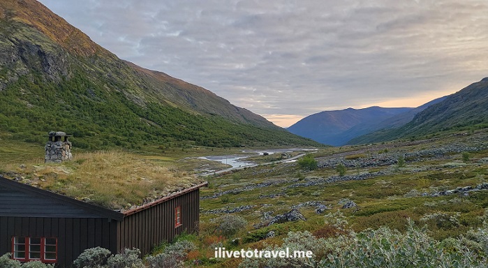
It is worth mentioning that there were definitely challenging parts to this trail. Plenty of water and mud due to recent rains requiring water crossings, stepping over stones to avoid walking in the water.

Jotunheimen National Park, DNT, Den Norske Forening, hiking in Norway, Norge trekking, Noruega senderismo
This IS the trail! A common occurrence

This required minding not only finding the next stone to step on but also ensuring not slipping or that the stone would move once you stepped on it. Muddy spots were handled similarly but I hated those more. There were plenty of these and rock fields to maneuver over (not around!). It took focus and, at the end of the day, my neck and shoulders were very stiff and needing a massage.

Rock field!
Lake Gjende, DNT, Gjendesheim, turisthytte, Jotunheimen, Norway, nature, Norge, Noruega, hiking, trekking, senderismo Noruega
Rocks everywhere – fun challenge but tiring!

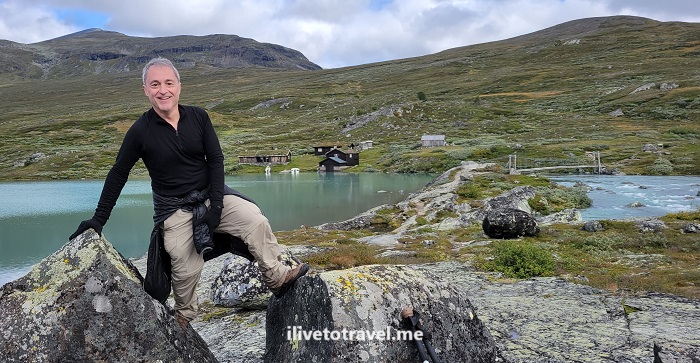
The trail also included 3 bridges got larger water crossings, including the one at the end.

Lake Gjende, DNT, Gjendesheim, turisthytte, Jotunheimen, Norway, nature, Norge, Noruega, hiking, trekking, senderismo Noruega
One of the bridges on the trail

And the temperature?

My hike was in late August/early September. Skies that day were a little overcast. Temperature-wise, though I started with a jacket, eventually I took it off and my wool baselayer shirt was sufficient. I did wear glove liners; it wasn’t cold enough for real gloves but the liners provided just the right amount of protection against the cold and the wind, while allowing to use fingers more normally. Other than that, nothing of note to report.

The Glitterheim lodge

I couldn’t have been more elated to arrive at Glittenheim. Though not the best of the lodges, it was heaven after a day 1 of 14 miles! There were two large buildings, much as at Gjendesheim.

This time we stayed in the main building on the second story. Our room again was a bunk bed room with no toilet or shower. The hallway did have a bathroom sink which helped with brushing teeth and filling water bottles. The showers and the toilets, though, were in the basement. In the middle of the night, going down two floors, with very sore knees after a 14-mile hike, using a spiral staircase while half asleep, was not my idea of fun. On top of that, lights would not turn on downstairs as, I guess, generators were turned off. I was thankful I had taken my phone for no good reason – the flashlight feature came in handy!

The common living area was nice with a massive fireplace and great views. The dining room, as usual, was communal tables which is nice to meet some other folks, hear where they are from, hear their hiking plans, etc. That night we sat with a young couple from Israel (whom we would see just about at every lodge during the circuit) and another young couple from the Ukraine (living in Poland).

Glittenheim, Jotunheimen, hiking in Norway, trekking, Norge, Noruega, nature, outdoors, DNT
Glittenheim common spaces

Dinner was buffet-style. The first dish was spinach soup and the entrée a beef stew with potatoes as the side. (If you have not gotten this from describing the food at both lodges… there is no menu. You eat of what is being served!) The dessert was very interesting. It was some form of rhubarb jelly over which one poured something akin to milk. I was hesitant at first but found it delicious!

After dinner we enjoyed beers at the common living space before going upstairs to ready things for the next day and get some good, well-earned rest!

Lake Gjende, DNT, Gjendesheim, turisthytte, Jotunheimen, Norway, nature, Norge, Noruega, hiking, trekking, senderismo Noruega, Russvatnet
A beautiful route

On to Day 2 – Glittenheim to Spiterstulen via Glittentind!

Or, go to read the overview of the circuit at Jotunheimen NP.

(Subscribe to the blog so you can be notified when the next post is issued OR bookmark this page and come back in a week or so!)

A Cool Hiking Circuit in Norway: Jotunheimen National Park

I recently had the good fortune to be able to go to Norway to do a hiking circuit in Jotunheimen National Park. Jotunheimen is northeast of Bergen, about halfway between the Atlantic Ocean and the Swedish border.

The park offers a wide range of opportunities to explore nature and experience it any way you want. These range from easy & short hikes to long & challenging ones. It is also possible to drive to some of the cabins/huts and just do short walks and enjoy the scenery around the cabins/huts. Oh, and some of the cabins/huts are worth spending time at!

Hiking Circuit in Jotunheimen, norway, norge, nature, lake

Our hiking circuit in Jotunheimen – options

A friend of mine had hiked in Jotunheimen before and suggested a hiking circuit for us to do over a period of 6 days. There were options in terms of:

  • which direction (clockwise/counterclockwise)
  • starting point (which of the driving accessible cabins/huts)
  • ending point (either the same as the starting point or another, coupled with a ferry ride to get back to the starting point)
  • cabin-to-cabin itineraries
  • routes options within a cabin-to-cabin route.

Our hiking circuit in Jotunheimen – starting point and direction

We opted to start in Gjendesheim as it afforded an early start if we stayed right there vs. ferrying to Memurubu or Gjendebu. That meant an earlier start than most people who would be doing hikes on that day. The trails ended up not being that crowded at all but I still liked the early start!

Gjendesheim also has a nearby long-term parking about a mile away which was good since we had decided to rent and hold the car while we spent the week in the park.

In terms of the direction, my friend had done counter-clockwise before and strongly believed that to the best way to tackle the circuit. For me, it was good getting the longest segment out of the way on the first day (which had the downside of doing the longest day when still not fully “warmed up”).

Our hiking circuit in Jotunheimen – the route

So with Gjendesheim being the starting point and the direction being counterclockwise, the obvious first cabin/hut was Glitterheim. This meant the 14-mile hike.

The next stop was obvious: Spiterstulen. However, the question was how to get to Spiterstulen. See, there were two options there:

  • Hike up to summit Glittertind, northern Europe’s second highest peak, OR
  • Hike around Glittertind.

We opted to summit Glittertind, weather-permitting, as it would be great to have the experience of summitting.

From Spiterstulen, the best option is Leirvassbu. This was my favorite trail but more on that in a later post!

From Leirvassbu, our best option on the loop we were going for was to head to Gjendebu on the shores of Gjende Lake.

From there, there is the option to skip out on the rest of the circuit and take the ferry to Gjendesheim (or even to Memurubu). We, of course, wanted to hike to Memurubu. That is a story onto itself…

Finally, from Memurubu the options included the ferry, the Bessegen route, and the shore-side trail. We opted for the latter and that story will be in a future post!

Hiking Circuit in Jotunheimen, norway, norge, nature, lake

Our hiking circuit in Jotunheimen – the summary

  • Day 1: Gjendesheim -> Glitterheim (14 miles) -> read about it here
  • Day 2: Glitterheim -> Spiterstulen (via Glittertind) (11 miles) -> read about it here
  • Day 3: Spiterstulen -> Leirvassbu (12 miles) -> read about it here
  • Day 4: Leirvassbu -> Gjendebu (10 miles) -> read about it here
  • Day 5: Gjendebu -> Memurubu (6.7 miles) -> read about it here
  • Day 6: Memurubu -> Gjendesheim (6.6 miles) -> read about it here

For me, in hindsight, this itinerary forced me to do the hardest work upfront (days 1 and 2) and having “easier” hikes on the remaining days. Don’t be fooled when I say “easier”. None are a walk in the park by a long stretch!

There is no right or wrong way to do Jotunheimen but I can certainly say this route worked really well for me!


Check out the park’s website here.

Photo of the Week: Orange Fire in Oslo

A few years ago around this time of the year, I went to Oslo for business.  And I ran into this beauty!

orange, tulips, Oslo, Norway, flowers, photo, travel, spring

The “First Cousins” Capitals: Copenhagen, Oslo and Stockholm

It has been an interesting exercise to try to think of the Scandinavian countries and come up with a good and succinct outline of what makes them different from each other without requiring a degree in history, architecture, and other similar fields.  So I decided to not be that ambitious and limit this to taking a look at the Scandinavian “first cousins” capitals – Oslo, Stockholm and Copenhagen – and see what I came up with…

All of these first cousins felt very manageable for a first time visitor.  There was nothing daunting or complex about getting around which made it easy for me to walk aimlessly to see what I would discover.  Everyone spoke English which certainly facilitated the visit though I am OK attempting to communicate in any number of languages I can dabble in.   I visited them all more or less around May or June making my comparison even in terms of weather.  Clearly the time of the year I visited made them all come across as “alive” since everyone by then had finished thawing off from their winter “slump”.  Everyone was out and about enjoying the weather – and their cities.

Oslo

In Norway, they were actually having a warm spell in early May (I carried a coat through Europe because I was supposed to need it when I got to Norway; it was hotter than anywhere in Europe at the time!).  Everyone was out at the parks and streets just hanging out.  The outdoor cafes were all packed, everyone enjoying a beer or four.  I partook even if I was a little horrified at the cost of everything.

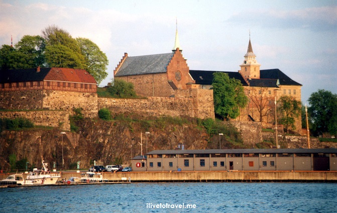
Akershus, Oslo, Norway, fortress, church, sunset, photo, Canon EOS Rebel

Looking towards Akershus Fortress at sunset

My favorite meal was a bucketful of fresh shrimp and beer sitting at a water-side restaurant (maybe by the Herbern marina) right around Aker Brygge, a modern shopping, entertainment, and office district near the Nobel Peace Center.  Of course, my favorite activity overall was taking a brief boat ride down Oslofjord but that is a different story!

It was neat to walk right by boats selling their catch to local restaurant buyers right across from City Hall.

Olso, Norway, fisherman, boat

Buying seafood right from the boat!

Oslo probably felt the smaller of the three cousins (I actually have not looked up population statistics) and the more relaxed, perhaps because of its size, perhaps because people just wanted to enjoy the newly found warmth by chilling (!) outdoors.  I loved scenes like the Akershus Fortress and the massive ski jump off in the distance!

Stockholm

As a capital city, Stockholm didn’t have a presence that screamed “big city”.  And I liked that.  It sits comfortably by the water built on and surrounded by islands.  It is quite easy to move about even if unfamiliar with it – its vast waterfront makes it hard to get lost.  I have previously written about this city by the water so I will not elaborate here.

We headed first to the area where the Royal Palace sits, “Stadsholm”, an island itself.  This is all part of old town or Gamla Stan.  Gamla Stan is full of charming architecture and beautiful streets.  From there, one can easily cross to a small island where Parliament sits (Riksdag) and exit it on the other side to enter the pedestrian shopping street (Drottninggatan) and move on to parks and other areas of town.  Almost across the water from the Royal Palace, of course, on another island, one finds the Vasa Museum (a must-see in Stockholm).

Gamla Stan, old town, Stockholm. Sweden. architecture, travel, photo, Canon EOS Rebel

Charming architecture in Gamla Stan

Riksdag, Parliament, Stockholm. Sweden. architecture, travel, photo, Canon EOS Rebel

Riksdag (Parliament)

Stockholm, and the people, there felt very relaxed, none more so than the students celebrating being done with school atop a party bus, one of the city scenes I shared in another post.  I could see myself lounging a few days, weeks, or more in this capital.  Of course, likely not during winter.

Copenhagen

During my visit to Copenhagen (three days), we toured around all the main areas of town you are always told to see and visit.  These included palaces, museums, the maverick community of Freetown Christiania, and other key sights.  As with many cities, my favorite part of Copenhagen was exploring the smaller side streets and finding that little jewel of a restaurant (as happened to us, with Restaurant and Café Nytorv which sits at about 150 years old).

We also happened upon the Copehagen Carnival (in June!) which made the main pedestrian street, Strøget, a lively corridor.  It may have lacked the wildness of Rio’s Carnival or Nawlins’ Mardi Gras but I certainly give it an “A” for enthusiasm and effort!Carnival, Copenhagen, Denmark, parade, colorful, fun, Canon EOS Rebel

The Danish capital definitely felt the more developed of the “first cousin capitals”, the more urbanized, the more identifiable as a capital.  While it sits on the water’s edge like the other two, it lacked the splendid fjords of Oslo or the charm of the many islands in and around Stockholm.  Granted it may have more diversity of older and modern architecture than but it often was not impressive.  For example, the buildings composing the royal palace/residence at Amalienborg were not imposing, nor terribly interesting from the outside, nor graced with gardens or green spaces (Rosenborg Castle fares much better.)

Amalienborg Palace, Copenhagen, Denmark, travel, photo, Canon EOS Rebel, royalty, architecture

Amalienborg Palace

While it was interesting to visit Copenhagen and walk its old streets, I hate to say, it did not wow me.  I didn’t feel an urge, say, to live there for 6 months, nor linger longer (though that may be precisely what I should do to “get” Copenhagen?).

Have you visited these first cousins?  Which one did you like best/least?  What influences your answer?

Photo of the Week – Walking Home into the Sunset

In 2006, I visited Oslo for work. As usual, I like going to a place where I can see the locals in their day-to-day. This plaza gave me a great view of folks headed home at the end of a work day…

Couple headed home at sunset in Oslo, Norway


(Picture taken with Canon EOS Rebel)
%d bloggers like this: