Glacier Mountain National Park in Montana is known as the “Crown of the Continent.” And it is rightly so called: it is peaceful, magnificent, and elegant. One of the funnest hikes in the park is hiking to St. Mary Falls and Virginia Falls right by the edge of St. Mary Lake, one of the two main lakes in the most visited part of the park.
St. Mary Lake is on the eastern side of the park, at the eastern end of the famous Going-to-the-Sun Road, by the small town of St. Mary. GTTS Road, as it is colloquially known, is one of the absolute must-dos to enjoy the Glacier Mountain park’s majesty. Driving along the lake going westward from the park’s main entrance is by itself an enjoyable experience. As you drive west, the lake will be on your left with majestic mountains as the backdrop – which makes for many great photo opportunities. There are numerous spots to pull off the road to admire the beauty and/or take pictures (don’t snap and drive!). Depending on the time of day, the light will be different. If you have the luxury of seeing it at different times of the day (especially early-early AM or late/late afternoon), do so! I got to drive GTTS Road both in the mid/late-afternoon and in the early morning, and loved the difference sunrise vs. pre-sunset made in the scenery.

Once we got to the western end of the lake (about 10 miles from the park entrance), we pulled in to the parking area to take us to St. Mary Falls. This parking lot was between the St. Mary Falls shuttle stop and the Sunrift Gorge shuttle stop. If you are taking the park’s red shuttle, you can start the hike from either of those stops as there are trailheads next to them.
Our plan was to hike 1.2 miles to get to St. Mary Falls (4,560 ft altitude). Then we would go a little further (an additional 0.7 miles) to reach Virginia Falls which sits higher at around 4,800 ft. If you are of average fitness, you are likely able to go all the way to Virginia Falls. If you feel you can handle the climb, you will likely agree that it is worth going that much further and higher to see Virginia Falls. In the end, it is not a long hike, really.
While bears are in their natural habitat anywhere in the park, this particular trail is well-trodden by people so, hopefully, the noise of people talking keeps them from approaching the trail. Just be on the lookout and carry your bear spray in a spot where you can quickly access it. There is no better way to keep yourself safe than to be proactive in looking out for your safety!
Hiking to St. Mary Falls
Along the way you can admire mountains that rise upwards of 8,000 ft in altitude (on a trail where your max altitude is about 4,800 ft). Pay attention to the signage as (from the parking lot we started from) there are a couple of junctions that could take you to different places.

Once we were far enough along, all of a sudden we saw a river (St. Mary) and then heard the sound of the waterfall.


Pretty soon we saw the wooden bridge placed in front of the waterfalls and, as we turned a bend, got to the bridge so we could see the waterfalls. The waterfalls has three levels though two of them are the most eye-catching of the trio.

Hiking on to Virginia Falls
Once you are done enjoying St. Mary Falls continue the trail on the other side of the bridge. The terrain gets a little more difficult to get to Virginia Falls. We were excited to see a waterfall but realized that was not Virginia Falls. 
The trail got steeper but, thankfully, the scenery made it all worth it. I don’t think you have to be an athlete to do this hike as long as you are generally in good health. Feel free to stop and snap photos – it gives you a little rest and there are definitely a couple of spots where one should step and just soak it all in.

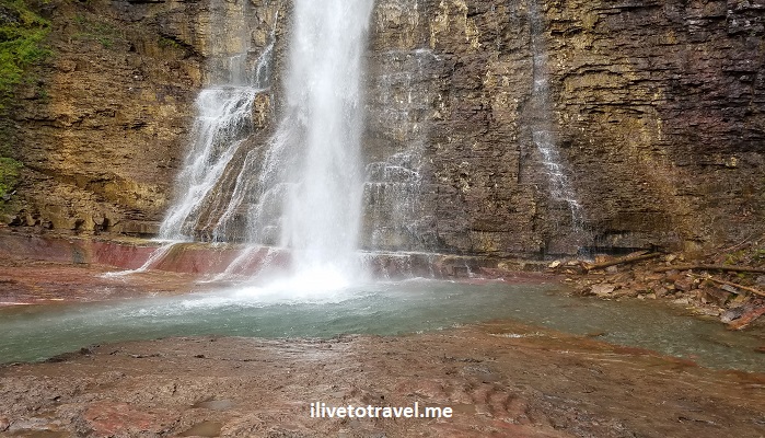
The best spot to do that is actually the foot of Virginia Falls. But wait. You will see Virginia Falls from a vantage point where you can appreciate them from a distance. But that’s not what I am calling the “foot” of the falls.

There is a view point a short distance up from that one. It is worth dealing with the trail which, if it is wet, can be a tad slippery.

That view offers a flat rocky area with plenty of space to get close enough to the waterfalls – you can feel the spray on you. It is much more impressive than St. Mary Falls partly for its size but also the setting of the spot.

What do you think??? Of the scenery, NOT of my video-ing skills!
This short hike (about 4 miles round trip) can be added to by visiting nearby Baring Falls which requires going almost all the way back and, at one of the aforementioned junctions, make a different turn (unless you park at Sun Point Nature Trail in which case you will pass Baring Falls on your way to St. Mary Falls). After seeing St. Mary and Virginia Falls, we felt it was unlikely Baring would impress us. I wish I had seen it just to know for sure but it was time to call it a day!


Leave a Reply