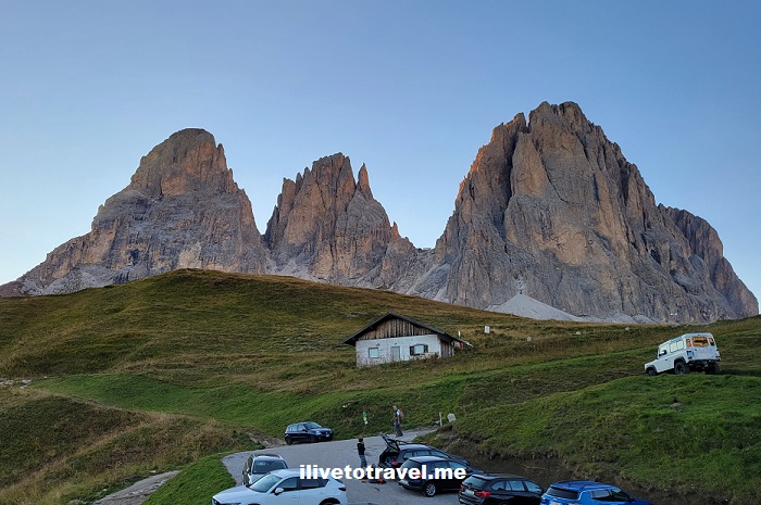
On day 2 of my hike in the Dolomites, we left the Rosengarten to reach the Sassolungo, an impressive massif in the western Dolomites. Mt. Sassolungo (also known as Langkofel in German, or Saslonch in the local language) is the tallest peak in the massif at around 10,400 ft (3,180 m). Mt. Sasso Piatto (Plattkofel or Sas Piat) is another famous peak in the group of five peaks. Sassolungo seems to lord over the valley below and was the backdrop to the rifugio I would stay that night.

The day started with departing Rifugio Passo Principe. From the rifugio’s deck, while I was waiting for the group to leave, I noticed along that along the peaks next to us, there were trails that were pretty steep and rocky. I could not believe when I spotted a couple of hikers far along that trail on a zig-zaggy uphill. But then, it completely shocked me when I was told that we were going on that trail ourselves! This is the western flank of the Catinaccio d’Antermoia.

We took trail 584 to head towards the Antermoia Pass. The trail was challenging but, actually, it was a lot of fun to take the challenge and get through it successfully (a few slips included but no falls for me!).

We got to the Antermoia Pass (Pas de Antermoa) at close to 9,100 ft (2,770 m). It was a great feeling to reach it and pause for a moment to absorb the view of peaks close and far.

Soon thereafter we began a downhill that led us to different terrain. I don’t know how to describe it, really. Maybe the photo can convey this better…

The trail would become flat and we would pass Lake Antermoia and Rifugio Antermoia (where we would stop for a short break).


From there we walked along beautiful terrain along 578 to Val Duron. Eventually we got our first glimpse of Mt. Marmolada which holds the only glacier in the Dolomites. We would see this mountain from different angles over the next few days.


Somewhere there we switched to 532 to stop for a nice lunch at Baita Lino Brach restaurant where many dishes were polenta base. The polenta was pretty bland but that is only to be expected of polenta. In any case, it was a very nice place to stop and eat outdoors.

After lunch, we walked down a flat path up until a point where a ride waited to take us to Campitello di Fassa (Campiedel) where we would take a lift from Campitello di Fassa to Col Rodela (at 2,484m). Campitello di Fassa is a small town about 70 km from Trento where most people speak Ladino, a unique language of these mountain valleys.


From Col Rodela we would finish our hiking day along trail 557 and Passo Sella to arrive at our lodging for the night: Rifugio Carlo Valentini, a very nice place!


I greatly enjoyed my meal of spaetzle and pork tenderloin, right after a delicious and humongous salad (the photo shows also my breakfast the next day).

We started the day at 8:30 AM and finished around 5 PM, covering around 8 miles. The meal above (and the wine I enjoyed) set me up well for a good night’s rest!
Missed day 1? Click here to see how the trek started in the Rosengarten (“Rose Garden”) massif.
Or move head to day 3 where we reached Rifugio Kostner over some of the more challenging terrain of the trek.

Leave a Reply