US & Canada
-
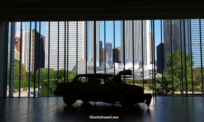
The Art Institute of Chicago – A New Favorite
More Details: The Art Institute of Chicago – A New FavoriteChicago is many things but dull it isn’t. This city is rich in culture, architecture, outdoors fun (in the summer, at least!), food and many other things. I love coming to this city but have rarely been here on my own to explore. I have greatly enjoyed coming to Chicago with friends, whether to party…
-
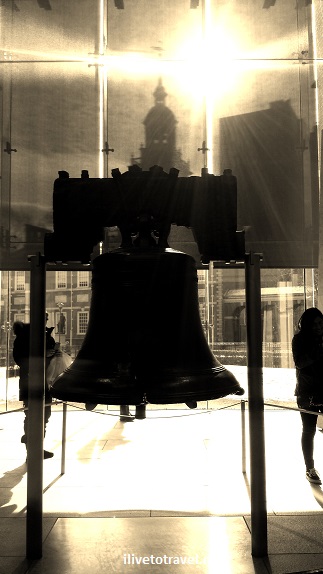
Exploring Old Philadelphia – Liberty and Independence
More Details: Exploring Old Philadelphia – Liberty and IndependenceThis past January I traveled to Philadelphia to visit family. It was BITTERLY cold but that did not stop my uncle from taking me around. It had been a couple of decades since I had last seen Liberty Bell and my uncle told me the whole place had been re-done so off we went, from…
-
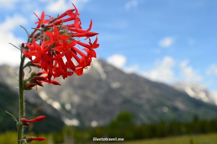
Photo Essay: Grand Teton National Park, Wyoming
More Details: Photo Essay: Grand Teton National Park, WyomingMy friend Bruce T., an outdoorsman and all-around nice guy, is traveling around the Grand Teton National Park (in northwestern Wyoming) with his wife, Sonia, and had sent out a few pictures of the sights he has encountered. I have never been to the park and loved the landscape, wildlife, and color in his pictures. …
-
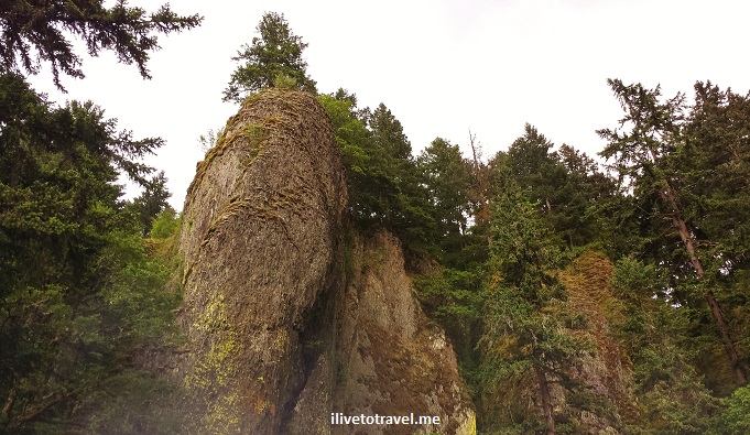
Great Drive Series – Along the Columbia River in Oregon
More Details: Great Drive Series – Along the Columbia River in OregonOregon has been a place I have always been wanting to go. When the opportunity to go on a business trip to Portland arose, I was thrilled. Though I was not able to append a weekend on either end of the business trip to get to explore more, I did have a Sunday afternoon and…
-

Hiking Tips from an Unexpected Climb of Blood Mountain
More Details: Hiking Tips from an Unexpected Climb of Blood MountainI enjoy hiking and love exploring new routes. On one recent hike, near my home in Atlanta, I had the opportunity to learn some lessons in hiking so I’d thought I’d share some hiking tips from that experience. While these tips may be common sense, the refresher is always good… But before I share the…
-
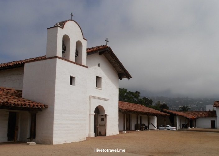
What to Do in Santa Barbara? Check out El Presidio
More Details: What to Do in Santa Barbara? Check out El PresidioI have been to California a few times but mainly to the areas around San Francisco and, less so, around Los Angeles (plus a business trip to Sacramento). This past summer, though, I got to sample some of the “other” Californias. I got to spend a few days in lovely Santa Barbara. We had a nice…
-
Panther Creek: A Challenging and Rewarding Hike in North Georgia
More Details: Panther Creek: A Challenging and Rewarding Hike in North GeorgiaI was looking for a hike that I could do within 4 hours that was not right on the outskirts of Atlanta. A friend and I were looking for a more challenging hike than the usual so after selecting a few finalists, we settled on Panther Creek, about an hour and a half north of…
-
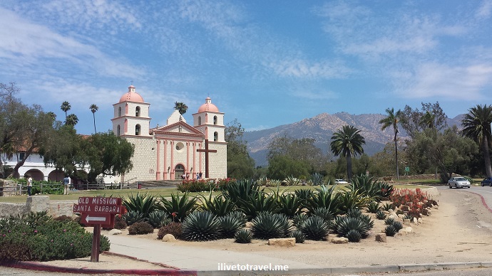
I Have a Mission for You: in Santa Barbara!
More Details: I Have a Mission for You: in Santa Barbara!Among the many beautiful things to enjoy in Santa Barbara, California, one of my favorite ones is the Old Mission. Its architecture, its setting, its history all make it a neat place to visit but what I like the most is that it is still in use by the monks and the locals; in other…
-
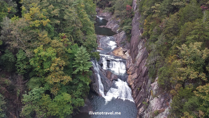
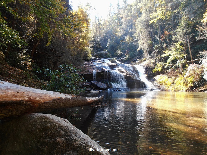
A Hike in Tallulah Gorge State Park
More Details: A Hike in Tallulah Gorge State ParkTallulah Gorge State Park is located pretty much in the northeast corner of the state of Georgia. The park centers around the Tallulah Gorge around the – guess what- Tallulah River. The river starts in North Carolina and eventually makes its way to the Savannah River and the Atlantic Ocean. It has a series of…
-

Photo of the Week: Sunset over Santa Barbara, California
More Details: Photo of the Week: Sunset over Santa Barbara, CaliforniaNothing like a beautiful sunset. And even better: one in California! So I will celebrate that with TWO, not one, of my favorite sunset pictures I took while visiting Santa Barbara!
-

Michigan Wine Country: Unexpected and Beautiful
More Details: Michigan Wine Country: Unexpected and BeautifulI was looking forward to visiting Traverse City, Michigan and exploring the neighboring areas but little did I know my timing was going to be SO good. You see, that weekend, the Leelanau Peninsula Spring Sip & Wine was taking place (check here for other events!). Over 20 wineries participated and the ticket included a…
-
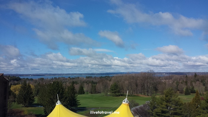
The Grand Traverse Resort and Spa: Something for Everyone!
More Details: The Grand Traverse Resort and Spa: Something for Everyone!I had the opportunity to head north to Michigan recently to explore the town and area around Traverse City. Mind you, I had only learned about Traverse City a couple of years ago when I read about it from one of my favorite travel blogs, The Working Mom’s Travels. So, always ready to explore new…