In June 2024 I spent a day in Arches National Park as part of an 8-day hiking trip along the “Mighty Five” U.S. National Parks in Utah. Arches is one of the most iconic and recognizable of the National Parks, a great system of parks and preservation of the beautiful nature available to anyone who lives or visits the U.S. (Throughout my trek across the Mighty 5, I was struck by how many Europeans were out visiting all these gems of nature.)
The park has many viewpoints, short walks, and longer/more difficult hikes such as Devils Garden, Fiery Furnace and Delicate Arch. It offers a scenic drive past many of the viewpoints so one can enjoy the amazing terrain and cool rock formations (the one that I call “Nefertiti” being my favorite!).
Devils Garden Trail
My trip to Utah’s National Parks focused on hiking, first and foremost. So, in reviewing the options, Devils Garden Trail was a clear must-do. This trail is a 7.8 mi loop; it passes many of the arches worth seeing at Arches National Park. However, as I researched the park and this trail in particular, I learned that the eastern side of the loop is a lot rougher and has fewer of the sights while adding considerable distance.
In fact, of the eight arches on this loop trail, seven can be accessed from the Double O Arch Trail (see below), a subset of the loop trail so the decision was very easy to make. To maximize our day and see other sights in the park after the main hike, we opted to skip the eastern part of the loop and just do the Landscape and Double O Arches route. Doing this shortened the hike to 4.25 miles while not short-changing seeing the most beautiful parts of the loop.
Hiking just to Landscape Arch
Landscape is the longest arch in North America; it spans about 306 ft but at its narrowest point, it may be about 6 ft wide. I wish one could get closer but the area around it is off-limits (probably for good reason). This arch feels so fragile when you look at it! Hiking to Landscape Arch takes about 1.9 mi roundtrip (with about 250 ft elevation gain). It is not hard, but still requires a little effort (bring water no matter how short the trail is).
Landscape Arch has many visitors since it is fairly accessible; so this part of the Double O Arch Trail is more crowded. Thankfully, after Landscape Arch, the trail becomes much less crowded.
Double O Arch Trail (past Landscape Arch)
As I mentioned, this trail is about 4.25 mi roundtrip (with an elevation gain of about 680 ft) including passing Landscape Arch. This trail presents some fun challenges that could be intimidating for anyone with a fear of heights as there are a couple of narrow spots. Also, there are some steep-ish rock climbs uphill past Landscape Arch. I enjoyed walking on a fin as part of this hike. At no point did I feel unsafe on the rocks or terrain.
The vistas from the trail are phenomenal and the big reward is the imposing Double O Arch. Definitely a cool spot.
We decided to not make any of the small detours to see the other arches on the way in and to leave those for the return back to the trailhead. A good idea to break the monotony of seeing something you already walked past on the “out” part of the in-and-out!
It is allowed to climb on to the base of the lower arch for great photo opps but not atop either arch. (Often there is a sign indicating climbing them is not allowed.)
On to the Dark Angel
From the Double O Arch one can continue to the Dark Angel, adding perhaps 0.8 mi roundtrip. We were not sure exactly what it was, and started on the trail. We got close to the halfway point and decided the trail did not look interesting. Plus, we could see the Dark Angel “column” from afar (and realized we had seen it in the distance from the Double O Arch already).
It was very hot and we wanted to spend time elsewhere in the part so we turned around. My recommendation: time is better spent in other parts of this trail or the park itself. It was cool to see the Double O Arch from the other side so not a bad thing!
Black Arch
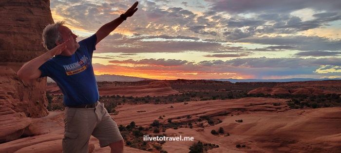
We saw the Black Arch from afar and high up. While we did not reach it, this viewpoint offered many chances for clowning-around photos that I won’t bore you with!
Navajo Arch
Navajo Arch was pretty cool and a little different than the other arches. You can walk right under it. It is unusual that there is not a view through it. A little more of secluded cave-like spot.
Partition Arch
I liked the views from Partition Arch, the breeze, and the chance for good photos of the view and of climbing (or trying to) around on the base of the arch. I may update later to add a photo!
Pine Tree Arch
Pine Tree Arch felt like a window out to the landscape behind it. A massive rock with a hole, it was the least interesting (structurally speaking) of the arches on the trail. Landscape and Double O were the most interesting in that regard with Navajo and Partition coming right behind them.
Skyline Arch
The Skyline Arch was not on the Double O Trail but was at a stop along the drive. It was far enough away on a trail that, by itself, did not seem to offer much. So we just took a look at the arch, nodded, and returned to the car (remember, we had done already Double O Trail + 1.5 mi towards/back from Dark Angel AND we were planning on a sunset hike).
Sand Dune Trail
Another cool arch along the scenic drive (so not on Double O Trail) is Sand Dune Arch. It is a very easy walk from the parking lot and just different than anything else in Arches National Park.
Cool Rock Formations at Arches
The drive afforded so many great views. Here are just a few, including Balanced Rock (one the most famous spots in the park) and my “Nefertiti”.
Ending a Day in Arches: Delicate Arch
Leaving the best for the end (of this post and of this day!) of this day in Arches NP … The plan had been, due to the high heat, to do the main hiking early and then visit the various viewpoints and short walks afterwards. But part of the plan was to see the huge and impressive Delicate Arch at the best time of day to see it: sunset.
Of course, this is well-known and the 3.2 mi roundtrip trail will not be empty nor will the viewpoint at the top. However, it was not annoyingly crowded (it is not an easy hike with an elevation gain of 629 ft so maybe fewer people attempt it). The only time to mind the “crowd” is when everyone is getting their photo under the arch but even that did not require a long wait time.
The colors, not only of the arch, but of the sky and terrain around at sunset were out of this world! Sitting up there, wind blowing, looking at the natural beauty all around was one of the best experiences of my trek across Utah!
Getting to Arches National Park
We opted to fly in and out of Las Vegas, though it is 6.5 hrs from Moab, Utah because of the availability of flight options, cheaper flights, and that it would be 2.5 hrs or so from our end point (Springdale, UT).
The town of Moab is the closest to the National Park. Since we were also going to spend time in Canyonlands National Park, Moab made great sense. The town also has a lot to offer in terms of options of places to stay, eat and shop. We rented an AirB&B south of town and enjoyed having easy access to grocery stores so we could cook dinners.