US & Canada
-
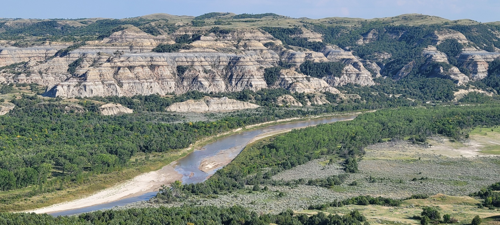
Check Out Theodore Roosevelt National Park
More Details: Check Out Theodore Roosevelt National ParkNestled in western North Dakota is an area that captivated the 26th President of the United States, Theodore Roosevelt, before he began the war and political life we know him more for. Theodore Roosevelt National Park is a memorial to the love Teddy Roosevelt felt for this region and landscape. This bit of nature nursed…
-
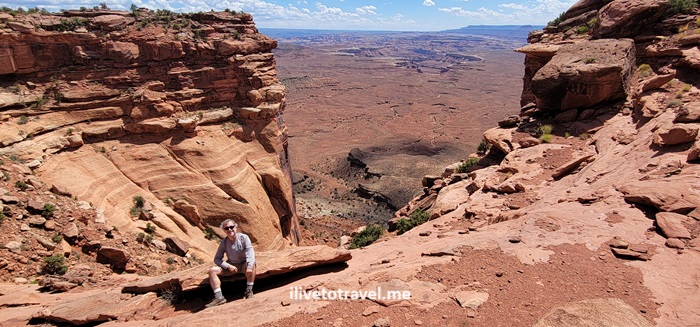
Two Days Exploring Canyonlands, a Mighty Five National Park Powerhouse!
More Details: Two Days Exploring Canyonlands, a Mighty Five National Park Powerhouse!Canyonlands seems endless: truly a Mighty Five National Park! Along with Arches, Zion, Bryce Canyon, and Capital Reef, it is one of the Mighty 5 U.S. National Parks in Utah. Canyonland National Park is located near Moab, Utah and not far from Arches National Park, it is far from from a major airport but certainly…
-
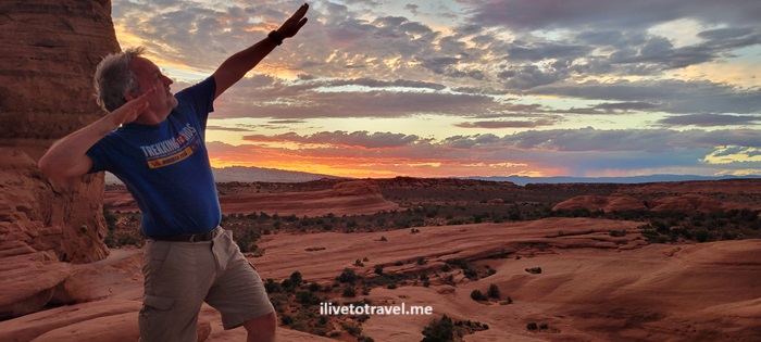
A Day in Arches, One of the Mighty Five National Parks
More Details: A Day in Arches, One of the Mighty Five National ParksIn June 2024 I spent a day in Arches National Park as part of an 8-day hiking trip along the “Mighty Five” U.S. National Parks in Utah. Arches is one of the most iconic and recognizable of the National Parks, a great system of parks and preservation of the beautiful nature available to anyone who…
-
Checking out Cloudland Canyon State Park
More Details: Checking out Cloudland Canyon State ParkOn a very cold fall morning (actually, late morning as it was 11:45AM) I started what would be a super cool hike in Cloudland Canyon State Park in NW Georgia. NW as in the true corner of Georgia where it meets Alabama and Tennessee, in the Cumberland Plateau. A friend selected this state park, two…
-
Cross-Country Drive Day 2 – Kingman to the Grand Canyon
More Details: Cross-Country Drive Day 2 – Kingman to the Grand CanyonCross-country drive starts in San Jose, California and crosses the southeastern part of the state including Barstow and hot Needles, California.
-
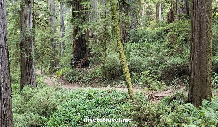
Guide for Seeing California’s Redwoods
More Details: Guide for Seeing California’s RedwoodsRedwoods are among the most impressive living organisms in this planet. And not only due to their height. They are certainly impressive as the tallest trees, growing upwards of 350 ft at their highest – think of that, like a 30+ storied building! But also due to how they grow, fuse, and survive fires. A…
-
Hiking Arabia Mountain near Atlanta
More Details: Hiking Arabia Mountain near AtlantaJust when I think I have explored a good bit of hiking trails near Atlanta, last weekend a pleasant surprise awaited me: Arabia Mountain National Heritage Area. Right outside of Atlanta, right by the town of Lithonia is a series of trails that span a good bit, anchored by Arabia Mountain. If you have ever…
-

Innovative Dining in Atlanta
More Details: Innovative Dining in AtlantaAtlanta has always been an eating-out town. Are you buying a house? That kitchen is likely not far from brand-new more than likely! OK, I exaggerate but we are not known to be a cooking urban citizenry – we love to eat out! And food in Atlanta has evolved nicely thanks to many young cooking…
-

Photo of the Week – Never Forget the Twin Towers
More Details: Photo of the Week – Never Forget the Twin TowersMany, many years ago, I went to New York City as an 18 year old and my eyes could not believe that city. I had seen Miami, Tampa, San Juan, Panama City (Panama), Washington D.C., and Atlanta at that point in my life. The Big Apple wowed me. I recall seeing the Twin Towers of…