Living in Atlanta, I am blessed to be within 1.5-2.5 hrs of really phenomenal mountain hiking. While we have many nature trails within the city itself and around I-285 (our ring road), the majesty of the south Appalachians is within easy reach. And so was Blood Mountain.
This fall, I left home with a hiking buddy at 1:30PM and got started on the route around 3:30PM. We had picked starting on the Appalachian Trail’s Neels Gap as the route to climb Blood Mountain (4,458 ft in elevation). Blood Mountain is on the Appalachian Trail proper.
Luckily for the avid hiker, there are several trails to go up Blood Mountain from either side: Neels Gap, Freedom Trail, Slaughter Creek. I had hiked it up via Freedom Trail a few years ago. However, we could not park at Neels Gap but a quarter of a mile away, there was another trailhead: Byron Reese Trail.
Headed up Blood Mountain via Byron Reese Trail
Byron Reese was about 0.7 mi away from connecting with the Appalachian Trail (and the entry point coming from Freedom Trail). From there up to the summit it would be about 1.6 mi each way by my estimation.
The trail up was moderate in terms of terrain with many roots, stones and rocks, and segments that were relatively smooth. The rocks often were purposefully laid steps. There were also larger masses of stone (granite perhaps?). Thankfully, though the larger masses of stone and the rocks were wet that day, they were not slippery (unless they had moss on them which not many did in October).
While the terrain was moderate to me as an experienced hiker, there was certainly enough inclines to be challenging enough for the short distance. It may be a harder trail for someone newer at hiking.
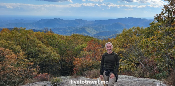
As one approaches the summit, there is an initial clearing offering a phenomenal view south to much lower mountains and hills. Clearly, Blood Mountain is higher than all visible terrain looking south.
Atop Blood Mountain!
But, that is not the summit. The terrain is granite stone interspersed with vegetation. As one follows the trail, it becomes very narrow and surrounded by tall bushes. One wonders if one already summited. However, all of a sudden, you see the rear of the shelter available to Appalachian Trail hikers right at the summit.
Climb up the large rocks right by the shelter for more good views, though far from a 360 degree view.
We want down the same route we had gone up (vs. continuing on the Appalachian Trail down to Slaughter Creek. It started lightly raining on the way down and we even had small pellets of ice. It was a great wrap-up to a shorter (4.6 mi total) but awesome hike surrounded by the perfect scenery that fall provides at this time of year!