A Gem to Behold in Bavaria: Würzburg, Germany

Germany is not short of beautiful scenery, be it natural or man-made. On the natural side, there are the forests, their rivers (and some of them with phenomenal views around them, like the Rhein or Danube), or the mountains to the south. On the man-made side, there are many great things, and there is more than one gem to behold in Bavaria! Just this one region is full of beautiful and impressive towns, big and small.

Wurzburg fortress, Residentplatz, Bayern festung, Wurzburg palace, Visiting Bavaria
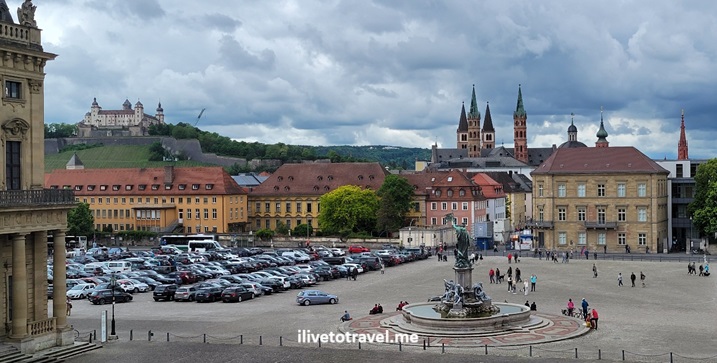
View of old town and Marienberg Fortress

In May of this year, I got to pay a visit to an “undiscovered” gem. I mean undiscovered because, to my shame, I had never really seen or heard of Würzburg!

Thanks for friends who live in Germany, short drive took us to Würzburg. There are a few sights to not miss intown.

A palace to behold: Residenzplatz

In the edge of the old town, one can find this 18th century mini-Versailles palace. It almost feels out of place in Bavaria for those of us who have not explored the area much beyond Munich or Nuremberg.

Wurzburg fortress, Residentplatz, Bayern festung, Wurzburg palace, Visiting Bavaria

Residentplatz was severely damaged during World War II as many sites in Germany but there are some parts that are original and many that are faithfully reconstructed. The palace is impressive.

Wurzburg fortress, Residentplatz, Bayern festung, Wurzburg palace, Visiting Bavaria

Some rooms are quite ornate – great reproductions of the pre-War structure.

Wurzburg fortress, Residentplatz, Bayern festung, Wurzburg palace, Visiting Bavaria
Wurzburg fortress, Residentplatz, Bayern festung, Wurzburg palace, Visiting Bavaria, Marienberg fortress, fortress on a hill

Who knew a smaller town would have such a regal place!

Walkable and easy old town

Würzburg’s town center is compact and full of life. Market, cafés, shops, and churches are all right there in a small area – easy to walk about and around. St. Mary’s Chapel (Marienkapelle) is the anchor in the large town square “Marktplatz”.

Wurzburg fortress, Residentplatz, Bayern festung, Wurzburg palace, Visiting Bavaria, Marienberg fortress, fortress on a hill, Marienkapelle

I can see a phenomenal Christmas market being held there every Christmas – must be a fun one!

Wurzburg fortress, Residentplatz, Bayern festung, Wurzburg palace, Visiting Bavaria, Marienberg fortress, fortress on a hill, Marienkapelle

The old bridge along the river Main is full of life especially as it has a popular stand on the town entrance to it.

Wurzburg fortress, Residentplatz, Bayern festung, Wurzburg palace, Visiting Bavaria, Marienberg fortress, fortress on a hill, Marienkapelle, Wurzburg alte bruck
Wurzburg fortress, Residentplatz, Bayern festung, Wurzburg palace, Visiting Bavaria, Marienberg fortress, fortress on a hill, Marienkapelle, Wurzburg alte bruck, Main river

Marienberg Fortress

Marienberg Fortress or “Marienberg Festung” dominates the town across the river from the old town. One can drive up to it going the back way or one can climb up from the riverside. Upon reaching the top, one is rewarded with great views of Würzburg and beyond by walking the ramparts. That, by itself, makes it worth the visit. Doing this also allows to explore the outer walls and towers of the fortress from the outside

Wurzburg fortress, Residentplatz, Bayern festung, Wurzburg palace, Visiting Bavaria, Marienberg fortress, fortress on a hill, Marienkapelle, Wurzburg alte bruck

The fortress, which dates from the 13th century, grew and evolved through medieval and baroque architectural styles.

Wurzburg fortress, Residentplatz, Bayern festung, Wurzburg palace, Visiting Bavaria, Marienberg fortress, fortress on a hill, Marienkapelle, Wurzburg alte bruck

It not only served as a fortress defending the region against many threats but it also served as the home-base of Prince-Bishops who ruled the area for centuries. These were not only political rulers but also great drivers of art, architecture and scientific endeavors in the region.

Wurzburg fortress, Residentplatz, Bayern festung, Wurzburg palace, Visiting Bavaria, Marienberg fortress, fortress on a hill, Marienkapelle, Wurzburg alte bruck

While Munich is what tourists visiting Bavaria focus on, they are missing out in understanding the depth and richness of Bavaria’s history and assets if they just stick to Munich. Würzburg would be a good choice due to its charm but also due to its location, on its way to other places in Bavaria and Germany!

Two Days Exploring Canyonlands, a Mighty Five National Park Powerhouse!

Canyonlands seems endless: truly a Mighty Five National Park! Along with Arches, Zion, Bryce Canyon, and Capital Reef, it is one of the Mighty 5 U.S. National Parks in Utah.

Canyonland National Park is located near Moab, Utah and not far from Arches National Park, it is far from from a major airport but certainly worth the effort. We spent two days exploring Canyonlands which was perfect in the context of our broader trip covering the Mighty Five.

Attacking Canyonlands: Island in the Sky District

The park is made of several districts with Island in the Sky being easily the most accessible and with a lot to offer to hikers and non-hikers alike. It was easy to spend two days and leave territory not-covered, even just in Island in the Sky. This district’s main roads are in the form of a “Y”. One enters on the top right of the Y, the only entrance/exit to this district (with a main paved road).

We had dedicated two days to Canyonlands, the second of the Mighty Five U.S. National Parks we were visiting on this hiking trip. We decided to split the visit as follows:

  • Day 1: The lower leg of the Y, starting by going all the way to the bottom and making our way back up (and out). On this day, we visited the following:
    • Orange Cliffs Overlook facing the Green River
    • Buck Canyon Overlook facing the Colorado River
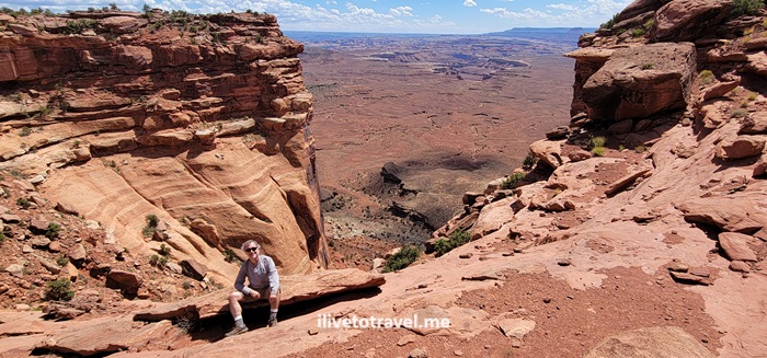
    • Grand View Point Overlook walking along the rim
    • Murphy Trail.
  • Day 2: The upper part of the Y, starting at the far end of the left upper arm of the Y. These were all short hikes, easily accessible.
    • Upheaval Dome
    • Whale Rock
    • Aztec Butte
    • Mesa Arch
    • Shafer Canyon Overlook.
Great VIew Point Overlook, Canyonlands National Park, Green River, Colorado River, Utah hiking, Orange Cliffs
Easily accessible Orange Cliffs Overlook view!

Grand View Point Overlook and a good intro to Canyonlands

After stopping at the Orange Cliffs and Buck Canyon Overlooks, we proceeded to Grand View Point Overlook. As we entered the trail, we happened upon a 10 AM outdoor park ranger talk. Very fortunate as I learned a lot about the major forces that shaped the terrain and created the multiple layers of different colors and compositions we see today.

Great VIew Point Overlook, Canyonlands National Park, Green River, Colorado River, Utah hiking

Great VIew Point Overlook, Canyonlands National Park, Green River, Colorado River, Utah hiking

The trail to the overlook was a short and highly rewarding 1.8 mi walk along the canyon rim with little elevation gain though you are in an altitude of ~6,000 ft. There is a short rock climb to get to the best viewpoint – and great spot for photos!

Great VIew Point Overlook, Canyonlands National Park, Green River, Colorado River, Utah hiking

Great VIew Point Overlook, Canyonlands National Park, Green River, Colorado River, Utah hiking

Wrapping up day 1: Murphy Trail

Murphy Trail was going to be our strenuous hike on this day. Not because of the length, as it was not too long (a 4.5-mile hike), but because we started in the afternoon and it was one very hot day. On and it would be steep with an elevation gain of 1,109 ft. The initial part of the trail was a walk on a field that did not have much to say in its favor. But then we reached the edge and began the best part of this fun hike. The terrain included rock scrambles and the like, and the view was always breathtaking once we left the field.

Murphy Trail, Canyonlands National Park, parks in Utah, hiking in Utah, outdoors, canyon hikes, outdoors, adventure

Murphy Trail, Canyonlands National Park, parks in Utah, hiking in Utah, outdoors, canyon hikes, outdoors, adventure
Down and up all those rocks

Murphy Trail, Canyonlands National Park, parks in Utah, hiking in Utah, outdoors, canyon hikes, outdoors, adventure

Once we got to the connector to the loop trail at the bottom, we stopped for lunch (at the “green” rock level) before beginning he hike back up to the rim. Though it was a very hot day, with good hydration and electrolytes, we did it safely and greatly enjoyed the hike: navigating the rocks, the descent/ascent, and the great vistas and rock formations.

Murphy Trail, Canyonlands National Park, parks in Utah, hiking in Utah, outdoors, canyon hikes, outdoors, adventure
The little green area at the bottom was our lunch spot

Certainly, a few degrees cooler would have been nice. But the ice cold water awaiting for us in the cooler we had in the car felt like heaven as I poured it over my head and feet!

Upheaval Dome

Day 2 was not going to be the strenuous hike day, but a day full of moderate or easy relatively short hikes for us. Upheaval Dome was our first destination of the day.

There were two overlooks, the first of which was about halfway in. The trail, an in-and-out, was only only 1.3 miles but with 226 ft elevation gain. Not strenuous at all but providing a great vantage point to look at Upheaval Dome. It was unlike any sight we saw or were going to see during our time in the park. It was a circular hole, as in a volcano’s caldera or a crater, but inside there were massive, tilted rock formations of a greenish color.

upheaval dome, canyonlands, hiking, rock formations, utah, southwestern parks

Whale Rock

Right by Upheaval Dome was Whale Rock. No explanation needed for its name… It is about a 0.8-mil trail roundtrip though we tooled around a little so maybe it was a mile for us. Elevation gain is 128 ft to the top. Not strenuous but has a steep spot that some may take slow. It offers a good view of Island in the Sky with little effort. Just because a trail is short it does not mean shoes with good traction are not necessary: always good to have them because of the sloped nature of some of the rocks one will walk on on trails like Whale Rock.

whale rock,, canyonlands national park, parks in utah, hiking, rock formations, southwestern US, nature
View of the road from Whale Rock

Aztec Butte

The walk to Aztec Butte was not that exciting but the climb to the top of the butte offered a nice challenge with a very steep rock face.

aztec butte, canyonlands, hiking in utah, rock formations, southwestern parks

aztec butte, canyonlands, hiking in utah, rock formations, southwestern parks
Steep and cool rock layers along the route

Right below the top are small “caves” that I imagine were used by people long ago. I read that they were used to store grains and other food.

aztec butte, canyonlands, hiking in utah, rock formations, southwestern parks
Cavemen

The roundtrip is about 1.4 miles with 213 ft elevation gain (all when the butte is reached). Great views from the top.

aztec butte, canyonlands, hiking in utah, rock formations, southwestern parks

And, no, no Aztecs lived in the area…

Mesa Arch

The combination of a short hike at 0.83 miles and the amazing structure of Mesa Arch make this a definite must-see. Only 102 ft elevation gain to boot so relatively easy. It does require, though, walking on rough terrain and stones. But, through the arch ones has a great view of the canyons below and the La Sal Mountains afar.

aztec butte, canyonlands, hiking in utah, rock formations, southwestern parks, mesa arch

aztec butte, canyonlands, hiking in utah, rock formations, southwestern parks, mesa arch
Having some fun: on the same photo in two places!

Canyonlands is a phenomenal place for all, hikers and non-hikers alike. The beauty of the canyons is outstanding. The Colorado and Green Rivers add to the scenery as they snake their way down the canyons. But what certainly caught my eye was the variety of colors across the many layers of rock exposed for us to see!

A Day in Arches, One of the Mighty Five National Parks

In June 2024 I spent a day in Arches National Park as part of an 8-day hiking trip along the “Mighty FiveU.S. National Parks in Utah. Arches is one of the most iconic and recognizable of the National Parks, a great system of parks and preservation of the beautiful nature available to anyone who lives or visits the U.S. (Throughout my trek across the Mighty 5, I was struck by how many Europeans were out visiting all these gems of nature.)

The park has many viewpoints, short walks, and longer/more difficult hikes such as Devils Garden, Fiery Furnace and Delicate Arch. It offers a scenic drive past many of the viewpoints so one can enjoy the amazing terrain and cool rock formations (the one that I call “Nefertiti” being my favorite!).

Devils Garden Trail

My trip to Utah’s National Parks focused on hiking, first and foremost. So, in reviewing the options, Devils Garden Trail was a clear must-do. This trail is a 7.8 mi loop; it passes many of the arches worth seeing at Arches National Park. However, as I researched the park and this trail in particular, I learned that the eastern side of the loop is a lot rougher and has fewer of the sights while adding considerable distance.

In fact, of the eight arches on this loop trail, seven can be accessed from the Double O Arch Trail (see below), a subset of the loop trail so the decision was very easy to make. To maximize our day and see other sights in the park after the main hike, we opted to skip the eastern part of the loop and just do the Landscape and Double O Arches route. Doing this shortened the hike to 4.25 miles while not short-changing seeing the most beautiful parts of the loop.

Hiking just to Landscape Arch

Landscape is the longest arch in North America; it spans about 306 ft but at its narrowest point, it may be about 6 ft wide. I wish one could get closer but the area around it is off-limits (probably for good reason). This arch feels so fragile when you look at it! Hiking to Landscape Arch takes about 1.9 mi roundtrip (with about 250 ft elevation gain). It is not hard, but still requires a little effort (bring water no matter how short the trail is).

landscape arch, arches national park, day in arches, hiking in utah, visit utah, alltrails

landscape arch, day in arches, arches national park, hiking in utah, alltrails
The photo does NOT do it justice

Landscape Arch has many visitors since it is fairly accessible; so this part of the Double O Arch Trail is more crowded. Thankfully, after Landscape Arch, the trail becomes much less crowded.

Double O Arch Trail (past Landscape Arch)

As I mentioned, this trail is about 4.25 mi roundtrip (with an elevation gain of about 680 ft) including passing Landscape Arch. This trail presents some fun challenges that could be intimidating for anyone with a fear of heights as there are a couple of narrow spots. Also, there are some steep-ish rock climbs uphill past Landscape Arch. I enjoyed walking on a fin as part of this hike. At no point did I feel unsafe on the rocks or terrain.

double o arch trail, arches national park, day in arches, alltrails, visit utah, hiking in utah
Walking up & down rocks was fun and not that hard

The vistas from the trail are phenomenal and the big reward is the imposing Double O Arch. Definitely a cool spot.

We decided to not make any of the small detours to see the other arches on the way in and to leave those for the return back to the trailhead. A good idea to break the monotony of seeing something you already walked past on the “out” part of the in-and-out!

Double O arch, arches national park, day in arches, hiking in utah, visit utah, alltrails
From afar; looks better from up front

It is allowed to climb on to the base of the lower arch for great photo opps but not atop either arch. (Often there is a sign indicating climbing them is not allowed.)

Double O arch, arches national park, day in arches, hiking in utah, visit utah, alltrails
Hiking buddy showing our disappointment!
Double O arch, arches national park, day in arches, hiking in utah, visit utah, alltrails
Hard to show how magnificent the arch is!

On to the Dark Angel

From the Double O Arch one can continue to the Dark Angel, adding perhaps 0.8 mi roundtrip. We were not sure exactly what it was, and started on the trail. We got close to the halfway point and decided the trail did not look interesting. Plus, we could see the Dark Angel “column” from afar (and realized we had seen it in the distance from the Double O Arch already).

dark angel, arches national park, day in arches, hiking in utah, visit utah, alltrails
That is the Dark Angel “column”

It was very hot and we wanted to spend time elsewhere in the part so we turned around. My recommendation: time is better spent in other parts of this trail or the park itself. It was cool to see the Double O Arch from the other side so not a bad thing!

Black Arch

We saw the Black Arch from afar and high up. While we did not reach it, this viewpoint offered many chances for clowning-around photos that I won’t bore you with!

black arch, arches national park, day in arches, hiking in utah, visit utah, alltrails
The arrow points to the Black Arch

Navajo Arch

Navajo Arch was pretty cool and a little different than the other arches. You can walk right under it. It is unusual that there is not a view through it. A little more of secluded cave-like spot.

navajo arch, arches national park, day in arches, hiking in utah, visit utah, alltrails

Partition Arch

I liked the views from Partition Arch, the breeze, and the chance for good photos of the view and of climbing (or trying to) around on the base of the arch. I may update later to add a photo!

Pine Tree Arch

Pine Tree Arch felt like a window out to the landscape behind it. A massive rock with a hole, it was the least interesting (structurally speaking) of the arches on the trail. Landscape and Double O were the most interesting in that regard with Navajo and Partition coming right behind them.

pine tree arch, arches national park, day in arches, hiking in utah, visit utah, alltrails

Skyline Arch

The Skyline Arch was not on the Double O Trail but was at a stop along the drive. It was far enough away on a trail that, by itself, did not seem to offer much. So we just took a look at the arch, nodded, and returned to the car (remember, we had done already Double O Trail + 1.5 mi towards/back from Dark Angel AND we were planning on a sunset hike).

Skyline Arch, day in arches, arches national park, visit utah, hiking in utah, day in arches

Skyline Arch, day in arches, arches national park, visit utah, hiking in utah, day in arches
My friend took a peek inside the arch to ensure we weren’t missing something

Sand Dune Trail

Another cool arch along the scenic drive (so not on Double O Trail) is Sand Dune Arch. It is a very easy walk from the parking lot and just different than anything else in Arches National Park.

day in arches, arches national park, visit utah, hiking in utah, sand dune trail

day in arches, arches national park, visit utah, hiking in utah, sand dune trail

Cool Rock Formations at Arches

The drive afforded so many great views. Here are just a few, including Balanced Rock (one the most famous spots in the park) and my “Nefertiti”.

cool rock formations, day in arches, arches national park, visit utah, hiking in utah, day in arches

cool rock formations, day in arches, arches national park, visit utah, hiking in utah, day in arches, balanced rock

cool rock formations, day in arches, arches national park, visit utah, hiking in utah, day in arches

Ending a Day in Arches: Delicate Arch

Leaving the best for the end (of this post and of this day!) of this day in Arches NP … The plan had been, due to the high heat, to do the main hiking early and then visit the various viewpoints and short walks afterwards. But part of the plan was to see the huge and impressive Delicate Arch at the best time of day to see it: sunset.

Of course, this is well-known and the 3.2 mi roundtrip trail will not be empty nor will the viewpoint at the top. However, it was not annoyingly crowded (it is not an easy hike with an elevation gain of 629 ft so maybe fewer people attempt it). The only time to mind the “crowd” is when everyone is getting their photo under the arch but even that did not require a long wait time.

Delicate Arch at sunset, arches national park, day in arches, visit utah, hiking in utah
Before the peak of sunset
Delicate Arch at sunset, arches national park, day in arches, visit utah, hiking in utah
Simply majestic – thank you, Lord, for the beauty of your Creation!

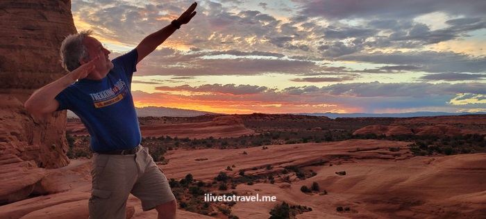
The colors, not only of the arch, but of the sky and terrain around at sunset were out of this world! Sitting up there, wind blowing, looking at the natural beauty all around was one of the best experiences of my trek across Utah!

Delicate Arch at sunset, arches national park, day in arches, visit utah, hiking in utah
Great feeling of exhilaration!

Getting to Arches National Park

We opted to fly in and out of Las Vegas, though it is 6.5 hrs from Moab, Utah because of the availability of flight options, cheaper flights, and that it would be 2.5 hrs or so from our end point (Springdale, UT).

The town of Moab is the closest to the National Park. Since we were also going to spend time in Canyonlands National Park, Moab made great sense. The town also has a lot to offer in terms of options of places to stay, eat and shop. We rented an AirB&B south of town and enjoyed having easy access to grocery stores so we could cook dinners.

Toledo’s Cathedral – One of the Most Impressive

The town of Toledo, in the heart of Spain, is loaded with history, faith and meaning for Spain. This town, perched high and surrounded on three sides by the river Tagus, served as capital of Spain – last time until the second half of the 16th century. Toledo’s Cathedral is its most impressive, but far from the only, great attribute. And definitely one of the most beautiful I have ever seen (and I have visited many!).

A unique setting is one of Toledo’s assets

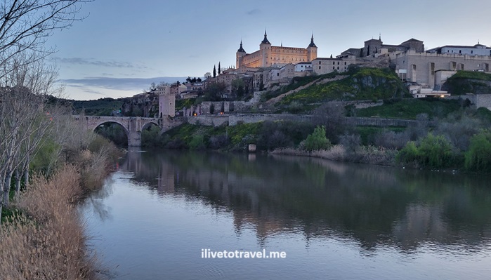
Its position up high by the river can be best appreciated across the river instead of within the town itself. If you come from the train station, you will -all of a sudden- see the Alcazar fortress prominently on display, and a couple of bridges across the river. One of these bridges is made of stonework and is very impressive. Once you cross, you can either climb up steps and ramps to arrive at the main square or take the electric stairs that seem to be endless. If you are able to, I recommend the walk even if you go slowly so you can appreciate more the setting/

toledo, espana, spain, mountaintop town, catedral de toledo, toledo cathedral, el greco in toledo
Toledo Spain

A crossroads of cultures and history

It is famous for so many things. It blended Christian, Jewish and Moorish cultures and their unique monotheistic faiths. One can see this manifested most strongly in the architectural details all over the old town. The old town is a maze of alleys, some pedestrian, some not, and it is easy to get lost but, thankfully, the town is small and contained by city walls for the most part.

toledo, espana, spain, mountaintop town, catedral de toledo, toledo cathedral, el greco in toledo

El Greco rules

Among the many valuable cultural treasures are many paintings of El Greco (many of them in the Cathedral). But one of his most famous paintings, the Entierro del Conde de Ordaz (the Burial of the Count of Orgaz) from 1586 resides in a small church called the Church of Santo Tomé. Friends of my family had a copy of the painting in their home during my childhood and I spent much time observing the painting, fascinated by the scene it portrays. So getting to see the real – and much larger – painting is a real treat.

Entierro Conde Orgaz, El Greco painting, Spanish art, Toledo santo tome

El Greco’s paintings usually portray people with elongated faces which I feel adds more drama to any scene he is painting. The museum at the Cathedral has a few more beautiful works of El Greco!

El Greco paintings, pinturas del Greco, catedral de Toledo, arte

And now to Toledo’s Cathedral

I have traveled a lot as you can tell from the blog and have seen many churches of many types and sizes. So it means something when I say this is in the top 5, if not top 3, in terms of how amazing it is in every which way. Upon first sighting the structure, it is not as striking as other cathedrals or large churches I have seen…

toledo, espana, spain, mountaintop town, catedral de toledo, toledo cathedral, el greco in toledo, gothic church

But that is the only shortfall in my book for Toledo’s 13th century Gothic cathedral!

The choir of Toledo’s cathedral

Its choir is something to admire, not just for pure woodwork, but for all the history that the woodwork depicts.

toledo, espana, spain, mountaintop town, catedral de toledo, toledo cathedral, el greco in toledo, choir, woodwork, virgin mary statue in toledo
toledo, espana, spain, mountaintop town, catedral de toledo, toledo cathedral, el greco in toledo, catholic cathedral choir, tiled vault ceiling

Side chapels and ceilings are works of art of their own!

Don’t miss checking out the altars and side chapels. And do not forget to look up. The artwork is amazing in every corner of Toledo’s cathedral.

spain,  catedral de toledo, toledo cathedral, catholic cathedral choir, tiled vault ceiling, painted ceiling, religious mural

The most spectacular altar

The cathedral’s altar is a jewel onto itself. A large, massive jewel! It is a wonder of man-made craft inspired by faith. Certainly, one is inspired to connect with God when standing, sitting or kneeling in front of it, which is the idea in the end…

The retable (or the main golden piece shown in the photo) at its center rises five stories high. The paintwork was done by many famous painters, architects and sculptios of the time and area.

catedral de toledo, toledo cathedral, el greco in toledo, catholic cathedral choir, tiled vault ceiling, golden altar, gilded altar

Behind the altar is more amazing artwork!

It would be so hard to not be moved as a Christian when walking around Toledo’s cathedral. In every corner there is major artwork! The backside of the altar is no exception.

grandiose painted ceiling, toledo cathedral, statue of virgin mary, rococo altar
The status above the altar magnified on the right

I am no art expert. I believe this is Baroque style: very elaborated! It certainly stands in contrast to the rest of the Cathedral’s Gothic style. I was very surprised when I saw it.

And then I looked up and saw the painted ceiling as it rose to a painted dome. Who thought of all this and how hard was it to design it and paint it?!

I learned later this altar is called “El Transparent” as it focuses light from the “skylight” above on the tabernacle at certain times of the day.

Until next time, Toledo!

A very inspiring and awe-inducing visit, even if not my first time there. 30 years between visits does take its toll in my memory bank from pre-smartphone days (and the ease of photographing freely). I am very fortunate to have been able to return and re-encounter Toledo and its cathedral.

toledo, espana, spain, mountaintop town, catedral de toledo, toledo cathedral, el greco in toledo

In Memoriam: Beautiful Memories of Travels with My Sister

This week marks five years since my dear sister left us in 2019. It does not get easier, really. But, while we all remain heartbroken, we remember her joy and beautiful smile on this day and always. In memoriam, I republish this post on the anniversary of seeing her go… May she be surrounded by the angels and making them laugh as she did with us! Te extraño mucho, Luly

Before there was me, there was my sister:  Luly.  Meet Luly!!!!!!

baby with parents in the 1960s
Luly with our parents in Philly
Trouble just started walking! And she KNOWS it!
girl smiling, 1960s studio photo
Luly at 4 years – the smile would never leave her!
She was a daredevil feeding the wildlife (with my Dad)!

Being born before me means she got to travel before I did through the accident of birth order :).   However, I have the claim to have flown first at a younger age.  She was no pushover in this category:  her first flight was around 9 months old to go to Puerto Rico from her birth town of Philadelphia.  But I got to at 4 months old.

family at the beach in the 1960s
My sister, parents and I at a beach in Puerto Rico

My sister was not only my play companion in our childhood, but also my travel companion.

Her mischievousness evident as she rode my tractor – and her great smile!

We traveled together between Miami and San Juan a few times throughout our childhood and pre-teen years with a side trip, no, two, to Walt Disney World in Orlando in 1973, a year-and-a-half after it opened in 1971.  Yes, we went to Disney twice in the same summer a few weeks apart!  My Godfather took us first and then my parents took us.  Sweeeet!!  My sister’s love of Disney is well-known by everyone who knows her – I think I know how it started!

Kids in Disney in 1973
With Alice in Wonderland’s rabbit
Parrot Jungle Miami
About 5 yrs after that Disney trip exploring Miami’s Parrot Jungle

Our traveling turned international with a trip to Panama in the late 1970s to visit family there and a side trip to one of the Pearl Islands:  Contadora – a little piece of paradise off the Pacific coast of Panama.

Our last trip together before serious adulthood (she was over 18 already… I wasn’t) was a day trip between San Juan and the island of St. Thomas in the Virgin Islands.   It wasn’t a sibling trip:  she was going with a high school friend and I was like the chaperone (never mind I was a tad younger than both of them!).  It was a hectic day but it was fun.

As we got busy with college years, our travels together were limited to spending the holidays or other significant events back at home.  Our next bigger adventure together was when I spent 6 months living in Paris, France on assignment with work.  My sister and her husband came over, explored Paris, Versailles and Normandy with me, and then they explored Belgium and The Netherlands on their own.  She loved the entire trip and the experience of exploring Europe unguided – adventurous!

My sister and brother-in-law in Belgium
tourists at Versailles
Exploring Versailles together!

Later, after her awesome kids were a little older, we continued joint travels mainly through cruises.  Cruises were perfect for someone with kids with the kids’ club helping them burn energy, while the adults relaxed on board.  Of course, all meals were together and off-cruise sightseeing was too.

We got to explore Alaska, Vancouver/Victoria, and many places in the Caribbean together.  My sister enjoyed laying by the pool on the boat (or on a beach at a cruise stop) and enjoying a frozen drink while at it.  She also enjoyed the shows, dancing, and people watching.

With her hubby and two kiddos at the glacier in Alaska
Ketchikan: Don’t ask me why but she fell IN LOVE with you!

While they went to some resorts in the Caribbean with my parents, I only got to do one resort trip with them to the Dominican Republic’s Punta Cana – heavenly place!

Resort wear – and my sister’s great smile!

Another adventure we had was renting a home in the Smoky Mountains by Gatlinburg, Tennessee.  We enjoyed the drive, the towns, the national park, and, barely escaping a bear that walked through our mountaintop rental house’s street right after she and I had wrapped up a short walk around the street.  Thankfully, we saw it maybe half an hour after we had gone inside.  The view from the house’s deck was sweet.

World’s bestest siblings enjoying the deck, post-bear!
The adventurer/explorer/bear-whisperer in action!

Later we branched out big time and splurged with a Baltic cruise!  She and her family, with our parents, an aunt/uncle, and I, flew to Copenhagen to catch our Baltic cruise.  We spent a little time in Copenhagen exploring and then went on the cruise.  Stockholm (Sweden), Berlin (Germany), St. Petersburg (Russia), and Tallinn (Estonia) were the stops we made and we all loved both the sunsets over the Baltic Sea and the ports we visited.  It was a very memorable trip since there were 9 of us.  Our favorite adventure was figuring out how to get everyone into the executive lounge I had access to due to my status for breakfast and happy hour!  Always successful, not the least because the staff was super nice and relaxed.

Our crew at the exec lounge in Copenhagen!
With the kids in Gamla Stan, the old part of Stockholm, taking a break
At a great photo spot in Tallinn!

Outside of smaller road trips, in the last few years our biggest trip took place a couple of years ago when she, my Mom and I, joined by an uncle, went to explore my Mom’s (and ours!) ancestral land in Spain’s Basque country and to make a special spiritual pilgrimage to Lourdes, France.  Both my sister and Mom had been named after the Virgin of Lourdes so it had special meaning for that reason and others.

Getting ready to first-class it to Europe!

We started in amazing San Sebastian, spent a day or two driving around the countryside visiting Basque villages and towns in our family tree, before heading over to Lourdes (with a short stop in cool Biarritz).

Yay! We found Andraca!
At Biarritz, a place my Mom dreamt all her life of seeing!

We had decided to take the opportunity to see more by not returning home the way we had come (U.S.->Paris->Bilbao) but to go check out Barcelona and fly home from there.  That placed Andorra and Montserrat in our route which was great as it got me to check off my last of the tiny European countries and see the important mountaintop monastery of Montserrat.  We enjoyed great food in Barcelona as well as riding the hop-on//hop-off bus all the time to get to places or just see them from the comfort of the bus.  The serious walking was left for the early morning and later afternoon/evening.

Celebrating life every day of her life – here in Barcelona

Three weeks ago, my sister went on a trip that I did not get to do with her:  all the way to the final destination.  Sadly, my sister lost her spirited fight against stage 4 breast cancer, a fight she fought for over 3 years.  She lived those years fully:  working in her dream job helping children in our society as a social worker, laughing with family and friends all the time, being mischievous (¡traviesa!), and traveling!  She got to do the trip to Europe I just described, a cruise, and her first visit to the Windy City, Chicago, all in the same year!

I (as is everyone who knew her) is deeply saddened at her passing and are missing her terribly.  But we will get back together again some day and that is of great comfort.  Every time I travel, I will think of her – which I did anyway, of her and the rest of my family, carrying their photo on my adventures, something that she always found touching.

in memoriam, social worker, luly pino, travels with my sister
They came with me to the fjords of Iceland
in memoriam, social worker, luly pino, travels with my sister, kilimanjaro remembrance
They came with me to the roof of Africa: Kilimanjaro

I may have beaten her at who got to fly younger, but my sister beat me in getting to heaven first.  Probably so she can prepare all the pranks she will continue to play on me while I am down here and once I get there.  Some things -thankfully- never change 🙂

in memoriam, social worker, luly pino, travels with my sister
Then (always protecting me)
in memoriam, social worker, luly pino, travels with my sister
Now and forever! (Enjoying typical Cuban breakfast: toast & café con leche!)

God bless you, Luly, and may you be soaking in the joys of heaven as you soaked the sun (beach- or pool-side) down here.  You were definitely sunshine in our lives.

in memoriam, social worker, luly pino, travels with my sister
The sun the day she left us
in memoriam, social worker, luly pino, travels with my sister
Celebrating life in Sarasota in 2016 – my sister is beauty!

Rest in peace, mi querida Luly.

Trekking in Patagonia!

(Re-posted this writeup from 10 years ago!)

Soon, I will be headed on another travel adventure.  This one will be another trekking adventure with Trekking for Kids (TFK).  With TFK, I climbed Mt. Kilimanjaro, hiked the Transylvanian Alps in Romania, and “pilgrimaged” on the Camino de Santiago in Spain.  I am thrilled because I get to return to a part of the world that is remote, pristine, and with which I fell in love the first time I went in 2010, to have an adventure:  a trek in Patagonia.  No, not the store but the southern part of the continent of South America.

Beginning of the adventure:  Buenos Aires

The trip begins in Buenos Aires, Argentina.  OK, it really begins at the Atlanta airport but that’s just a technicality.  I will spend a few days in the Argentine capital working with two local children’s home that are benefiting from our TFK trek.  Each trekker has fundraised so we can fund the work being done to the children homes.  It is really exciting to be able to spend some of my vacation on such a wonderful effort.

I am lucky to have visited Buenos Aires a couple of times and it is a great city.  I always enjoy getting to experience this magnificent and lively metropolis, no matter how much time I get to be there!

tourist, Buenos Aires, monuments, travel, photo

ilivetotravel in Buenos Aires MANY moons ago!

A detour before I begin…

I decided to take advantage of having some flexibility and will arrive in Buenos Aires a couple of days early.  The goal is to head over to a lesser-known jewel in neighboring Uruguay:  a colonial charming town appropriately named Colonia del Sacramento.   Colonia, as it is commonly referred to, is mentioned in the book 1,000 Places to See before You Die.  Not planning on dying anytime soon but better safe than sorry, no? 🙂  Colonia is an open-air “museum” of vintage cars (something I only discovered when I went).

Starting the trek in Argentina’s Patagonia

After the work with the children’s homes in Buenos Aires, we will fly down to the town of El Calafate on the Argentine side of Patagonia.  From there we will hike around the iconic Fitz Roy peak and its siblings,  and visit the famous and imposing Perito Moreno glacier.

Perito Moreno, glacier, Argentina, Patagonia, nature, adventure, ice, blue, water, photo, travel

Note the size of the glacier when compared to the boat in the red circle on the upper right

Onward to Chile

After visiting the glacier park, we will transfer the next day to Puerto Natales, the Chilean town that is the real gateway to the wildness and beauty of Patagonia (I like the Chilean side better!).

Puerto Natales, Patagonia, Chile, travel, photo, Canon EOS Rebel, water, sea, mountains

At the waterfront in Puerto Natales, gateway to glacier boat tours (from my 2010 visit)

Puerto Natales, Patagonia, Chile, travel, photo, Canon EOS Rebel, architecture

Example of the local architecture in Puerto Natales

The route for our trek in Patagonia:  the W Circuit

I stayed in Puerto Natales when I visited in 2010 and there is something about its remoteness, its simplicity that was very appealing to me.  From there, we will launch our trek to the impressive Torres del Paine, surrounded by lakes and glaciers.  Our route is the typical route to trek there – it is called the “W” route.  Take a look at the map (with the route in red) and you will see where the name comes from!

W circuit, Patagonia, Chile, Torres del Paine, hiking, trekking, glacier, lake, Pehoe, Grey, Nordenskjold, map

The W circuit

I am thrilled at this upcoming adventure and have tons to do to prepare.  I also wonder if I am physically ready enough as I will be needing to carry about 30 lbs on my back – a first for me in any of my hikes.  Wish me luck on my trek in Patagonia and stay tuned for future write-ups on the experience!


After I concluded the trek in Patagonia described before it happened above, I have written extensively about the experience.  Read more here!

  • Day 1 of the trek in Patagonia (W Circuit)
  • Day 2 of the trek in Patagonia (W Circuit)
  • Day 3 of the trek in Patagonia (W Circuit)
  • Day 4 of the trek in Patagonia (W Circuit)
  • Day 5 of the trek in Patagonia (W Circuit)
  • Puerto Natales, entryway to the Torres del Paine

Other hikes around the world that may be of interest:

Medieval Stave Churches in Norway

After all the hiking I did in Norway a couple of months ago, exploring the stave churches in Norway was the second highlight of the trip. I had never seen this type of churches (stavkyrkje) before and found them to be a neat ‘discovery’ for me out of this two-week trip.

Why “stave”?

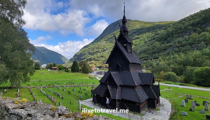
Stave churches are medieval churches made from wood typically found in northern Europe, mainly with vertically placed wooden planks. “Stav” is a Norwegian word referring to the pine posts that are used to build the frame of the structure. These days, the stave churches that have survived to this day (with very few exceptions) are actually in Norway. The exterior is usually covered in pine tar to protect it; it gives the structure a black or dark color. There is not just one design possible for these or methods of building them. You can read more about that here, if you are interested.

Borgund, stavkyrkje, stave church in norway, architecture, medieval church
Example of how the wood is covered (Borgund Stave Church)

Lom’s Stave Church

The first stave church I visited was the one in Lom. This one is an active church. Originally a Catholic church consecrated in the 12th century, it underwent major renovations (enlarged, re-decorated, etc.) in the 17th century. It is an old church and a fairly large one. It has been maintained and renovated even as recently at 50 years ago. It is an impressive church in a cool town!

Lom, stavkyrkje, stave church in norway, architecture, medieval church

Lomen Stave Church

The Lomen Stave Church is in the village of Lome. It dates from the late 12th century though it was also renovated in the mid-18th century. Its use as a church ended when a newer church was built in town in 1914. However, it is still used for weddings and special events.

Lomen, Slidrefjord, Valdres, stavkyrkje, stave church in norway, architecture, medieval church
The church is uphill from the main road
Lomen, Slidrefjord, Valdres, stavkyrkje, stave church in norway, architecture, medieval church
The view down to Slidefjord
Lomen, Slidrefjord, Valdres, stavkyrkje, stave church in norway, architecture, medieval church
Neighboring house

Høre Stave Church

The Høre Stave Church is also in the Valdres region in the village of Kvien. As it is often the case, sometimes the churches we see are built on the site of a prior church no longer visible. This stave church is estimated to have been built in the year 1179. Darn old! And, like many of these churches, it has undergone changes and renovations over the centuries. It is an active church still and is estimated to seat about 170 people.

Hore, stavkyrkje, stave church in norway, architecture, medieval church

Øye Stave Church

This stave church is also in the Valdres region. The structure we see today was only built in 1965. However, it was built with wood discovered under the newer church nearby and that wood was determined to belong to the original stave church that was built in the 12th century and demolished in the mid-18th century. It is a charming small church from the outside in a perfectly picturesque setting (it was closed to visitors when I visited).

oye, stavkyrkje, stave church in norway, architecture, medieval church

Borgund Stave Church

This church sits on a property that includes a museum and coffee shop across the street. Very visitor friendly with plenty to see and learn. It is located in Lærdal. A newer church was built next door that is still active, and the old church (built around the year 1200) was turned into a museum. It is a beautiful setting and well worth the stop and the visit to the museum.

Borgund, stavkyrkje, stave church in norway, architecture, medieval church

Hopefully, sharing these 5 stave churches in Norway gives you a glimpse of the history and architecture associated with religion in Norway back in the Middle Ages, when Christianity there was Catholicism. Through the Reformation, some of these churches were eliminated and others were renovated to depart from some of the elements of Catholicism that did not apply. But the main takeaway is the beauty that faith brought and brings which these wonderful churches serve as a perfect memorial for!

Geiranger: Great Views and Waterfall

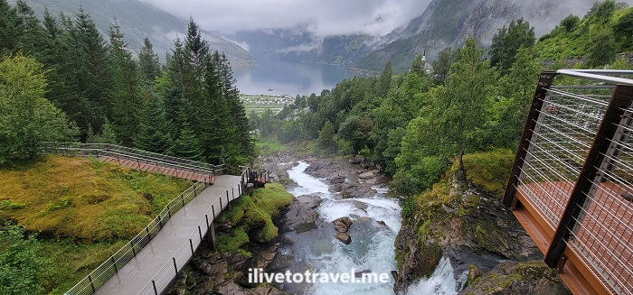
After a phenomenal and scenic ferry ride along the Geirangerfjord, I arrived in Geiranger. Our hotel was perched high up looking down to the town and the fjord – a perfect setting.

Geiranger, waterfall, geirangerfjord, hiking in norway, unesco world heritage site in norway
Looking down to the fjord

The visitor center for the waterfall trail (UNESCO World Heritage Site) is right across the street. One can do an easy walk along a metal sidewalk overhanging the terrain and see parts of the waterfall right there and up close, while also passing some local houses and viewing the end of the fjord straight ahead and down.

Geiranger, waterfall, geirangerfjord, hiking in norway, unesco world heritage site in norway

Waterfall hike in Geiranger

For those inclined for more of a hike, the hike to the Storseterfossen waterfall, can be started from right there. It is a 3.5 mile in-and-out up the side of a mountain. The trail can be covered with sheep droppings so that adds to the fun! It was not a perfectly maintained trail though I would learn throughout the next two weeks of my Norway hiking trip that that is standard.

Geiranger, waterfall, unesco heritage norway, world heritage, hiking in norway , Storsaeterfossen , geirangerfjord
Along the trail
Geiranger, waterfall, unesco heritage norway, world heritage, hiking in norway , Storsaeterfossen , geirangerfjord
Other paths along the way
Geiranger, waterfall, unesco heritage norway, world heritage, hiking in norway , Storsaeterfossen , geirangerfjord
Destination in sight!
Geiranger, waterfall, unesco heritage norway, world heritage, hiking in norway , Storseterfossen , geirangerfjord
They are watching you every step!
Geiranger, waterfall, unesco heritage norway, world heritage, hiking in norway , Storseterfossen , geirangerfjord
Storseterfossen

Anyway, hope this short post gave you a glimpse into Geiranger, made famous by the fjord but beautiful thanks to the waterfalls on the town. From here, we would we one day closer to start our great hike in Jotunheimen National Park!

Great Drives in Norway: Førde to Geiranger

I have so much to write about my trip to Norway! Finally completed my writing series about hiking in the Jotunheimen National Park. Now, time to turn to some of the other experiences from this trip. Here a glimpse into one of the coolest drives from the trip: heading from Førde to Geiranger.

Arriving in Førde and departing the next morning

Førde is a town of possibly around 11,000 folks. We arrived there after a 3.5-or-so hr drive from Bergen. We had landed from the US at a reasonable time after a very tight connection in Amsterdam (20 minutes!). Needless to say, our checked luggage did not run as fast as we did so then we had to sit at the Bergen airport waiting for the next inbound KLM flight 3 hrs later. Our start time was close to 4PM if memory serves me right. It was a relatively easy drive including a ferry ride at sunset.

Førde, Forde, Norway, Geiranger, Geirangerfjord, driving in norway, norsk, noruega
Top: Late afternoon on the ferry. Bottom: Sunset over Førde

In any case, we got to Førde around 9PM and headed straight to dinner as there were not that many options that were palatable after such a long day after a trans-Atlantic flight. We enjoyed some beverages at the bar at the Scandic hotel we stayed at and then said our good nights to get a fitful night of sleep.

The next morning, before setting out for Geiranger, we took a quick walk around town just to stretch our legs, breathe some fresh air, and wake up. Førde is a small but not-too-small town which made it a perfect stop for us.

Førde, Forde, Norway, Geiranger, Geirangerfjord, driving in norway, norsk, noruega
Around Førde

On the road to Geiranger

After fueling up, we hit the road. As the map below shows, it was to be a 4 hr drive or so. One must be aware that speed limits are much lower in Norway than back home so a certain distance will take longer there. And, do not be tempted to speed – the fines are huge!

The road is very scenic and the greens are so vibrant it does not feel real.

Førde, Forde, Norway, Geiranger, Geirangerfjord, driving in norway, norsk, noruega, nature in Norway

A ferry ride to experience along Geirangerfjord

The final hour of our drive would actually not be a drive but a ferry ride that would take us down the Geirangerfjord into Geiranger at the end of it. To get on this particular ferry on our route, we need to get to the small town of Hellesylt. Maybe it is less than a small town but it certainly was charming at the feet of an impressive cascade.

Førde, Forde, Norway, Geiranger, Geirangerfjord, driving in norway, norsk, noruega, nature in Norway, Hellesylt

This ferry not only offers transporting people and vehicles from one town to another, but also provides a very scenic tourist route. Along the edges of the fjord, one can spot abandoned farms and many tall waterfalls. Along the way, a recording provides some explanations in several languages. Though it can be cold and/or rainy, the best seat is upstairs and outside!

Førde, Forde, Norway, Geiranger, Geirangerfjord, driving in norway, norsk, noruega, nature in Norway, Hellesylt

At last, arrival at Geiranger!

Førde, Forde, Norway, Geiranger, Geirangerfjord, driving in norway, norsk, noruega, nature in Norway, Hellesylt
Top: Geiranger from the water Bottom: View towards the fjord from Gieranger

On the Appalachian Trail up to Blood Mountain

Living in Atlanta, I am blessed to be within 1.5-2.5 hrs of really phenomenal mountain hiking. While we have many nature trails within the city itself and around I-285 (our ring road), the majesty of the south Appalachians is within easy reach. And so was Blood Mountain.

This fall, I left home with a hiking buddy at 1:30PM and got started on the route around 3:30PM. We had picked starting on the Appalachian Trail’s Neels Gap as the route to climb Blood Mountain (4,458 ft in elevation). Blood Mountain is on the Appalachian Trail proper.

Blood Mountain, Appalachian trail, hiking in north Georgia, fall foliage, nature, hiking near Atlanta
The skies and the trees welcome us to north Georgia

Luckily for the avid hiker, there are several trails to go up Blood Mountain from either side: Neels Gap, Freedom Trail, Slaughter Creek. I had hiked it up via Freedom Trail a few years ago. However, we could not park at Neels Gap but a quarter of a mile away, there was another trailhead: Byron Reese Trail.

Headed up Blood Mountain via Byron Reese Trail

Byron Reese was about 0.7 mi away from connecting with the Appalachian Trail (and the entry point coming from Freedom Trail). From there up to the summit it would be about 1.6 mi each way by my estimation.

Blood Mountain, Appalachian trail, hiking in north Georgia, fall foliage, nature, hiking near Atlanta
The trailhead started with this – it bode well!

The trail up was moderate in terms of terrain with many roots, stones and rocks, and segments that were relatively smooth. The rocks often were purposefully laid steps. There were also larger masses of stone (granite perhaps?). Thankfully, though the larger masses of stone and the rocks were wet that day, they were not slippery (unless they had moss on them which not many did in October).

The white mark on the tree is specific to the Appalachian Trail
Blood Mountain, Appalachian trail, hiking in north Georgia, fall foliage, nature, hiking near Atlanta
Spectacular!
Blood Mountain, Appalachian trail, hiking in north Georgia, fall foliage, nature, hiking near Atlanta
We met a local

While the terrain was moderate to me as an experienced hiker, there was certainly enough inclines to be challenging enough for the short distance. It may be a harder trail for someone newer at hiking.

As one approaches the summit, there is an initial clearing offering a phenomenal view south to much lower mountains and hills. Clearly, Blood Mountain is higher than all visible terrain looking south.

Blood Mountain, Appalachian trail, hiking in north Georgia, fall foliage, nature, hiking near Atlanta
At the first clearing – better view that from the summit!

Atop Blood Mountain!

But, that is not the summit. The terrain is granite stone interspersed with vegetation. As one follows the trail, it becomes very narrow and surrounded by tall bushes. One wonders if one already summited. However, all of a sudden, you see the rear of the shelter available to Appalachian Trail hikers right at the summit.

Blood Mountain, Appalachian trail, hiking in north Georgia, fall foliage, nature, hiking near Atlanta, AT shelter
The shelter and my hiking buddy on Blood Mountain

Climb up the large rocks right by the shelter for more good views, though far from a 360 degree view.

Blood Mountain, Appalachian trail, hiking in north Georgia, fall foliage, nature, hiking near Atlanta
View from the summit
Blood Mountain, Appalachian trail, hiking in north Georgia, fall foliage, nature, hiking near Atlanta
At the summit’s top rock

We want down the same route we had gone up (vs. continuing on the Appalachian Trail down to Slaughter Creek. It started lightly raining on the way down and we even had small pellets of ice. It was a great wrap-up to a shorter (4.6 mi total) but awesome hike surrounded by the perfect scenery that fall provides at this time of year!

Blood Mountain, Appalachian trail, hiking in north Georgia, fall foliage, nature, hiking near Atlanta
Picture perfect colors from the summit

Day 6 in the Jotunheimen NP Circuit

Well, all good things come to an end and, so, is the final post about my 6-day hike in Jotunheimen National Park: from Memurubu to Gjendesheim.

Now, it is not my final hike in Norway for this trip but it wraps up exploring the beautiful and grandiose Jotunheimen. Jotunheimen is a park I had never heard of before until this trip entered the picture as a potential adventure. Grateful to my friend Troy for introducing me to this jewel of nature in Norway!

Should I stay or should I go?

On day 6 we were not only finishing the hike in Jotunheimen NP, but we were also going to leave the park altogether. We had an option to stay at Gjendesheim (again) that final day in the park but we had places to go! We were going to head to the Valdres valley and the small town of Røn. It did not make sense to get to Gjendesheim to spend a few hours and then drive a few hours the next day before our destination. We opted to make it to Gjendesheim and get on the road. It is not like Gjendesheim was Leirvassbu where I would not have minded an extra night! So the plans were to get to our car (in the long-term parking lot a mile from Gjendesheim) and hit the road.

But, first, let’s talk about leaving Memurubu

jotunheimen, ilivetotravel, trekking in norway, hiking i norge, norvege, senderismo en noruega, adventure
One last look towards the main building of Memurubu

We had planned to leave Memurubu and take the Bessegen route to Gjendesheim, not an easy route but well-known as an epic route. However, the weather forecast called for high winds that day at lake level. Bessegen was both higher up and more exposed to the edges (not quite cliffs) and a wind gust would be a life-endangering situation. So we decided to take the lower level route lake-side. It was maybe not as fun and interesting as Bessegen but, under those conditions, smarter.

jotunheimen, ilivetotravel, trekking in norway, hiking i norge, norvege, senderismo en noruega, adventure
The awesome marmalades at breakfast

A relatively easy trail…

… but the trail did not lack challenges though. Bessegen may be left for homework (i.e., a return trip) but the lake-side route was not just a nicely groomed trail. Nothing is at JNP! The cool thing about Bessegen is that you don’t have to do a circuit to do it as there are ferries to Memurubu so it can be just a day hike for those not wanting to do a longer circuit.

The trail initially had some elevation gain before the trail returned lakeside.

jotunheimen, ilivetotravel, trekking in norway, hiking i norge, norvege, senderismo en noruega, adventure, lake gjende
Elevation gave us one great last view of the lake
jotunheimen, ilivetotravel, trekking in norway, hiking i norge, norvege, senderismo en noruega, adventure

Then the trail went through forested areas and included water crossings and rock beaches before the final approach to Gjendesheim.

jotunheimen, ilivetotravel, trekking in norway, hiking i norge, norvege, senderismo en noruega, adventure

Overall, it was about 6.5 miles. We did it in 4 hours, including stops, the longest one in a rock beach where we had our lunch. By this point, of course, my legs were tired, my feet sore and my Achilles heels letting themselves be known. But, it didn’t really matter. The circuit we had just completed was worth every pain, every sore spot, every chain segment, every early wakeup, etc. Approaching Gjendesheim was a welcome sight but, also, bittersweet as it meant having new experiences around Jotunheimen was coming to an end. At least, on this trip…

jotunheimen, ilivetotravel, trekking in norway, hiking i norge, norvege, senderismo en noruega, adventure
Finished the Jotunheimen Loop!

Missed the start? Go to Day 1 (Gjendesheim to Glittertind)

Or, go back to the prior day: Day 5! (Gjendebu to Memurubu)

Day 5 in the Jotunheimen NP Circuit

The circuit hike is beginning to approach its conclusion on day 5. However, it is not a time to assume it will all be easy now! The Gjendebu to Memurubu hike on day 5 presented the most scary section of the six hikes I did at Jotunheimen.

The trail that day would be about 6.75 miles and about 2,400 ft elevation gain. It took us almost 5 hrs (durations cited include breaks taken).

It was our earliest departure to-date at 8:10 AM. The day was a little rainy as we departed Gjendebu, walking past the ferry pier (that could take you to Gjendesheim). We proceeded along a forest expecting fast elevation gain, which was true after maybe 1.25 miles, when we cleared the forest.

Jotunheimin, hiking in Norway, Lake Gjende, Gjendebu, Memurubu, norge, norvege, senderismo en noruega
Just cleared the forest and started to climb

As usual in Jotunheimen, rocks and water mix to become THE trail. These trails are not groomed, folks. Walk on them. Carefully.

Jotunheimin, hiking in Norway, Lake Gjende, Gjendebu, Memurubu, norge, norvege, senderismo en noruega

Neat views and narrow trails

The terrain was STEEP. The trail hugged the side of the ridge VERY tightly as the next two photos show. Of course, offering great views.

Jotunheimin, hiking in Norway, Lake Gjende, Gjendebu, Memurubu, norge, norvege, senderismo en noruega

Chain me up to leave Gjendebu

And, at some point high up, we hit 4 rock faces that required chains to go up. The first segment was the worst as it had no toehold/foothold to help support the body weight. It was pure arm strength to pull oneself (and the backpack) up to the next level. Mind you, behind me was a steep drop as the segment was very vertical so that added to the adrenaline… The next two segments offered some toeholds which certainly made it a tad easier.

Jotunheimin, hiking in Norway, Lake Gjende, Gjendebu, Memurubu, norge, norvege, senderismo en noruega, chain trail
Yep, that is straight down
Jotunheimin, hiking in Norway, Lake Gjende, Gjendebu, Memurubu, norge, norvege, senderismo en noruega, chain trail
On the 2nd or 3rd segment where there were footholds

However, I had no idea how many of these were ahead and of what kind so it was a little concerning not having trained for it. Thankfully, there were only four chain sections and the last one required chain to walk and not slip vs. needing to pull up.

Jotunheimin, hiking in Norway, Lake Gjende, Gjendebu, Memurubu, norge, norvege, senderismo en noruega, chain, technical climb
The 4th segment’s chain and terrain. That is a STRAIGHT drop right there!

A bit after the fourth section, I was able to exhale believing we were done with the chains – which we were! At the end of the day, looking back, it was fun to have faced this challenge and glad to know I was fit enough to do it. We reached the top of this massive climb around mile 2.1. The elevation gain in less than a mile had been about 1.500 ft.

And a nice, beautiful, kind trail…

After that, the terrain consisted of climbs and descents of moderate levels with some flat segments in between. We were sort of walking along a ridge, going up to the various high points of the ridge (sort of “summits”). They went on probably for 5 miles or a little less. The scenery was amazing – a great reward for the steep-and-scary elevation gain earlier on.

Jotunheimin, hiking in Norway, Lake Gjende, Gjendebu, Memurubu, norge, norvege, senderismo en noruega, chain, technical climb
Kind trail: flat, no water, almost rock-free
Jotunheimin, hiking in Norway, Lake Gjende, Gjendebu, Memurubu, norge, norvege, senderismo en noruega, chain, technical climb
Beautiful trail
Jotunheimin, hiking in Norway, Lake Gjende, Gjendebu, Memurubu, norge, norvege, senderismo en noruega, chain, technical climb
Kind and beautiful trail; almost forgot about the chains!
Jotunheimin, hiking in Norway, Lake Gjende, Gjendebu, Memurubu, norge, norvege, senderismo en noruega, chain, technical climb
Trail going up the ridge
Jotunheimin, hiking in Norway, Lake Gjende, Gjendebu, Memurubu, norge, norvege, senderismo en noruega, chain, technical climb
Two of the climbs along the ridge – not too bad!
Jotunheimin, hiking in Norway, Lake Gjende, Gjendebu, Memurubu, norge, norvege, senderismo en noruega, chain, technical climb
Just spectacular views!

… until the final, cruel descent to Memurubu

Before getting to the final summit on the ridge, we spotted our target: Memurubu turisthytte!

Jotunheimin, hiking in Norway, Lake Gjende, Gjendebu, Memurubu, norge, norvege, senderismo en noruega, chain, technical climb
The cabin is where the river meets the lake

But, before the descent, we had a quick stop for lunch. The ham and cheese sandwich with cucumber was a favorite of mine! It is worth noting that you prepare whatever sandwich you want for lunch at the breakfast service before you leave the lodge you spent the night at. So you get to make yourself 1 or 2 sandwiches of whatever you want.

Jotunheimin, hiking in Norway, Lake Gjende, Gjendebu, Memurubu, norge, norvege, senderismo en noruega, chain, technical climb
And the descent to Memurubu begins…

We hit the final summit (at around 4,200 ft above sea level) after lunch and proceeded to descend to Memurubu which we could see during the final bit of the ridge hike. The descent was very steep and with a lot of loose rocks. It was not pleasant terrain at all but the views continued to inspire – as well as seeing the end goal so within reach 🙂 And, compared with descents like from Glittertind, this was easy stuff!

At Memurubu to rest, eat and… rest!

We arrived in Memurubu around 1:40 PM and reception was not open yet. There were quite a number of people around but many were just waiting for the ferry to Gjendesheim.

There were quite a number of people but many were just waiting for the ferry to Gjendesheim.
You can see part of the downhill trail on the right. It looks deceptively kind!

We were assigned to a room in a building near the main lodge. We opted for a private bath at this lodge which was nice. The common areas of the lodge were very nice, spacious and you really felt you wanted to hang out.

There were quite a number of people but many were just waiting for the ferry to Gjendesheim.

We enjoyed a beer after showering and before dinner. OK, maybe more than one. It was happy time at Memurubu!

There were quite a number of people but many were just waiting for the ferry to Gjendesheim. Ringnes beer

Check out Day 4 (Leirvassbu to Gjendebu)

Or, read on to the final day: Day 6 (Memurubu to Gjendesheim!)

%d bloggers like this: