Raul
-
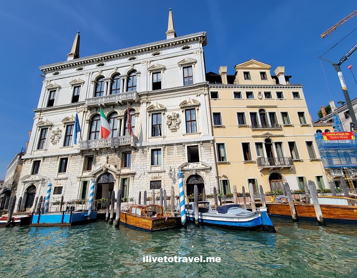
Venice’s Splendor Is Best Seen from Its Grand Canal
More Details: Venice’s Splendor Is Best Seen from Its Grand CanalVenice must be one of the most photographed cities in the world and the views from the Grand Canal, the wildly curvy main thoroughfare of the city, are likely the main object of such photos. In this “postcard” post, I will share Venice’s splendor from its great waterway. Many of the buildings along the way…
-
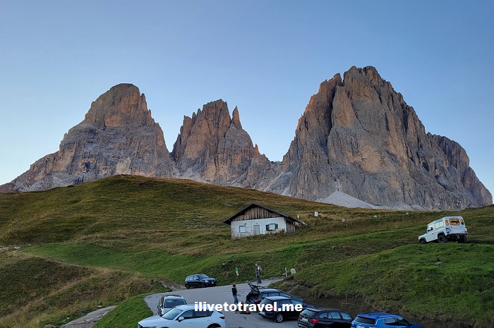
Hiking to the Sassolungo, an Impressive Massif in the Dolomites
More Details: Hiking to the Sassolungo, an Impressive Massif in the DolomitesOn day 2 of my hike in the Dolomites, we left the Rosengarten to reach the Sassolungo, an impressive massif in the western Dolomites. Mt. Sassolungo (also known as Langkofel in German, or Saslonch in the local language) is the tallest peak in the massif at around 10,400 ft (3,180 m). Mt. Sasso Piatto (Plattkofel…
-
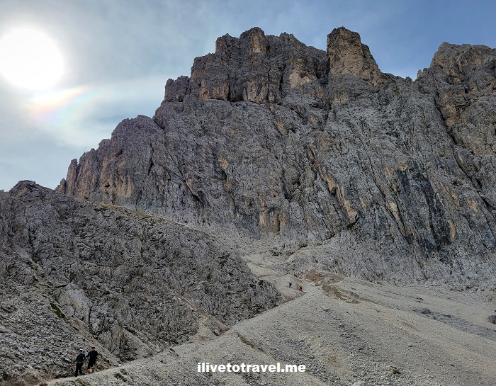
Challenge in the Dolomites: Hiking the Rosengarten
More Details: Challenge in the Dolomites: Hiking the RosengartenMy first day of hiking presented a neat challenge in the Dolomites taking us from Carezza / Karersee to Rifugio Passo Principe (Grasleitenpasshütte). There we would spend the night after traversing the iconic Rosengarten Massif, near Bolzano, Italy. The massif contains several peaks with its highest elevation being at 9,849 ft (3,002 m). The trek…
-
Around Belfast. Maine, That Is.
More Details: Around Belfast. Maine, That Is.A little over 30 miles from Bangor, lies the coastal town of Belfast, Maine on Penobscot Bay. It sits about midway on the Maine coast right on US route 1. With about 7,000 inhabitants, it is a small town but it is the seat of Waldo County. At the start of my trip to Maine…
-
Not Egypt’s Valley of the Kings but its Valley of the Whales: Wadi El-Hitan
More Details: Not Egypt’s Valley of the Kings but its Valley of the Whales: Wadi El-HitanHave you visited the Valley of the Kings near modern day Luxor in Egypt? Yes? Have you visited that “other” valley in Egypt? “What other valley?” you ask? Well, the Valley of the Whales, of course! AKA Wadi El-Hitan! Located about 100 miles southwest of Cairo near the town of Fayoum, you can easily visit…
-
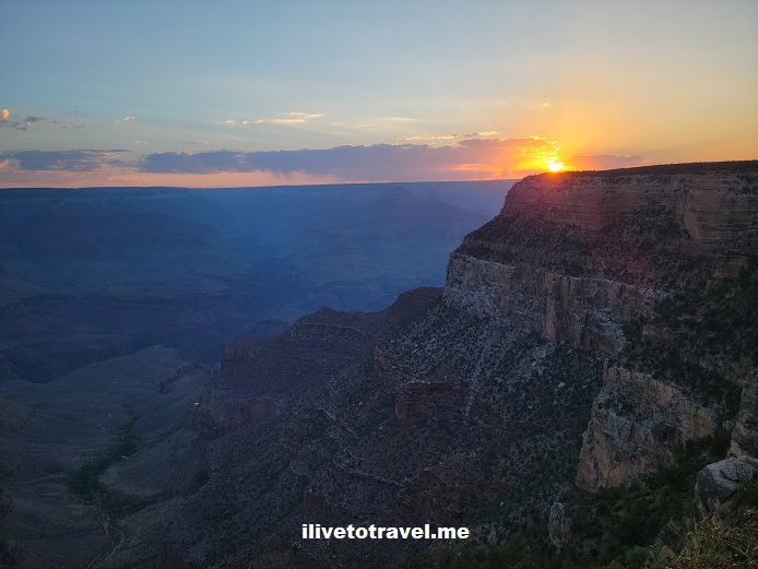
Cross-Country Drive Day 3 – From the Grand Canyon to Amarillo, Texas
More Details: Cross-Country Drive Day 3 – From the Grand Canyon to Amarillo, TexasA brief summary of day 3 of my cross-country drive: Grand Canyon to Amarillo, Texas, begins with the stats! Stats of the drive Third day: Grand Canyon National Park (GCNP) in Arizona to Amarillo, Texas Routes taken: Route 64 (south) to I-40 east, crossing New Mexico Departure time: 6:20AM (Pacific time in Arizona) Arrival time: 7:20PM (Central…
-
Cross-Country Drive Day 2 – Kingman to the Grand Canyon
More Details: Cross-Country Drive Day 2 – Kingman to the Grand CanyonCross-country drive starts in San Jose, California and crosses the southeastern part of the state including Barstow and hot Needles, California.
-
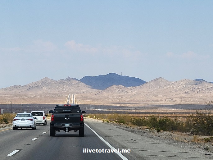
Cross-Country Drive Day 1 – San Jose, CA to Kingman, AZ
More Details: Cross-Country Drive Day 1 – San Jose, CA to Kingman, AZCross-country drive starts in San Jose, California and crosses the southeastern part of the state including Barstow and hot Needles, California.
-
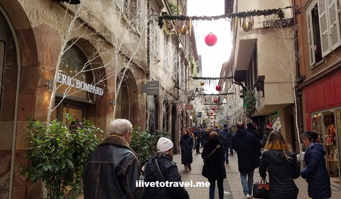
Christmas Time in Strasbourg – A Beautiful Sight
More Details: Christmas Time in Strasbourg – A Beautiful SightOne of Europe’s capitals is not the capital of a country. It is one of the capitals of a union that is not a country: the European Union. Strasbourg, currently sitting in France, is one of those capitals, along with Brussels. It sits sort of in the middle of France’s border with Germany, who formally…
-
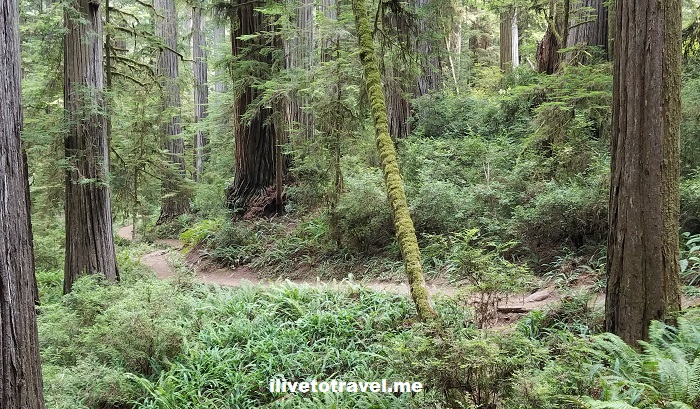
Guide for Seeing California’s Redwoods
More Details: Guide for Seeing California’s RedwoodsRedwoods are among the most impressive living organisms in this planet. And not only due to their height. They are certainly impressive as the tallest trees, growing upwards of 350 ft at their highest – think of that, like a 30+ storied building! But also due to how they grow, fuse, and survive fires. A…
-
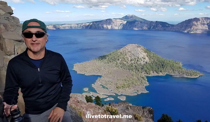
How to Explore Crater Lake National Park
More Details: How to Explore Crater Lake National ParkOregon is known for many great landscapes from its magnificent coast to the Cascade Mountains, to the Willamette Valley, to the Columbia River Gorge, etc. But one of its most spectacular sights has to be Crater Lake. Crater Lake, since 1902 part of Crater Lake National Park, serves as witness to the incredible story of…
-
11 Places to See on the Oregon Coast
More Details: 11 Places to See on the Oregon CoastThe Oregon coast stretches for over 360 miles (580 km) facing the mighty Pacific Ocean. To drive along the coast non-stop would take approximately seven hours on U.S. Route 101. Of course, stops are likely and recommended to plan well! We did the top third on one day, and the remaining on a second day.…