Raul
-
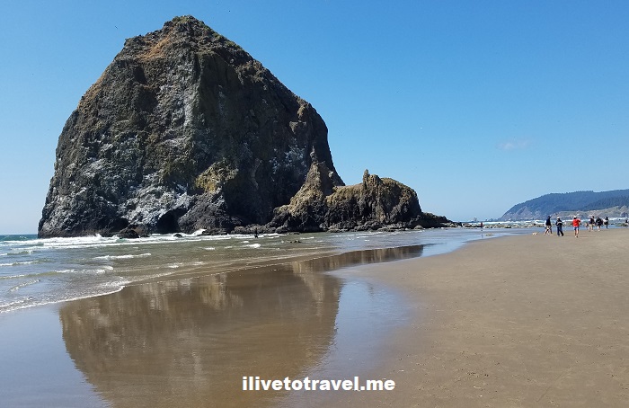
Postcard from Cannon Beach
More Details: Postcard from Cannon BeachCannon Beach, Oregon is a magnificent spot on the very northwest corner of Oregon. The town of less than 2,000 people hosts one of the most magnificent beaches in the Pacific Northwest. It is crowned by Haystack Rock (235 ft high) which is sort of the identifiable symbol of the beach. A long stroll looking…
-
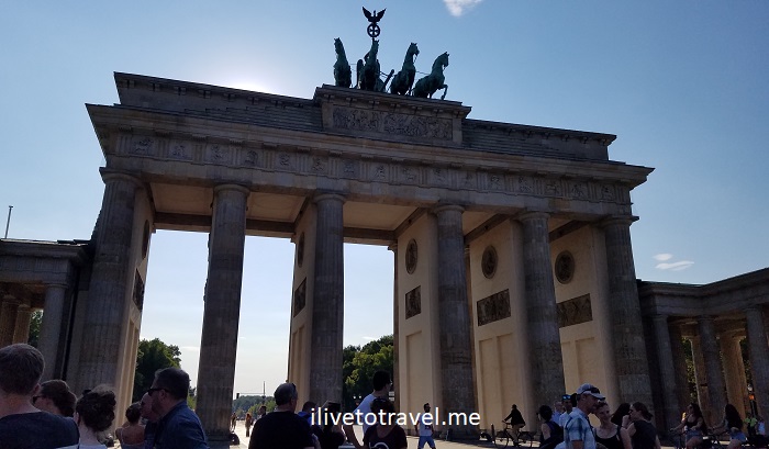
Some of My Favorite Spots in Berlin
More Details: Some of My Favorite Spots in BerlinMany times I write about my exploring right after I return home, when the memories are fresh and I first go through all the photos I took during my trip. Today, I thought I’d re-visit my days in Berlin less than a couple of years ago. The capital of reunited Germany is laden with history…
-
Hiking Arabia Mountain near Atlanta
More Details: Hiking Arabia Mountain near AtlantaJust when I think I have explored a good bit of hiking trails near Atlanta, last weekend a pleasant surprise awaited me: Arabia Mountain National Heritage Area. Right outside of Atlanta, right by the town of Lithonia is a series of trails that span a good bit, anchored by Arabia Mountain. If you have ever…
-
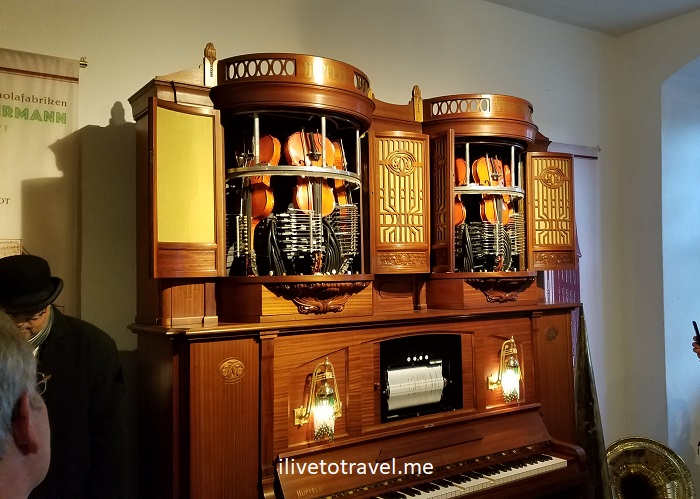
Cruising the Rhine – A Unique Music Cabinet Museum
More Details: Cruising the Rhine – A Unique Music Cabinet MuseumA gem in the Rhine River town of Rüdesheim, Germany: a music cabinet museum (music instrument machines) has over 300 pieces on display.
-
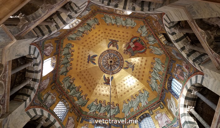
Aachen and its Imperial Cathedral
More Details: Aachen and its Imperial CathedralThe Cathedral of Aachen is something unique with its long history and beautifully set interiors (stained glass windows, mosaics, chandelier).
-
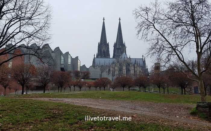
The Magnificent Cologne Cathedral
More Details: The Magnificent Cologne CathedralCologne boasts one of the most important cathedrals in Europe from many aspects: spiritual, architectural, and historical. Read more about these aspects and take a look at it during Christmas season.
-
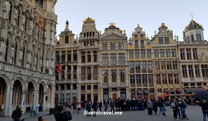
Post Card from the Grand Place in Brussels, Belgium
More Details: Post Card from the Grand Place in Brussels, BelgiumA quick look around Brussels’ main square, the Grand Place, home to many beautiful buildings.
-
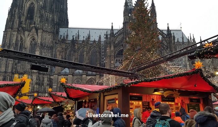
Experiencing Christmas Markets along the Rhine River
More Details: Experiencing Christmas Markets along the Rhine RiverTop tips to explore Christmas markets along the Rhine River
-
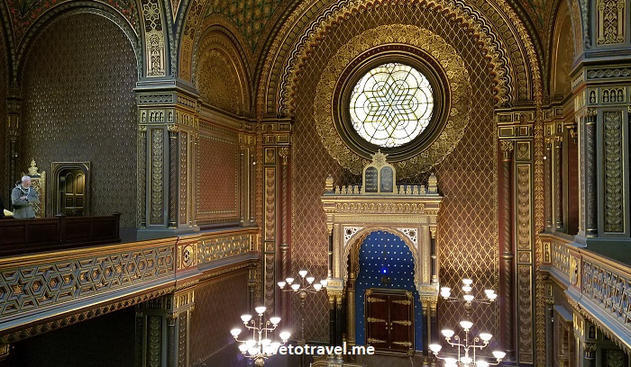
The Historic Jewish District of Prague
More Details: The Historic Jewish District of PraguePrague’s Jewish Quarter preserves the important history of the Jewish residents of Prague over the centuries. It is a unique place.
-
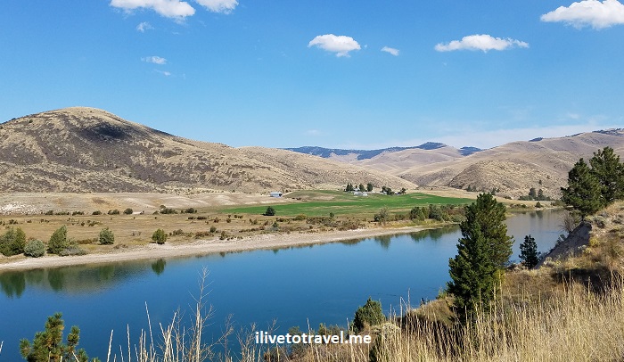
Great Drive Series – St. Ignatius to St. Regis, Montana
More Details: Great Drive Series – St. Ignatius to St. Regis, MontanaWhile exploring northwest Montana with a friend this past September, we tried to chart different routes as we covered a loop over a 4-day visit to the area. We started in and finished in Spokane but wanted to minimize taking the same route twice. We succeeded in that effort save for the stretch on the…
-
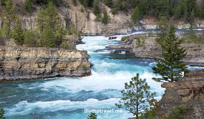
3 Places to See in the Remote Corners of Idaho and Montana
More Details: 3 Places to See in the Remote Corners of Idaho and MontanaUp in the panhandle of Idaho and the northwest corner of Montana, there is some spectacular, largely unspoiled scenery. I imagine not many get to see these lands as people focus on Coeur d’Alene, Big Sky or Glacier Mountain National Park. Well, it may make sense that they focus on those places but, if you have the…
-
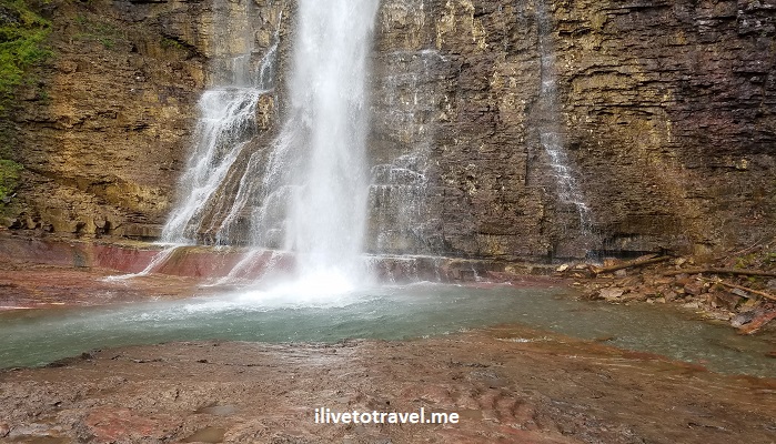
Glacier Mountain National Park: St. Mary and Virginia Falls
More Details: Glacier Mountain National Park: St. Mary and Virginia FallsGlacier Mountain National Park in Montana is known as the “Crown of the Continent.” And it is rightly so called: it is peaceful, magnificent, and elegant. One of the funnest hikes in the park is hiking to St. Mary Falls and Virginia Falls right by the edge of St. Mary Lake, one of the two main…