3 Places to See in the Remote Corners of Idaho and Montana

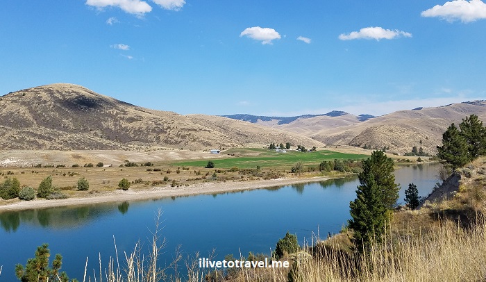
Up in the panhandle of Idaho and the northwest corner of Montana, there is some spectacular, largely unspoiled scenery.  I imagine not many get to see these lands as people focus on Coeur d’AleneBig Sky or Glacier Mountain National Park.  Well, it may make sense that they focus on those places but, if you have the chance, venture off-the-beaten-path.  I did just that simply on intuition, assuming/hoping that the remote corners of Idaho and Montana would deliver.  I was not disappointed.  Lake Pend Oreille, Ross Creek Cedar Trail and Kootenai Falls delivered!

#1 Before Montana: Idaho and Lake Pend Oreille

On my way to NW Montana, we drove north from Coeur d’Alene on route 95 through the town of Sandpoint to take Route 200 around Lake Pend Oreille.  Originally we had planned to go north past Sandpoint to Bonners Ferry and then take U.S. Highway 2.  However, the visitor center in Sandpoint recommended not continuing north on Route 95 but taking Route 200 instead to enjoy the scenic drive along the lake’s shore.   The exact quote was “I don’t why young punks insist of going north to Bonners Ferry”; I was flattered by the “young”…

In any event…  Lake Pend Oreille is the 5th deepest lake in the U.S. and the 38th/39th largest lake in the country.  Interestingly, it became the second largest naval training ground in the world during World War II after the attack on Pearl Harbor – who knew!

Lake Pend Oreille, Idaho's panhandle, map, great drive

Lake Pend Oreille looks like an ear – or a shrimp

The name of the lake means ear pendant in French which makes sense as it looks like an ear on the map.  However, it was named back when the shape was not as evident.  But, a likely explanation I read was that the Kalispeli residents of the area, whom the Canadian traders ran into, did wear ear pendants.

I don’t know what our original planned route would have been like but Route 200 around the lake was right on point. Lake Pend Oreille’s coastline is nice and curvy and there are plenty of pull-offs to stop and soak it all in.Lake Pend Oreille, Idaho, nature, great lakes, driving in the pacific northwestLake Pend Oreille, Idaho, nature, great lakes, driving in the pacific northwestLake Pend Oreille, Idaho, nature, great lakes, driving in the pacific northwest

We were also advised to try The Pantry bakery in Clark Fork where locals make delicious and fresh pastries (and one could pick up something for lunch too).  We did stop and enjoyed apple and cherry pies and bought this phenomenal chocolate pound cake that I enjoyed the rest of the trip!Clark Fork, Idaho, Pend Oreille, great drive in the pacific northwest

#2 Ross Creek Cedar Trail in Route 56

Once we left Clark Fork, the visitor center advisor had also suggested we take Route 56 on our way to get to U.S. Highway 2 as the Ross Creek Cedar Trail park was worth a stop and Route 56 was quite scenic.  Our plan all along had been to get to Hwy 2 (but by Bonners Ferry, if you recall…) to enter Montana so the recommendation would still allow us to do that, so we took it.  Some time after crossing into Montana from Idaho on Route 200, we found Route 56.Ross Creek Cedar Trail, hiking in Montana, exploring western Montana, massive cedar tree

Ross Creek Cedar Trail was a short (1 mile or so) walk through a grove of cedar trees.  The tree trunks were massively wide at their bases.  Some of the trees are 1,000 years old (I found it mindboggling but the forest service website says so!).  It was a nice way to stretch the legs on an easy trail and breathe clean, fresh air!  (Well, as long as you are not close to the vault toilets… what a situation!)Ross Creek Cedar Trail, hiking in Montana, exploring western Montana, massive cedar treeRoss Creek Cedar Trail, hiking in Montana, exploring western Montana, massive cedar tree Ross Creek Cedar Trail, hiking in Montana, exploring western Montana, massive cedar treeRoss Creek Cedar Trail, hiking in Montana, exploring western Montana, massive cedar tree

The drive out of the park along route 56 going north towards Troy was fun as it was not highly trafficked and the scenery quite enjoyable.  Driving north seeing the mountains ahead made for a memorable drive!

Ross Creek Cedar Trail, hiking in Montana, exploring western Montana, massive cedar tree

Heading out of the Ross Creek Cedar Trail park towards route 56

Ross Creek Cedar Trail, hiking in Montana, exploring western Montana, massive cedar tree

Views off route 56

Ross Creek Cedar Trail, hiking in Montana, exploring western Montana, massive cedar tree

Views off route 56

Kootenai River, route 56 in Montana, Kootenai Falls, US Highway 2 in Montana

Entering Kootenai River Country in route 56

#3 Kootenai Falls in Montana

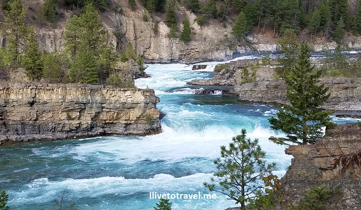
Soon, we reached Hwy 2 and and headed east to get to Kootenai Falls, about 4 miles away or so.  Easy to pull off the road into a parking area next to the trail-head.  It did not take long to see why this spot is so highly recommended as a must-see. The hike itself is not too strenuous but it is not a flat, smooth path.  But before you get there, you will have to go down a few flights of stairs in a large metal staircase that helps cross over the railroad line that goes through the area.

I will let the photos speak for themselves, just know that there are two paths:  one to the main part of the falls and the other to a swinging bridge that serves a a good vantage point to look at the falls.  Do cross the bridge as there is a good vantage point from there too.Kootenai Falls, northwest Montana, Off the beaten path Montana, natureKootenai Falls, northwest Montana, Off the beaten path Montana, natureKootenai Falls, northwest Montana, Off the beaten path Montana, natureKootenai Falls, northwest Montana, Off the beaten path Montana, nature

Kootenai Falls, northwest Montana, Off the beaten path Montana, nature

Some spectacular fishing spot!

Kootenai Falls, northwest Montana, Off the beaten path Montana, natureKootenai Falls, northwest Montana, Off the beaten path Montana, natureKootenai Falls, northwest Montana, Off the beaten path Montana, natureKootenai Falls, northwest Montana, Off the beaten path Montana, natureKootenai Falls, northwest Montana, Off the beaten path Montana, nature

Kootenai Falls, northwest Montana, Off the beaten path Montana, nature

Photo opps galore!

Kootenai Falls, northwest Montana, Off the beaten path Montana, nature

Check out the falls in motion!

Do you have other suggestions for exploring the remote corners of Idaho and Montana ??

Glacier Mountain National Park: St. Mary and Virginia Falls

Glacier Mountain National Park in Montana is known as the “Crown of the Continent.”  And it is rightly so called:  it is peaceful, magnificent, and elegant.  One of the funnest hikes in the park is hiking to St. Mary Falls and Virginia Falls right by the edge of St. Mary Lake, one of the two main lakes in the most visited part of the park.

St. Mary Lake is on the eastern side of the park, at the eastern end of the famous Going-to-the-Sun Road, by the small town of St. Mary.  GTTS Road, as it is colloquially known, is one of the absolute must-dos to enjoy the Glacier Mountain park’s majesty.  Driving along the lake going westward from the park’s main entrance is by itself an enjoyable experience.  As you drive west, the lake will be on your left with majestic mountains as the backdrop – which makes for many great photo opportunities.  There are numerous spots to pull off the road to admire the beauty and/or take pictures (don’t snap and drive!).  Depending on the time of day, the light will be different.  If you have the luxury of seeing it at different times of the day (especially early-early AM or late/late afternoon), do so!  I got to drive GTTS Road both in the mid/late-afternoon and in the early morning, and loved the difference sunrise vs. pre-sunset made in the scenery.

montana outdoors, st mary lake, sunset over a lake, GTTS road, GMNP, Glacier Mountain National Park

Looking west towards a mid-afternoon cloud-covered sky

Once we got to the western end of the lake (about 10 miles from the park entrance), we pulled in to the parking area to take us to St. Mary Falls.  This parking lot was between the St. Mary Falls shuttle stop and the Sunrift Gorge shuttle stop.  If you are taking the park’s red shuttle, you can start the hike from either of those stops as there are trailheads next to them.

Our plan was to hike 1.2 miles to get to St. Mary Falls (4,560 ft altitude).  Then we would go a little further (an additional 0.7 miles) to reach Virginia Falls which sits higher at around 4,800 ft.  If you are of average fitness, you are likely able to go all the way to Virginia Falls.  If you feel you can handle the climb, you will likely agree that it is worth going that much further and higher to see Virginia Falls.  In the end, it is not a long hike, really.montana outdoors, st mary lake, sunset over a lake, GTTS road, GMNP, Glacier Mountain National Park

While bears are in their natural habitat anywhere in the park, this particular trail is well-trodden by people so, hopefully, the noise of people talking keeps them from approaching the trail.  Just be on the lookout and carry your bear spray in a spot where you can quickly access it.  There is no better way to keep yourself safe than to be proactive in looking out for your safety!

Hiking to St. Mary Falls

Along the way you can admire mountains that rise upwards of 8,000 ft in altitude (on a trail where your max altitude is about 4,800 ft).  Pay attention to the signage as (from the parking lot we started from) there are a couple of junctions that could take you to different places.

montana outdoors, st mary lake, GTTS road, GMNP, Glacier Mountain National Park

One of the junctions

hiking trail, montana outdoors, st mary lake, GTTS road, GMNP, Glacier Mountain National Park hiking trail, montana outdoors, st mary lake, GTTS road, GMNP, Glacier Mountain National Park hiking trail, montana outdoors, st mary lake, GTTS road, GMNP, Glacier Mountain National Park

Once we were far enough along, all of a sudden we saw a river (St. Mary) and then heard the sound of the waterfall.

montana outdoors, st mary falls, GTTS road, GMNP, Glacier Mountain National Park

The bridge is the sign of the destination!

montana outdoors, st mary falls, GTTS road, GMNP, Glacier Mountain National Park

St Mary River downstream from the same-named falls

Pretty soon we saw the wooden bridge placed in front of the waterfalls and, as we turned a bend, got to the bridge so we could see the waterfalls.  The waterfalls has three levels though two of them are the most eye-catching of the trio.

montana outdoors, st mary falls, GTTS road, GMNP, Glacier Mountain National Park

St. Mary Falls

Hiking on to Virginia Falls

Once you are done enjoying St. Mary Falls continue the trail on the other side of the bridge.  The terrain gets a little more difficult to get to Virginia Falls.  We were excited to see a waterfall but realized that was not Virginia Falls. montana outdoors, st mary lake, GTTS road, GMNP, Glacier Mountain National Park, waterfall

The trail got steeper but, thankfully, the scenery made it all worth it.  I don’t think you have to be an athlete to do this hike as long as you are generally in good health.  Feel free to stop and snap photos – it gives you a little rest and there are definitely a couple of spots where one should step and just soak it all in.

hiking trail, montana outdoors, st mary lake, GTTS road, GMNP, Glacier Mountain National Park, ilivetotravel hiking

Can’t pass on snapping a photo in front of the beautiful landscape!

virginia falls, montana outdoors, st mary lake, sunset over a lake, GTTS road, GMNP, Glacier Mountain National Park virginia falls, montana outdoors, st mary lake, sunset over a lake, GTTS road, GMNP, Glacier Mountain National Park

The best spot to do that is actually the foot of Virginia Falls.  But wait.  You will see Virginia Falls from a vantage point where you can appreciate them from a distance.  But that’s not what I am calling the “foot” of the falls.

virginia falls, montana outdoors, st mary lake, sunset over a lake, GTTS road, GMNP, Glacier Mountain National Park

The first sighting of Virginia Falls

There is a view point a short distance up from that one.  It is worth dealing with the trail which, if it is wet, can be a tad slippery.

virginia falls, montana outdoors, st mary lake, sunset over a lake, GTTS road, GMNP, Glacier Mountain National Park

Keep on going!

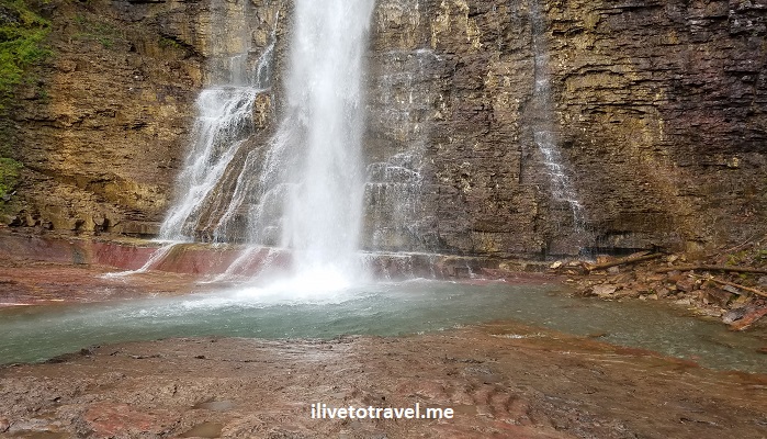
That view offers a flat rocky area with plenty of space to get close enough to the waterfalls – you can feel the spray on you.  It is much more impressive than St. Mary Falls partly for its size but also the setting of the spot.

virginia falls, montana outdoors, st mary lake, sunset over a lake, GTTS road, GMNP, Glacier Mountain National Park

Amazing!

virginia falls, montana outdoors, st mary lake, sunset over a lake, GTTS road, GMNP, Glacier Mountain National Park


What do you think???  Of the scenery, NOT of my video-ing skills!

This short hike (about 4 miles round trip) can be added to by visiting nearby Baring Falls which requires going almost all the way back and, at one of the aforementioned junctions, make a different turn (unless you park at Sun Point Nature Trail in which case you will pass Baring Falls on your way to St. Mary Falls).  After seeing St. Mary and Virginia Falls, we felt it was unlikely Baring would impress us.  I wish I had seen it just to know for sure but it was time to call it a day!

montana outdoors, st mary lake, sunset over a lake, GTTS road, GMNP, Glacier Mountain National Park

The reward after a nice hike is looking back west across St. Mary Lake as one follows GTTS Road

Exploring the former East Germany Off-the-Beaten-Path: Wismar

Most of us experience the former East Germany via a visit to Berlin.  I don’t know about most but, for me, most of my time in Germany has been either in Berlin, Munich or the western parts (Dusseldorf, Koblenz, Heidelberg, etc.).  This past summer, I got to venture elsewhere.  More precisely, northern Germany with focus on Hamburg (read here for top things to do there for free) and Lübeck.  It was while visiting the area around the latter that I happened upon an unexpectedly wonderful town:  Wismar, in the former East Germany, a coastal city by the Baltic Sea.  I was exploring off-the-beaten-path Germany.

Wismar, East Germany, DDR, Germany, platz, German squares

Main square

To say that it was a great find would not be inaccurate.  And it is a far cry from the experience of Berlin which, I am sure, is more of an outlier than the norm.  Visiting Wismar is definitely off-the-beaten-path Germany!Wismar, East Germany, DDR, Germany, Hanseatic architecture

Is Wismar the Jewel of the Baltic Sea?

I don’t claim to have explored the towns around the Baltic Sea to any great extent so I can’t say quite that.  But I can probably say it is likely one of the great “undiscovered” (by the North American travel audience, at least) destinations on the shores of the Baltic Sea. Wismar, East Germany, DDR, Germany, Hanseatic town, Hanseatic architecture

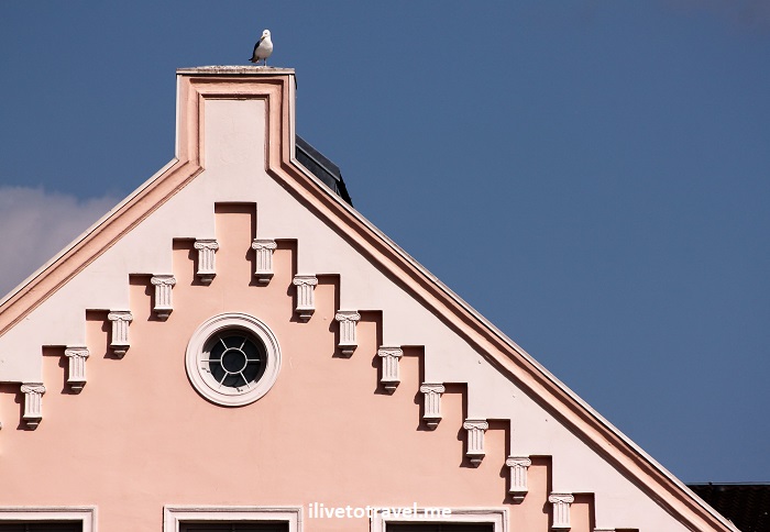
I have to be frank:  I had not heard of it at all before I landed in Germany for this trip.  Only upon looking for a half a day trip to take from our base near Lübeck did I discover Wismar.  I will let you decide from the photos what you think but know that Wismar is a UNESCO World Heritage Site since 2002.  But look at the architectural details of the town’s buildings!Wismar, East Germany, DDR, Germany, Hanseatic town architecture, architectural details Wismar, East Germany, DDR, Germany, Hanseatic town architecture, architectural details Wismar, East Germany, DDR, Germany, Hanseatic town architecture, architectural details Wismar, East Germany, DDR, Germany, Hanseatic town architecture, architectural details Wismar, East Germany, DDR, Germany, Hanseatic town architecture, architectural details

A long history

Wismar was one of the Hanseatic League towns that dotted the coasts of northern Europe / Scandinavia.  Its origins can be traced to the 1100s.  I was surprised to learn that Wismar became part of Germany only as recently as 1871 and that Sweden only renounced its claim to it in 1903!  Today, it claims about 42,000 inhabitants and it seems in the process of being re-born from and getting past the era of Communism.

A town re-born out of the ashes of communism

For a visitor, Wismar is a manageable town, easy to drive around, easy to walk around.  Not hard to orient oneself from its main square where there is still a surface parking lot.  It has a good amount of medieval architecture for a country where WW II destroyed many, many old buildings.  And the town has been spruced up significantly since East Germany got rid of its Communist regime and the shackles it imposed.  Wismar is colorful and feels alive!

It was interesting to learn that some key renovations / repairs from the WW II damage had to wait until the early 1990s to start.  Almost 50 years of ruin – unbelievable how much neglect of the human soul and history Communism brought.

Wismar, East Germany, DDR, Germany, platz, German squares

Restoration of old buildings still going on

Out of the ruins of WW II – churches in Wismar

St. Mary’s (St. Marien) is a key example of the ruins from WW II. Marienkirche, St. Mary, German churches, Wismar, churches in the former East Germany, DDR, travel, religion

The nave was severely damaged and it was not brought down until 1960.  The bell tower survived (it probably had some repairs) but the nave was not re-constructed by design.  That space, instead, serves now as a memorial to what was and what happened.  Powerful.

Marienkirche, St. Mary, German churches, Wismar, churches in the former East Germany, DDR, travel, religion

The bell tower from 2 sides

Marienkirche, St. Mary, German churches, Wismar, churches in the former East Germany, DDR, travel, religion

Looking at the tower/facade from what would have been the inside of the church

Marienkirche, St. Mary, German churches, Wismar, churches in the former East Germany, DDR, travel, religion

The bases of the columns

Nearby St. George’s survived structurally but, with repairs carried out ONLY once Communism fell (40+ yrs later!), it has been re-opened but not as a church but as a museum.  Georgenkirche, St. George Church, Wismar, Germany, DDR, kirche, church, St. Georgen KircheGeorgenkirche, St. George Church, Wismar, Germany, DDR, kirche, church, St. Georgen KircheGeorgenkirche, St. George Church, Wismar, Germany, DDR, kirche, church, St. Georgen Kirche

Georgenkirche, St. George Church, Wismar, Germany, DDR, kirche, church, St. Georgen Kirche

How the church was (unrestored still) in 1990…

The best part of visiting St. George is to go up its bell tower.  It has an elevator so it is accessible to all. The platform on the bell tower provides a great view of the town around it (not quite 360 degrees, unfortunately, but good enough).Georgenkirche, St. George Church, Wismar, Germany, DDR, kirche, church, St. Georgen Kirche Georgenkirche, St. George Church, Wismar, Germany, DDR, kirche, church, St. Georgen Kirche Georgenkirche, St. George Church, Wismar, Germany, DDR, kirche, church, St. Georgen Kirche

While our time in Wismar was short, it opened my eyes on what was possible to explore in the Baltic coast of Germany, and especially its eastern part.  So much to learn and see (and to eat) in off-the-beaten-path Germany!

salmon, German potato cakes, German food, comida alemana, Wismar, Germany

This was an amazing lunch and a nice break from sightseeing!

Wismar, East Germany, DDR, Germany, Hanseatic town architecture, architectural details

Beautiful image to close out this post on this charming Baltic town!


Save this image to your travel pin board!

4 Tips to Visit the Charles Bridge in Prague

The Charles Bridge in Prague deserves every bit of fame it gets for gracing and connecting Prague – a quite unique town itself.  The Charles Bridge spans the Vltava River (not the Danube!) and provides ample photo opportunities for selfie-crazed tourists or normal tourists!  I got to check it out or walk on it to get places and want to share four tips to visit the Charles Bridge as an excuse to showcase my photos 🙂

A little history of the Charles Bridge in Prague

Construction of the bridge began in the 1300s to replace a prior one and it was finished in 1402.  Now THAT is an old bridge!  The King that ordered its construction was Charles, hence the name of the bridge, though that name is a relatively recent name actually.  For hundreds of years, it was the only way to cross the river other than a boat.

Prague, Praga, Praha, Charles Bridge, Czechia, Czech, travel

Old relief carving of the city shows the bridge already crowded!

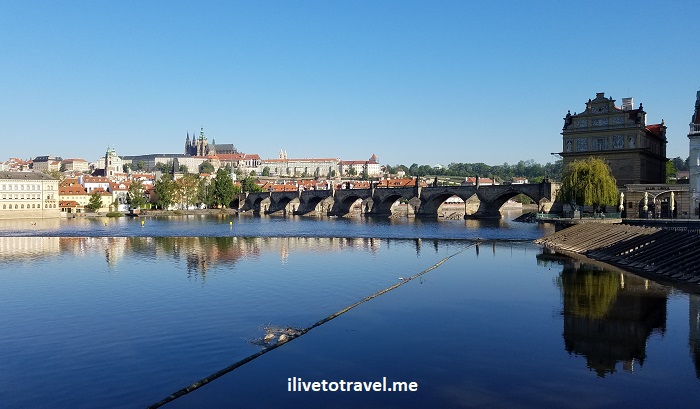
The bridge is about 600m long and has 16 arches holding it up.  It was cool to see the ice breaking structures protecting the pillars though I did not see them “in action” as I went in the spring.

Tips to visit the Charges Bridge – #1 – the statues

My first tip is to not just look at the statues that grace either side of the bridge and snap a photo, but to read about them as you look at them.  They are mainly not the original statues but replicas.  Now, there are many (perhaps around 32?) so maybe you will not have time or attention span to do that with all of them (I didn’t!) but there is a lot of meaning and stories behind the people.  These statues were placed there to convey stories or values, memorialize individuals, and perhaps to add grace to the bridge.  Mind them!

Prague, Praga, Praha, Charles Bridge, Czechia, Czech, travel

One of the many statues on the bridge!

While the statues are the dominant “decoration” of the bridge, there are a few plaques or carvings worth noting (and reading of in advance!).

Prague, Praga, Praha, Charles Bridge, Czechia, Czech, travel, John Nepomuceno

Carvingn depicting St. John Nepomuk being thrown off the bridge under orders of King Wenceslas

Tips to visit the Charges Bridge – #2 – the light and time of day

OK, my next tip is that there are many angles for a good photo but which angle is best varies with the time of day as the sun changes position in the sky.  I recommend going at different times throughout the day so you can face the sun as you take that priceless group photo or selfie with different sides of the city behind you.  And that includes nighttime!

Prague, Praga, Praha, Charles Bridge, Czechia, Czech, travel, tips to visit the Charles Bridge

Early in the morning – beautiful angle

Prague, Praga, Praha, Charles Bridge, Czechia, Czech, travel, tips to visit the Charles Bridge

Night time looking towards Prague Castle

Tips to visit the Charges Bridge – #3 – the underside

Of course, people spend the time during the visit ON the bridge.  But, I ventured a little bit on the Prague Castle side of the bridge in the residential area BELOW the bridge.  It was charming (and quiet at that early time of the day).  I wonder how the residents cope with the hordes of us tourists all over the area during the day…  In any case, you will find the entrance to staircases to take you down right on the bridge, or you can enter the area near the tower on the Prague Castle end of it.  Get off the bridge and explore its “underside”!

Prague, Praga, Praha, Charles Bridge, Czechia, Czech, travel

Right under the bridge

Prague, Praga, Praha, Charles Bridge, Czechia, Czech, travel

Around the small neighborhood under the bridge

Prague, Praga, Praha, Charles Bridge, Czechia, Czech, travel, tips to visit the Charles Bridge

And you never know when you will spot wedding photo sessions!

Prague, Praga, Praha, Charles Bridge, Czechia, Czech, travel, NYFD memorial

Memorial to the 911 NYC firemen who died – unexpected find!

Tips to visit the Charges Bridge – #4 – when to spend time there

My top tip for visiting the Charles Bridge is to go early in the morning, before the city gets crowded with locals and tourists.  I am an early riser and while the rest of my group woke up and got ready, since we were staying a block away from the bridge, I went for a walk and almost had the bridge all to myself!

Prague, Praga, Praha, Charles Bridge, Czechia, Czech, travel

The same shot in the afternoon would look very different as the sun would light the photo differently

————————————————————————————————————

Hope these tips to visit the Charles Bridge in Prague are helpful.  Enjoy checking out the Charles Bridge – and Prague!

Pin this image to your travel board!

Prague, Praga, Praha, Charles Bridge, Czechia, Czech, travel

Serbia’s Novi Sad and Its Petrovaradin Fortress

As part of my short visit to Serbia, I wanted to check out the town of Novi Sad, not far from Belgrade.  I combined it with exploring Fruska Gora and its vicinity.  I went in a small guided tour which, unfortunately, mainly gave us free time in Novi Sad; i.e., not much in terms of a guided tour there.  But it did spend time at the Petrovaradin Fortress and covered it pretty well.

I have to admit not knowing much about Novi Sad before planning my trip and had never heard about the fortress at all.  But that’s why I travel:  to learn of the things that have not crossed my path before and then to get to see them in person!  A lot of the learning happens while researching potential destinations and then when the planning begins:  studying the destination to allocate my time there to those things that catch my eye the most, be it a high point (in Lübeck, Germany), a unique sight (the DMZ in Korea), a historic building (the monstrous Parliament in Bucharest), or just food (in Rome’s Testaccio neighborhood)!

Petrovaradin Fortress

The Petrovaradin Fortress sits high along the banks of the Danube River facing the center of Novi Sad.  Its unique vantage point provides great views of the river, the bridges crossing it, the main part of the city, and the surroundings of the fort itself.  The site seems to have hosted human settlement and early fortifications from before the times when Romans established themselves there.  Petrovaradin was a key battleground in the Hapsburg Empire (Austria) pushing back the Ottoman Empire one final time away from being a threat to Central Europe.  Its fortress’ buildings and walls have been built, maintained, enhanced, etc. over the centuries.

Petrovaradinska tvrđava, Danube River, Donau

Entrance to the fort

Petrovaradinska tvrđava, Danube River, Donau

Walking along the uppermost walls facing the Danube

Petrovaradinska tvrđava, Danube River, Donau

One can explore the fortress and its massive walls by walking around

A curiosity of the fortress is the clock tower.  It was built with the hour hand being longer than the minute hand, contrary to most clocks that are not digital 🙂

Petrovaradinska tvrđava, Danube River, Donau

Clock tower; it was around 12:45PM

Supposedly Petrovaradin has miles of anti-mine tunnels underneath but we did not get to see them; perhaps they are in disrepair and not safe?  Petrovaradin was more than just a fortress.  It was a fortified area with exterior walls protecting an area with many buildings.  In any case, the site was impressive to me for two main reasons:  the scale of the fortifications that one can see and the great location up high so one can soak in Novi Sad and the Danube River.

Petrovaradinska tvrđava, Danube River, Donau

View towards the city center of Novi Sad

Novi Sad, Serbia, Srbija, Petrovaradin Fortress, Петроварадинска тврђава, Petrovaradinska tvrđava

Area right below the viewing area is part of the fortified area

Petrovaradinska tvrđava

Modern road crossing the “moat” and going through massive walls

Petrovaradinska tvrđava

Fortifications facing the Danube River

Novi Sad’s city center

Novi Sad is Serbia’s second largest city with about a quarter million inhabitants – nice size:  not too big, not too small!  It resides in the Vojvodina autonomous province and serves as its capital.  The city actually does not pre-date the Petrovaradin Fortress but the other way around.  As cities go in this part of the world, it is ONLY slightly over 300 years old.  A baby by European standards but ancient by U.S. standards!!

Novi Sad, Serbia, Srbija, Central Europe, architecture, modern, travel

Bishop’s Palace from 1901 – interesting mix of styles

Novi Sad, Serbia, Srbija, Central Europe, architecture, modern, travel

St. George’s Orthodox Cathedral

Novi Sad suffered a lot of damage in shelling that took place in the mid 19-century.  The main square and neighboring streets, though, contain many charming buildings with architecture that I associate with 19th century Central Europe.  I wish I had had more time to walk further out than I did.

Novi Sad, Serbia, Srbija, Central Europe, architecture, modern, travel

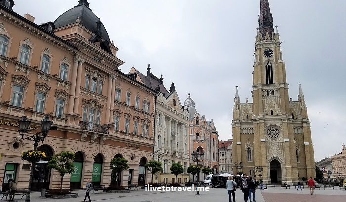
The Name of Mary Catholic Church

Novi Sad, Serbia, Srbija, Central Europe, architecture, modern, travel

Other angle on the church and nearby buildings on the square

Novi Sad, Serbia, Srbija, Central Europe, architecture, modern, travel

Roof of the Church of the Holy Name of Mary

While there are beautiful buildings from back when, one can also spot some post-WW II modern buildings here and there in the city center, with more of them to be found as one moves out, I am sure.

Novi Sad, Serbia, Srbija, Central Europe, architecture, modern, travel

Great contrast of old and new

Novi Sad, Serbia, Srbija, Central Europe, architecture, modern, travel

Old and new again but the new is less so than the prior photo…

As I ventured outwards from the main square, I spotted what I am guessing is the bar/party street of the city center.  But, it was around lunchtime so no parties going on!

Novi Sad, Serbia, Srbija, Central Europe, architecture, modern, travel

Party street!

Novi Sad, Serbia, Srbija, Central Europe, architecture, modern, travel

I enjoyed strolling down the pedestrian streets filled with shops and cafés, while looking at the neat buildings all around. While this was just a short visit to get a mental image of Novi Sad, it looks like a relaxed town to spend time at.  Perhaps I will get to visit it again some day!

Novi Sad, Serbia, Srbija, Central Europe, architecture, modern, travel

The Hotel Vojvodina in the main square

Novi Sad, Serbia, Srbija, Central Europe, architecture, modern, travel

A building near the main square

Novi Sad, Serbia, Srbija, Central Europe, architecture, modern, travel

City Hall on the left built in 1894


Check out what cool places to see in Belgrade!


Fruska Gora: An Easy and Rewarding Day Trip from Belgrade

The Fruska Gora (Fruška Gora, Фрушка гора) mountain gives the name to the national park in Serbia around which many monasteries, charming towns, and vineyards can be found, just an hour or less away from Serbia’s capital, Belgrade, and much closer to Serbia’s second town, Novi Sad.  The Fruska Gora National Park runs east to west, almost or barely spilling into neighboring Croatia.  While we drove through parts of it, we did not explore it but, instead, checked out some of the places right outside its borders.

Driving in the area, on my way to Novi Sad from Belgrade (and now, while looking at my photos) makes me wish I could have spent a week just exploring every corner of this area in north Serbia bordering eastern Croatia and southern Hungary.  Such natural beauty, such complicated history, and so easy to explore!

On my recent trip to Serbia, I was based in Belgrade where I enjoyed sightseeing.  I have learned that in many Central and Eastern European countries, the country’s second largest city tends to be more charming and relaxed than the capital cities (Poland/Krakow, Bulgaria/Plovdiv, Romania/Brasov, etc.) so I booked a day trip to Novi Sad.  However, the one I decided upon would show me a glimpse of the area in and around the Fruška Gora National Park which I thought would add to my exploring by seeing something beyond two cities.

It was a good decision.  First off, we visited the Krusedol Monastery, and then we visited the colorful town of Sremski Karlovci where -bonus- I got to sample the local Bermet wine!  Win, win, and triple win!

Krusedol (Krušedol) Monastery

Serbia is known for the monasteries that grace its land.  Many were built in the Middle Ages and have seen the sweeps of history cross this country placed in a unique geographical crossroads (some, in fact, did not survive those “sweeps”).  From what I have read, the monasteries are quite diverse in their design and location (cliff face, valleys, etc.).  This page in the Serbia.com website shows a few images that convey this diversity.  In our visit, we stopped at what I would assume is a more conventional monastery near the Fruska Gora National Park:  Krusedol Monastery.  (Other day trips from Belgrade are available to explore other monasteries too.)

Krusedol was built between 1509-1514 and is dedicated to the Annunciation of the Virgin Mary.  It peaked at 90 monks in the late 17th century and has been damaged and ransacked across the centuries so many treasures, relics, etc. from the older times are gone.  Later reconstructions of the church changed its initial architecture some, creating a blended style.

Krusedol Monastery, church, Serbian Orthodox, Srbija, Serbia, Belgrade day trip, travel

Church and inner courtyard

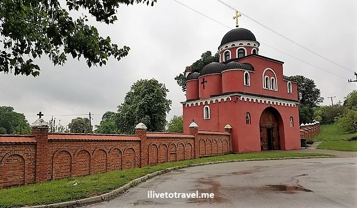
The monastery first greets you with a large red gate in the shape of a church and red walls.  To the left you can notice a cemetery on an uphill and you can perhaps see a family picnicking on its grounds with a cake and other food items to remember a lost one.

Krusedol Monastery, church, Serbian Orthodox, Srbija, Serbia, Belgrade day trip, travel

The main gate

Krusedol Monastery, church, Serbian Orthodox, Srbija, Serbia, Belgrade day trip, travel

Door of the main gate

Krusedol Monastery, church, Serbian Orthodox, Srbija, Serbia, Belgrade day trip, travel

Perimeter wall by the main gate, notice the cemetery on top of the hill

As you enter the gate a treed field greets you as you make your way to the main compound.  You can see some quarters and stables straight ahead as you walk, and then you make a turn towards the church and main compound.

Krusedol Monastery, church, Serbian Orthodox, Srbija, Serbia, Belgrade day trip, travel

The area between the main gate and the monastery’s compound

Krusedol Monastery, church, Serbian Orthodox, Srbija, Serbia, Belgrade day trip, travel

Approaching the main compound. Note the old well on the left.

Inside the church, there are icons dating back to the 17th century though the frescoes, I understand, may be more recent or recently touched up.  It is an understated place of worship, meaning it is not grandiose but still inspiring.

Krusedol Monastery, church, Serbian Orthodox, Srbija, Serbia, Belgrade day trip, travel

Entrance to the church

Krusedol Monastery, church, Serbian Orthodox, Srbija, Serbia, Belgrade day trip, travel, Serbian fresco

Remnants of the fresco above the door (no photos allowed inside)

I recommend a visit to either this or other monasteries to get a sense of the important role these places had for centuries, much as they did in other places (see my visit to Moldova‘s monasteries here).

Sremski Karlovci

Near Novi Sad sits the small town of Sremski Karlovci, a charming and historically important town of about 9,000 in Serbia’s northern Vojvodina province.  The town is right outside the Fruska Gora National Park along the shores of the Danube River.  The town makes for a convenient stop when going to or coming back from visiting Novi Sad.  Combined with the monastery visit, it is a great day trip from Belgrade though I would personally rather spend a few days exploring the Vojvodina province which offers a lot more.  It was a weekend day when I visited and people were out and about.  Though there was a little rain, it still felt that the place was alive (vs. some other towns I have visited that seem completely devoid of people on a weekend day!).

The town, as many places in this part of Europe, went back and forth between different rulers.  Some of the most important ones were Hapsburg Austria and the Ottoman Empire.  Sremski Karlovci served as the meeting point when an important peace treaty was agreed to by both sides at the end of the 17th century.  The town, in general, served as an important center of Serbia’s political, cultural, and spiritual life during the Austrian rule.  The town boasts Serbia’s first secondary school and its first seminary.  The secondary school or “gymnasium” is really colorful – architectural eye-candy.

Karlovci Gymnasium, Sremski Karlovci high school, Serbian architecture

Karlovci Gymnasium (high school)

Other cool buildings include the Patriarchate (where the Serbian Orthodox Church leader -or Patriarch- used to reside, built at the end of the 19th century), the City Hall (built around 1810), and random buildings in various states of restoration / health!

Patriarchate Court, Sremski Karlovci, Vojvodina, architecture, Serbian Orthodox Church

Patriarchate Court

City Hall, Sremski Karlovci, Vojvodina, neoclassic Serbian architecture, Srbija, Serbia

City Hall

old buildings in Serbia, Sremski Karlovci, Vojvodina, Srbija, Serbia architecture

Notice the roof lines, especially on the rightmost structure!

I found it really cool that the Serbian Orthodox Church of St. Nicholas and the Roman Catholic Church of the Holy Trinity in the town’s center sit next to each other.  I like the symbolism…

St, Nicholas, St. Nikolaj, Serbian Orthodox Church, Sremski Karlovci, Vojvodina

St. Nicholas Serbian Orthodox Church

St, Nicholas, St. Nikolaj, Serbian Orthodox Church, Sremski Karlovci, Vojvodina

Interior of St. Nicholas Church during a service

Holy Trinity Church, Catholic Church in Serbia, Sremski Karlovci, Vojvodina

The Holy Trinity Catholic Church

The Four Lions fountain sits in front of the Catholic Church and, allegedly, if you drink its waters, you will come back to town and get married.  I didn’t test the premise…

Four Lions fountain, Sremski Karlovci, Vojvodina, Srbija, Serbia

The Four Lions fountain

Many other beautiful buildings border the center of town (not quite a “square”) and they hold important spots in Serbian history.  It is a nice town to walk around and enjoy the architecture, the charm, and the happenstance of small town life.

Four Lions fountain, Sremski Karlovci, Vojvodina, Srbija, Serbia

A dog’s rough life by the fountain!

Fruska Gora’s Bermet wine

After some of that wandering, a stop at a local winery is a good idea.  The one we visited did not take walk-ins so be sure to make an appointment ahead of time. The winery itself was in a cool (temperature and ambience!) setting and had some nice old artifacts.

Bermet wine, Sremski Karlovci winery, Serbian wine, dessert wine from Serbia

Tunnels where the wine is stored

Bermet wine, Sremski Karlovci winery, Serbian wine, dessert wine from Serbia

Public area at the winery

We sampled the local specialty wine of Bermet, supposed to be the favorite dessert wine of European courts.  It originates from the Fruska Gora region of the Vojvodina and I not only sampled, but took a bottle with me to share with my family when I met up with them the next day in Prague!

Bermet wine, Sremski Karlovci winery, Serbian wine, dessert wine from Serbia, Fruska Gora

Nice stuff!

Bermet wine, Sremski Karlovci winery, Serbian wine, dessert wine from Serbia, Fruska Gora

It was superb! Živeli !

How to Handle Money when Traveling: Multiple Currencies

Managing money when traveling may not be the sexiest travel topic as it does not involve recounting places seen, accidental cool discoveries, or the most delicious dessert eaten.  However, it deals with a topic that many new travelers wonder about.  And not just only new travelers.  I have traveled quite a bit and my recent trip to Europe certainly made me stop and think on a strategy for all this.

Why?  If you have visited or will be visiting a region with multiple currencies, you will get what I had to deal with.  Here is my deal:  I was visiting 5 countries using 4 different currencies and spending only about 2-3 days in most of them.  I had to figure out a strategy.

Serbia had the dinar.  The Czech Republic had the koruna.  Austria and Slovakia used the euro.  Hungary had its forints.  That presented a challenge on what to do to not end up with a lot of unused local currency to either bring home or exchange back into my currency at some brutal exchange rate (where I would be on the losing end of brutal).  I am not one to just throw away good money!

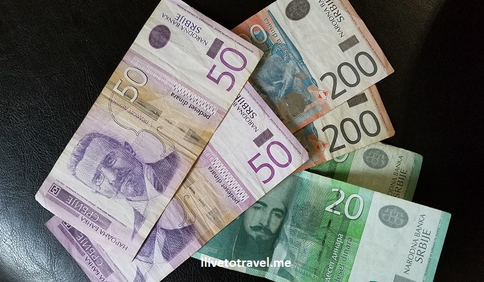
Serbia, currency, dinars, paper bills, Money when Traveling, multiple currencies

Serbian dinars

Should one get foreign currency before leaving for the trip?

Before we get to my strategy.  Let’s talk about this which is important even if just needing one foreign currency…

Some folks like to be prepared and get currency for the countries they are visiting before they leave home.  That can be out of a sense of being well-prepared or because they are nervous about arriving somewhere without local currency.  I get those two concerns.  Or, it could be that they are fearful of using ATMs in another country.

I don’t exchange money in my home country before my trip for several reasons.  Firstly, one is charged more than one should spend doing it this way.  Not to mention that some of the currencies you may need (think Serbian dinar) may not even be available in one’s home country.

Secondly, I am not worried about using ATMs in another country as, in my experience, they are no less safe than ATMs in my own country.  Perhaps 20 years ago the concern was more valid (though I have been using ATMs internationally since the networks’ connectivity became available sometime in the 1990s), but in today’s globalized world and in regions like East Asia, Australia/New Zealand, South America or Europe there should be no concerns.

Thirdly, it is easy enough to get local currency upon arrival at another country especially when arriving via an international airport or major train station.

korunas, euros, currency, paper bill, coin, Money when Traveling, multiple currencies

Czech and EU money

So how to get local currency in a foreign country?

Usually, there are ATM machines in most airports in the regions I mentioned.  However, there are two ATM types:  the ones affiliated with banks and the ones independent of those banks and just associated with some random network that costs more to use than using a regular local bank’s ATM.  I don’t want to name names here but if the most prominent label on the ATM has the word “net” in it, I would be suspicious…

Where can you find the ATMs?

  • Banks’ ATMs are usually located in the public area after one passes customs and exits to mingle with those waiting for passengers arriving.
  • Non-bank ATMs typically are found in the baggage claim area, almost preying on the overeager passenger, and sometimes in the public area too.

What I recommend and do (most of the time) is research ahead of time where the airport’s ATMs are located (most airports’ websites have this information).

Also search using your favorite search engine the names of banks so you know which are real banks’ ATMs.  Examples of banks include Raiffeisen, Ceska Sporitelna, CSOB, OTP Bank, Erste Bank, CIB Bank, etc.  Only use local banks’ ATMs!!

But is cash really needed abroad?  Are credit cards readily accepted abroad?

Great question.  Again, in the areas I mention and other countries outside of those, credit cards are generally accepted.  But even in the regions I cited, not everyone accepts credit cards.  In the heart of Vienna itself, for example, a not-small cafe we ate at did not take credit cards – and caught us by surprise as we were not paying attention.  Thankfully, ATMs were easily accessible in that area…

In addition, sometimes a purchase in a place that accepts credit cards is so small that cash payment is required.

Note:  When paying with credit cards, in many places one is offered to pay in U.S. dollars (at least for U.S.-issued credit cards) or the local currency.  ALWAYS go for the local currency as your credit card will always give you a better exchange rate than the local company handling the transaction will use to convert your tab to U.S. dollars!

However, besides those two scenarios and the note, there is also the topic of tipping which may further affect the need for having local cash…

Tipping abroad – how it works

Well, this is a topic for another post but, since many have written about it, I will only touch on a couple of points.

First, if you are from the U.S., please please understand that tipping like we tip at home is NOT necessary.  In many places, waitstaff is not paid minimum wage like at home so the need for tipping is more a courtesy or a show of gratitude than needing to help the person earn an acceptable living.

Secondly, though, tipping norms vary across countries (even in the same region!) and vary across services (taxis, bell boys, waitstaff, etc.).  So, it is best to read up ahead of time to understand what may be normal/expected in the country(ies) you are visiting.  In some places, just rounding up the bill is enough.  In others, 5-10% is typical.

Finally, there is the question of how can one tip.  Fun times…  In some places (I found this more common in Budapest than the other places), the service charge or fee is already on the bill which means that, if one pays by credit card, one does not need cash for tipping.  In the places where it was not pre-added to the tip, tipping may or may not be addable to the check (and, therefore, to the credit card) for a number of possible reasons so one may need to have cash available.  In Prague, it was hit or miss whether one could add the tip to the bill, making it unpredictable!

So how much local currency to get?

OK, having said all that, the question remains:  given the short time spent in each country, and with varying considerations, and not wanting to have to exchange money back, what was my approach?

Let me start by explaining that I have a good situation with my bank.  My bank does not have its own ATMs at home so I am always forced to use other banks’ ATMs when I do get cash.  Therefore, my bank’s policy is to refund all standard ATM fees I incur.  This played into my strategy on how to manage currencies in this trip.  I would withdraw a slightly smaller amount than I thought I needed on the first day. That was knowing I could withdraw more at another time, without incurring more costs, if I learned that credit cards were not as accepted in the places I visited, or if I needed more cash for tips, taxi rides, or small purchases.

Another aspect of my approach was that, since I was traveling with my cousins and uncle, instead of each of us facing the same dilemma, we would keep it to one of us withdrawing cash and pooling our “cash needs” since some of those expenses would be shared.  This would also reduce the fees assessed and likely leftover cash.

Managing my money when traveling on this multi-currency trip:  how did it go?

In the end, if you decide to use ATMs and have to pay the ATM fees, the tradeoff is taking the risk of one more withdrawal’s cost vs. the likelihood of ending up with leftover cash to exchange.  That is a decision that different people will handle differently.  In our case, this all worked out very well and we rarely ended with too much cash outside of local currency I wanted to bring home for family’s and friends’ kids!  Success!


Share this post with others planning a trip and pin it to your planning board!


How to See Lübeck, Germany – from Up High

Lübeck, Germany is an amazing medieval town with lots to see and incredible architecture and streets to explore.  An earlier post shares all these sights and places to explore.  In this post, I share how to see Lübeck from up high.  The vantage point offered by going up the tower of St. Peter’s Church (St. Petri Kirche) near the Holstentor Gate is probably best as it is almost at the center of the island where the heart of the city lies.

How to see Lübeck – first an aerial view

This aerial photo of the old town shows a couple of the places that will be mentioned – note the location of St. Peter (“St. Petri Kirche” on the map).Lübeck Map, Germany

Looking west from St. Peter’s Church

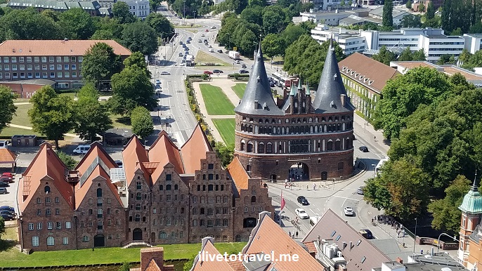
The Holstentor Gate (shown on the map above) is the symbol of Lübeck and, short of being near it on the ground, this is the best way to appreciate it.  It lies due west of St. Peter’s, a very short walk.

Salzspeicher , Holtenstor Gate, Lubeck, Germany, what to see in Lubeck, travel, explore

Holtenstor Gate flanked on the left by the Salzspeicher warehouses

Salzspeicher , Holstentor Gate, Lubeck, Germany, what to see in Lubeck, travel, explore

Close-up of Holstentor Gate

Salzspeicher , Holstentor Gate, Lubeck, Germany, what to see in Lubeck, travel, explore

Salzspeicher warehouses on the Trave River in Lubeck

Looking north

Looking immediately down on the north-facing side of the viewing area, you look down on Holstenstrasse, the shopping avenue that leads to the Holstentor gate.  On the top right corner, you see a bit of Marienkirche (which you can see on the map above).

View of Lubeck, Germany, architecture in Germany

Then looking up still facing north, there is Marienkirche, still being worked on as it is repaired from war damage.  Amazing.

View of Lubeck, Germany

Looking east

Looking east, you see St. Aegidien Church and lots of green in the background.  St. Aegidien’s Church honors an abbot born in the 7th century in Athens, Greece who lived most of his life in south France.  The history of a church on that site dates back from the 13th century and the church has mostly survived the ravages of war…

View of Lubeck, Germany, architecture in Germany - St. Aegidien Church

St. Aegidien Church

Looking northeast

Looking sort of to the northeast from St. Peter’s, one sees the historical main square and market area.  On the left with a low white facade and a brick structure behind it with copper/green towers are city government offices.  Towards the centre of the buildings on the market is the Niederegger Café where we enjoyed a glass of wine and a deliciously decadent cake made of marzipan.  Mmm!!

Tip:  Go through the arcade to the street behind and you will find a Niederigger store where your eyes will pop at all the amazing ways they can craft marzipan and make great sweets…

View of Lubeck, Germany, architecture in Germany

The main square with government offices and markets

Looking south

Looking south you see on the right the Trave River and to the left the Cathedral (Dom) of Lübeck.  The cathedral suffered bombing and fire in World War II and, though some of the contents survived, it required major reconstruction that only got completed in 1982 as priority was given to re-building Marienkirche.  An odd fact is that, although it is a cathedral, it is not the tallest church in town due to “competition” (or, political battles more likely) between religious authorities and guilds (which helped support their churches).

View of Lubeck, Germany, architecture in Germany

And, finally, looking southeast

The view below shows, from above, a typical street lined up with beautiful architecture.  There are quite a few streets like this on the east side and south side of the town.  I could have kept on walking admiring the facades of these beautiful buildings.  The street seen in the center of the photo is Mühlenstrasse (look at the map at the top of this post where this street shows towards the bottom middle, and then look up on the right of the photo to see how many such side streets there are!).

View of Lubeck, Germany

You can see, I am certain, why I enjoy going up high in any town I visit so much.  Seeing it from up high gives you perspective and a sense of the lay of the land that a map just doesn’t do justice to.  Be it Bologna, Sydney, Berlin, Chicago or Lübeck, it is always worth the climb (or elevator ride where available!).


Save this pin to your travel board!

best views of Lubeck, seeing Lubeck from up high, view from up high, lubeck germany,, luebeck

What to See in Lübeck, Germany – Charming Medieval Town

Lübeck is the best example of medieval architecture in northern Germany (so I read).  In this post, I hope to share with you what to see in Lübeck whether you are planning a visit or just want to check out a lesser-known destination in Germany!  I see little or nothing in blogs or social media about Lübeck.  I am grateful that friends who live in Germany knew better and I got to explore Lübeck, now a UNESCO World Heritage Site.  Lübeck suffered during WW II but many medieval structures survived (two of the four city gates survived) or were re-constructed (like St. Mary’s Church); another thing to be grateful for.Lubeck main street, Germany, German architecture

A bit about the Hanseatic League

Before sharing what to see in Lübeck, a little background / history…  The Hanseatic League was a commerce and defense league that operated from the 14th until the 17th century in northern Europe on the coasts of the North Sea and Baltic Sea.  The town of Lübeck, in north Germany, was its capital.

The Hanseatic League was not a kingdom or a state of its own.  Rather, it was a confederation of free cities and towns along the North and Baltic Seas located in what today includes The Netherlands, Germany, Sweden, Poland, Estonia, etc.  Bottom line:  it was about commerce and banding together to protect the towns’ rights.  Smart.

Lübeck had a lot to do with the origination of the league.  Its strategic location as almost a crossroads between the North Sea and the Baltic Sea, and between inland Germany to Scandinavia sealed its role as the capital of this powerful entity.  However, Lübeck had been an important settlement since around the 10th century, a few centuries before the Hanseatic League.  Having been afforded the status of a Free Imperial City of the Holy Roman Empire in 1226 (i.e., directly overseen by the Emperor) certainly elevated its prominence and likely helped it become a center of trade that would give it its leading role in the Hanseatic League since it was the most important of all the towns in the region.

Lübeck’s location

Lübeck is in the north of Germany, not quite on the coast but a tiny bit inland.  Its river, the Trave, connects to the Elbe River via a canal giving it water access to the North Sea.  But Lübeck is almost at the mouth of the Trave River where it hits the Baltic Sea by the beach town of Travemünde.  The old part of town is actually on an island in the Trave River but the greater Lübeck area covers a broader area, including the hamlet of Schlutup, where we stayed during our visit to the area.  Schlutup was right on the western side of the former West-East Germany border during the Cold War so Lübeck was not that far from the border itself.

Visiting Lübeck is easiest from Hamburg, the closest large city (check this ilivetotravel post for the top free things to do there!).  It is a short drive (about an hour or so).  A commuter train ride is also possible from Hamburg.

The town’s Gothic architecture is at the heart of what to see in Lübeck

Brick Gothic is an architectural style seen in the northern parts of Europe west and east of Lübeck in Germany and Poland.  The lack of stone in the region led to the reliance of bricks for construction.  Old town Lübeck is a great representative of this unique architectural style as are other towns like Rostock and Wismar (of which I will write more later).  Churches were built in this style but merchants’ and guilds’ buildings also built on this style.  Keep an eye out for this architecture style as you see photos in this post!

Red brick gothic architecture, german architecture, hanseatic architecture Red brick gothic architecture, german architecture, hanseatic architecture

Market Square

The market square, by city government offices and a short walk from St. Mary’s Church, is fairly small compared to other such squares in Europe but it does have a neat arcade worth checking out. Lubeck market square, Germany, Niederegger, German architectureLubeck market square, Germany, Niederegger, German architecture

Also worth checking out is the Niederegger marzipan café with some amazing specialty beverages (like fancy coffee drinks) and even more spectacular desserts, some of the them using Niederegger’s well-known marzipan.  Right behind this café outside of the market square is Niederegger’s main store offering a dizzyingly good array of goods.  It is worth walking through, even if you are not buying anything!

Burgtor Gate

The northern gate into old town Lübeck crosses a canal from the north.  It is one of the two medieval gates in town (the other being the more famous, more beautiful, and more iconic Holstentor Gate, see below…) though its roof is more recent.  We entered the old town through this gate after crossing a branch of the Trave River.

Burgtor, Lubeck, Germany, red brick Gothic architecture

Burgtor (city gate)

Trave River, Burgtor, Lubeck, Germany, red brick Gothic architecture

Bridge over part of the Trave River by Burgtor

St. Mary’s Church (St. Marien Kirche)

One of the great examples of Gothic brick architecture in Europe, influencing the design of many other churches in the region, is Lübeck’s St. Mary’s Church, built between 1260 and 1350 on the site of a former church. It is one of the first church built on the French Gothic style but with red bricks as the main construction material.

For someone who has seen Gothic churches elsewhere in Europe, the style rings familiar yet something feels a bit off – it’s the red bricks!  It is really cool to see this twist on Gothic. However, it is important to note that what we see today is a reconstruction as WW II saw the ancient church structure destroyed in 1942.  A broken bell from the bell tower is displayed inside the church as a sad but lasting remembrance of the ravages war can bring about…  See a picture of it and read more about St. Mary’s in this earlier write-up in this blog here.

The Holy Spirit Hospital

This building towards the north end of old town houses one of the oldest social services institution in Europe:  the Holy Spirit hospital (Heiligen Geist Hospital).  The institution was founded in the 13th century to take care of the sick and elderly.  In the early 16th century, it stopped being affiliated by the church and passed to the civilian authorities.  The front of the building has an open space, a choir, and hosts frescoes and triptychs.  It stopped having residents in the 1960s and now hosts art and craft fairs on occasion.

Holy Spirit Hospital, Lubeck, Germany Holy Spirit Hospital, Lubeck, Germany, church tryptich

St. Jacob’s Church

Right near the Holy Spirit Hospital is the Church of St Jacob‘s, the church of seafarers.  It may not be the most impressive of the churches in Lübeck, but I still liked seeing the details inside.  The church was built in the mid 14th century.  It did not suffer damage from World War II so it retains the original boxed pew and organ.  I also enjoyed the area around it as I waited for my friends to come out (I was babysitting their dog, Luna – a cute one!).

St Jacob, St Jakobi, church in Lubeck, Germany, historic, architecture in Germany. kirche LubeckSt Jacob, St Jakobi, church in Lubeck, Germany, historic, architecture in Germany. kirche Lubeck, church altarSt Jacob, St Jakobi, church in Lubeck, Germany, historic, architecture in Germany. wooden art St Jacob, St Jakobi, church in Lubeck, Germany, historic, architecture in Germany. wooden art

St. Peter’s Church (St. Petri Kirche)

This church was built in the 13th century and continued to be modified in the 15th and 16th centuries.  It lost its roof in World War II and the final renovations from that damage and temporary repairs was completed in 1987.  Its best feature, in my book, is the views from its tower.

Holstentor Gate

Lübeck’s most iconic structure represents the city to the world.  It is a beautiful building, even as it leans.  Holstentor, the western gate into the old town, is just a couple of blocks from St. Peter’s Church. Holstentor, Lubeck, Germany, Deutschland, medieval architecture

Holstentor almost got demolished in the 1860s because of a movement to get rid of old fortifications around the town.  Unbelievable that locals thought this gate dating from 1464 was not worth keeping!!   It has required maintenance over time to stabilize it with the last major restorations being done in the 1930s and the 2000s.  Holstentor survived World War II which is a miracle – and, therefore, it is a must-see structure for any visitor to Germany.

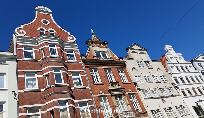
And the streets of the old town with the majestic facades!

If you liked any of the above, walking around the old town is even better!  The design of the building’s facades felt so new to me, it captivated me…  Here are some images of what I so enjoyed.  Definitely top of the list of what to see in Lübeck !Lubeck, Germany, Deutschland, medieval architecture, facade, German architecture, blue sky over GermanyLubeck, Germany, Deutschland, medieval architecture, facade, German architecture, blue sky over Germany Lubeck, Germany, Deutschland, medieval architecture, facade, German architecture, windows, Lubeck, Germany, Deutschland, medieval architecture, facade, German architectureLubeck, Germany, Deutschland, medieval architecture, facade, German architectureLubeck, Germany, Deutschland, medieval architecture, facade, German window shutters——————————————————————————————————

Save this pin to your travel board!

Lubeck, Germany, Deutschland, medieval architecture, facade, German architecture

Visiting the Namsan Seoul Tower for the Best Views of Seoul

As I have written about before, when I visit a new town, I immediately look for a place from which I could get a great view.  In my recent visit to Seoul, South Korea, I did some research and very quickly realized there was one clear place I had to go to get the best views of Seoul from up high:  the Namsan Seoul Tower.Namsan seoul tower, seoul tower, best views in seoul, travel, telecom tower, blue sky

Most major cities abroad tend to have one of those imposing communications towers that stand out in any city’s skyline.  Seoul’s does it one better:  the communications tower sits atop a mountain right in the heart of the city!

The tower opened back in 1980 and boasts having had 30 millions visitors to date.  Not bad.

How to get to the Namsan Seoul Tower

The good news is that, though it sits on top of a mountain, the Namsan Seoul Tower can be reached by car, bus, cable car, or on foot.  If I had had more time, I would have turned the whole thing into a hike up.  But, having walked part of the mountain a day earlier, on the day of my visit to the tower, I decided to speed things up.  I took the cable car.

The best time for the best views of Seoul from the tower

I wanted to get up before the crowds started arriving and the tower opened at 10 AM.  A second reason for getting there as early as possible is that the sun would rise opposite the side of the tower with the best views.  That is, the stuff I wanted to photograph would face me while the sun would be behind me.  I didn’t want the sun to be up high (say, around noon) and diminish the quality of the colors of the views.

Namsan Seoul Tower, best views of Seoul, South Korea

While this is a good photo, it is almost facing in the direction of the sun, so not as vivid

The cable car

The cable car, luckily as I did not plan this, was just two blocks from my hotel near the Myeongdong subway station.  To get to the cable car lower station, one either climbs a series of staircases (quite steep), or one takes a short tram.  However, the tram had weekly maintenance that morning so it was not an option.  So up the stairs I went!  Good workout…

Namsan Seoul Tower, South Korea, best views of Seoul

The tram on the right and the cable car station on the left

Namsan Seoul Tower, South Korea, Seoul from up high

A little portion of the stairs!

Myeongdong, Namsan Seoul Tower, Seoul, South Korea, travel, cityscape

Even from the stairs, there is a view

Once you get to the cable car station, just buy the ticket (you get a better deal if you buy the round-trip up front).  The cable car opens at 10 AM and I got there just a couple of minutes past that time.  The line was 10 deep and I was able to move quickly from it to the platform in little time.  The next car was full and I was one of the last ones in but I made it.

Namsan Seoul Tower, cable car station, Seoul, South Korea, travel

The cable car station

Going up the tower

The tower complex boasts “attractions” and other neat spots (the love lock handrails in the main plaza after you exit the cable car station). Its website provides a glimpse of all they offer.

Namsan Seoul Tower, love locks, Seoul, South Korea, colorful

Locks galore; other handrails were completely covered up

Namsan Seoul Tower, love locks, Seoul, South Korea, colorful

Once up at the plaza at the other end of the cable car, I went straight to the ticket office though it is a big enough space to explore and walk around.

Namsan Seoul Tower, ticket office, Seoul, travel, South Korea

Entrance to take the elevator up

There was no line to take the elevator up and it was waiting for me.  The ride was fairly quick in an enclosed (not panoramic) elevator car which was OK since the best views were about to come.  The ticket to go to the viewing platform cost 10,000 Korean Won for an adult (around US $10) so not bad at all for such a unique attraction.

The best views of Seoul from up high – finally!

Once you get up, the viewing platform is quite large, not terribly crowded at that time.  There are shops for souvenirs or candy.  There is a restaurant, a bar and restrooms in the other levels up there.  I was tempted to come at sunset and enjoy those views but my time in Seoul was limited (5 days) and I wanted to see and experience other things.  I imagine it would be really neat to go up, have a drink, and enjoy a spectacular sunset lighting up the city with some good golden colors (perfect for photos!).

Namsan Seoul Tower, best views of Seoul, South Korea

Facing NW or so

Namsan Seoul Tower, best views of Seoul, South Korea

Moving further towards the north

Namsan Seoul Tower, best views of Seoul, South Korea

Towards the Gyeongbukgung Palace in the distance (not really visible here)

Namsan Seoul Tower, best views of Seoul, South Korea

Close up shows at the base of the mountain the Blue House – the home of the President of the ROK

Namsan Seoul Tower, best views of Seoul, South Korea

Continuing eastward, the vast green space is Jongmyo Shrine in the front and another palace in the back

One cool thing is that there was free wi-fi up there so I video-called family members to show them the view live.

As you walk around the view platform, you can look 360 at Seoul all around you.  And you can walk around to find your favorite city around the world on the glass windows so you know you are looking out in its direction.

Namsan Seoul Tower, South Korea, Seoul, great view, views over Seoul, best views of Seoul

Atlanta did not show up on the glass but D.C. is close enough!

A restroom to remember!

Ah… not to say that the best was for last but… it may have been the best surprise…  I decided to run to the restroom before leaving and went to the men’s room in the floor below the viewing platform.  I was in for a surprise indeed.  Can’t speak to the setup of the women’s restroom but get a look at this!

Seoul, South Korea, Namsan Seoul Tower, restroom up high, urinal with a view

I think the urinals would point towards North Korea…

————————————————————————————————————————————–

I would definitely give the Namsan Seoul Tower a thumbs-up in the must-see spots in the South Korean capital!  The best views of Seoul for sure.

Namsan Seoul Tower, best views of Seoul, South Korea

The shadow of the tower on the Namsan mountain

————————————————————————————————————————————–

Other “best views” spots around the world from past travels:

Pin this to your bucket list board!

telecom tower, city view, Seoul, South Korea, seeing Seoul, how best to explore Seoul

Images of Hamburg: A City in Photos

Having written some posts on what to see in Hamburg, I wanted to share some images of Hamburg that did not make it to those posts.  Some are of Hamburg’s architecture or its setting, and some are a little more random.  Hope you enjoy these images and that they make you want to explore this former Hanseatic League city!

The High Views in Hamburg

As you may have read in posts about Chicago, Sydney or my top 8 climbs in Europe, I like going high (not the same as “getting high”!) to soak in the vastness of a place and get my bearings.  Well, Hamburg is no exception.  I wrote about St. Nicholas Church where I got to see the city from up high.  But there are more photos to share that I included in that post…

views of hamburg, seeing hamburg from above, hamburgo, germany

Looking towards the entrance to the old Elbe tunnel

views of hamburg, seeing hamburg from above, hamburgo, germany

Looking down to Speicherstadt and Hafencity

views of hamburg, seeing hamburg from above, hamburgo, germany

The Architecture in Hamburg

Like many city, really, Hamburg has great architecture.  It is an amalgamation of styles from pre-World War II that survived to modern and post-modern and just frigging funky.  You can see some more of these styles in my skyline photos in the Elbe Tunnel post, or in my unofficial guide to Hamburg covering places like Speicherstadt, Blankenese‘s stair district, the Concert Hall (Elbphilarmonie), and the Chilehaus.  But here are some other photos of the architecture in Hamburg that I really liked.

architecture, hamburg, arquitectura hamburgo, brick, neat tilework, staircases in Germany

Neat tile work and handrail

architecture, hamburg, arquitectura hamburgo, brick, neat tilework, staircases in Germany, statues in Hamburg

Lots of these statues atop doorways or along outer walls

architecture, hamburg, arquitectura hamburgo, brick, neat tilework, staircases in Germany

Staircase at the Chilehaus

architecture, hamburg, arquitectura hamburgo, brick, neat tilework, staircases in Germany

Along Speicherstad

architecture, hamburg, arquitectura hamburgo, brick, neat tilework, staircases in Germany

Another cool building

architecture, hamburg, arquitectura hamburgo, brick, neat tilework, staircases in Germany

Not sure what style this is but it looks very cool

architecture, hamburg, arquitectura hamburgo, brick, neat tilework, staircases in Germany

The Eclectic in Hamburg

Hamburg, like any big city, will have its quirky quarters and scenes.  Here are some images of Hamburg to help you visualize the eclectic side of Hamburg!

motorcycle, motorrad DDR, hamburg street scene, travel

Old school DDR

hamburg, street scene, graffiti germany hamburg, street scene, graffiti germany

hamburg architecture, architektur, arquitectura, germany, travel

The building must be melting with the heat wave…

curb art, Hamburg street scene, bottle cap art, travel

Bottle caps as part of the curb

The Canals of Hamburg

Hamburg is a little like the Venice of northern Europe.  The city center area is ground zero for the canals.  I read somewhere that it boasts more bridges inside its city limits than any other city.  Also, it is supposed to have more canals than Amsterdam or Venice – I find that hard to believe but not because I have any data or have studied the topic 🙂  So I will share a couple of images about the canals.

Hamburg canals, venice of the north, hamburg, hamburgo, germany, architecture, Hamburg canals at night, images of Hamburgimages of Hamburg, Hamburg canals, venice of the north, hamburg, hamburgo, germany, architecture images of Hamburg. Hamburg canals, venice of the north, hamburg, hamburgo, germany, architectureimages of Hamburg, Hamburg canals, venice of the north, hamburg, hamburgo, germany, architecture Hamburg canals, venice of the north, hamburg, hamburgo, germany, architecture, locks on bridge


Pin this image of Hamburg to your board!

hamburg, architecture, architektur, arquitectura, gemany, travel

The Best Views of Hamburg via the Old Elbe Tunnel

Hamburg is an impressive city in big ways and small ways.  And in deep ways.  Enter stage: the Old Elbe Tunnel (Alter Elbtunnel, as it is called in German) which, odd as it may sound, offers the best views of Hamburg !  Read on…Hamburg, Old Elb Tunnel, Elbtunnel, Elbe River, Germany travel

History of the Old Elbe Tunnel

Hamburg is located by the Elbe River, an important artery for transportation of imports/exports into and out of Germany.   Back in the early 20th century, there was a need to connect both sides of the river to facilitate local travel.  So, they (whoever that’d be) decided to build a tunnel 80ft (24m) beneath the surface and 1,400ft (426m) in length in what was an engineering marvel at the time:  the Elbe Tunnel.

Hamburg, Old Elb Tunnel, Elbtunnel, Elbe River, Germany travel

Beautiful mosaics (tile work) at the entrance to the tunnel on the city side

Hamburg, Old Elb Tunnel, Elbtunnel, Elbe River, Germany travel

Marker at the middle of the tunnel crossing

The Old Elbe Tunnel opened in September 1911 when, as it was new, was not called the “old” Elb Tunnel but rather the St. Pauli Elbe Tunnel (named so as it abuts the “famous” St. Pauli neighborhood of Hamburg).

How does this tunnel work?

While there are many bridges and tunnels connecting both sides today, the Old Elbe Tunnel remains active for local travel and tourists alike.  Four large elevators on either side of the tunnel bring up/down vehicles (cars, bikes) and people (locals, tourists) to go through the tunnel.  Oh, and it is actually two parallel tunnels…

Hamburg, Old Elb Tunnel, Elbtunnel, Elbe River, Germany travel

Two elevators side by side

Hamburg, Old Elb Tunnel, Elbtunnel, Elbe River, Germany travel

Another view of the car/bike/pedestrian elevator

It is a neat little experience for visitors for many reasons – an a free one (for pedestrians and bikes; 2 euros for cars)!  You can enter the tunnel and either walk down a long staircase or go down the elevator.

Hamburg, Old Elb Tunnel, Elbtunnel, Elbe River, Germany travel

Either down the steps (L) or the elevator (R)

I actually recommend going down the stairs (going up would be harder) so you can admire the interior of the structure and see the elevators from a distance.  Then go up in the elevator so you can experience that.

Once in the bottom, you will see one lane for vehicles and two one-directional sidewalks.  Cars will only come in one direction since it is just one lane.  And then pedestrians walk on the appropriate sidewalk depending on which direction you are walking.  The tunnel is about 20ft wide (6m).  As you walk, you can see some of the terracotta decorative tiles with maritime themes along the walls.

Hamburg, Old Elb Tunnel, Elbtunnel, Elbe River, Germany travel

Bikes cannot be ridden if you are going against vehicular traffic

Hamburg, Old Elb Tunnel, Elbtunnel, Elbe River, Germany travel

Some of the glazed tiles gracing the walls of the Elbe Tunnel

Some of the best views of Hamburg

The Old Elbe Tunnel comes out across the Elbe River at Steinwerder.  I was not aware exactly of whether there was a view point organized for the curious (like me) or whether I just had to walk around to find a good spot.  I made a right out of the building and followed its outer wall towards the back, assuming I was headed in the right direction.  Sure enough, there was a nice viewing platform after a short walk giving one a full view of the amazing city that is Hamburg.  I am glad I went after having explore the city some already as I was able to identify landmarks on the opposite side.  If you go, I would suggest doing the same (explore Hamburg first and then cross the river to check out the skyline).

From west to east, here is the skyline of Hamburg from Steinwerder.  Enjoy!

Hamburg, Old Elb Tunnel, Elbtunnel, Elbe River, Germany travel, best views of Hamburg

Looking towards Hamburg’s famous Fischmarkt (fish market)

Hamburg, Old Elb Tunnel, Elbtunnel, Elbe River, Germany travel, best views of Hamburg

Looking towards the St. Pauli district & the Elbe tunnel entrance

Hamburg, Old Elb Tunnel, Elbtunnel, Elbe River, Germany travel, best views of Hamburg

Looking towards the massive statue to Bismarck and St. Michael’s Church

Hamburg, Old Elb Tunnel, Elbtunnel, Elbe River, Germany travel, best views of Hamburg

St. Nicholas Church (now a memorial I wrote about in another post) in the middle

Hamburg, Old Elb Tunnel, Elbtunnel, Elbe River, Germany travel, best views of Hamburg

The Concert Hall on the right

While the view from this side of the Elbe River is from down low and there are other places to get great views from up high (like St. Nicholas Church of which I wrote about), to me, these were the best views of Hamburg !

At the end of my checking out the skyline and taking photos, I made my way back to the Old Elbe Tunnel entrance on this side and proceeded to walk back through the tunnel (which, by the way, is much cooler temperature-wise than the surface so beware) to get back to Hamburg.  Oh, and I took the elevator up on the other side 🙂


More off-the-beaten path Hamburg:


Pin this image to your travel board if you are planning to visit Germany – or, if you like engineering marvels!

engineering marvel, tunnel, elbe river tunnel, great views of hamburg

%d bloggers like this: